Walk in Bougnies

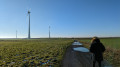
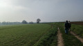
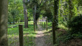
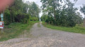
Discover the charming little village of Bougnies, where Belgium’s first youth hostel was built in 1939. The sunken paths and country lanes at the foot of the wind turbines, with their distant views, make this an enjoyable, easy walk.

Details

12154603
Creation:
Last update:
Last review:
  • Walking
    Activity: Walking
  • ↔
    Distance: 3.60 mi
  • ◔
    Average duration: 1h 45 
  • ▲
    Difficulty: Easy

  • ⚐
    Back to start: Yes
  • ↗
    Ascent: + 66 ft
  • ↘
    Descent: - 66 ft

  • ▲
    Highest point: 308 ft
  • ▼
    Lowest point: 233 ft
  • ⚐ Country: Belgium
  • ⚐ City: Quévy 
  • ⚑
    Start/End: N 50.387392° / E 3.943121°
  • ❏
    IGN map(s): Ref. 2806O
  • Hour-by-hour weather

Photos

Description of the walk

Parking and starting point on the square at the junction of Rue Neuve and Rue du Peuple.

(S/E) Take Rue du Peuple, against the flow of traffic, and walk uphill to the War Memorial.

(1) Walk up the street to the right, then turn right; at the Fork in the road with a wayside cross, turn right.

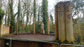
(2) From the Information Point, head to the former open-air theatre where the ‘Vivre’ statue stands, then retrace your steps.

(2) Turn left and walk over the waterfall. At the next junction, turn left onto Rue du Coron, then right onto Chemin d’Harveng. Go straight on at the next junction.

(3) Take the hairpin bend to the right towards the wind turbines. At the junction, go straight on

(4) Turn right, then, at the junction of the paths, turn left to head down the sunken path towards Bougnies

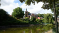
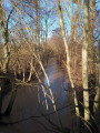
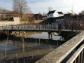
(5) On Rue Neuve, cross the footbridge over the By, just after the green gate, and walk along the left-hand side of the private pond until you reach Rue des Rocs. Turn right and walk back up to Rue Louis Piérard. Take this street on the right. Enter the churchyard, where you’ll find some ancient gravestones, and walk round the building to reach a small viewpoint. Return to Rue Louis Piérard on the right.

(1) Turn right and head down towards Place de la Rue Neuve (S/E).

Waypoints

  1. S/E : mi 0 - alt. 243 ft - Place de la Rue Neuve
  2. 1 : mi 0.06 - alt. 256 ft - Rue Louis Piérard
  3. 2 : mi 0.19 - alt. 243 ft - Information point
  4. 3 : mi 1.15 - alt. 272 ft - Junction towards the wind turbines
  5. 4 : mi 2.22 - alt. 285 ft - Crossroads
  6. 5 : mi 3 - alt. 236 ft - Footbridge on the left
  7. S/E : mi 3.6 - alt. 243 ft - Place de la Rue Neuve

Worth a visit

Reviews and comments

4.3 / 5
Based on 3 reviews

Reliability of the description
4.3 / 5
Ease of following the route
4.7 / 5
Route interest
4 / 5
Willy BOUVRY
Willy BOUVRY

Overall rating : 4.3 / 5

Date of your route : May 05, 2025
Reliability of the description : ★★★★☆ Good
Ease of following the route : ★★★★★ Very good
Route interest : ★★★★☆ Good
Very busy route : No

Take Rue du Peuple to park in the square.
This is a useful tip for finding this square.

See you there

WB

Machine-translated

Azimut71
Azimut71

Overall rating : 4.3 / 5

Date of your route : Sep 13, 2023
Reliability of the description : ★★★★★ Very good
Ease of following the route : ★★★★★ Very good
Route interest : ★★★☆☆ Average
Very busy route : No

There is very little shade along the route (apart from the wind turbines!).
The starting area is remarkably well laid out.

Machine-translated

naya59!
naya59!

Overall rating : 4.3 / 5

Date of your route : Oct 26, 2021
Reliability of the description : ★★★★☆ Good
Ease of following the route : ★★★★☆ Good
Route interest : ★★★★★ Very good
Very busy route : No

A lovely route through country lanes and narrow village streets

Machine-translated

Other walks in the area

For more walks, use our search engine .

The GPS track and description are the property of this route's author. Please do not copy them without permission.