The Gué Marie to La Chapelle au Riboul trail

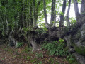
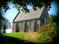
A circular route starting from the church at La Chapelle-au-Riboul, passing through pretty hamlets and along sunken lanes.

Details

n°55086463
Creation:
Last update:
Last review:
  • Walking
    Activity: Walking
  • ↔
    Distance: 5.32 mi
  • ◔
    Average duration: 2h 40 
  • ▲
    Difficulty: Easy

  • ⚐
    Back to start: Yes
  • ↗
    Ascent: + 207 ft
  • ↘
    Descent: - 207 ft

  • ▲
    Highest point: 653 ft
  • ▼
    Lowest point: 469 ft

Photos

Description of the walk

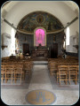
Start at Place de l’Église.

(S/E) Take the narrow lane (Chemin de la Grotte on the IGN map) on the other side of the main road (D113). Continue straight on until you reach the D129.

(1) Cross the road carefully, then take the sunken track directly in front of you. The path turns left, then you’ll come to some farm buildings.

(2) Carry on to the D113, cross it carefully and head along the sunken lane in front of you until you reach the next road junction. Cross the D129 carefully and enter the hamlet of La Fauvelière.

(3) (You have two options: see the practical information.)
Take the path at the top of the hamlet; it leads to a wayside cross near the D359. Follow this road, then turn left towards La Papinière.

(4) Carry on to the end of the hamlet, then take a small path between the houses. Continue straight on until you reach the D159.

:5:: Turn right onto this road, then left. Carry on along this small road before turning onto a dirt track again at La Ménagerie.

(6) Follow the path to the departmental road. Caution: dangerous crossing – please take care.

(7) Cross the D113 straight ahead, then enter the sunken lane directly in front of you. When you reach a crossroads, turn left and walk through the hamlet of Bordelay.

(8) Continue until you reach the D264. Turn left, walk carefully along the road, then turn right towards the hamlet of La Bardoulière.

(9) Walk through this pretty hamlet, then take the sunken lane on your left. You’ll come out onto the D264 again.

(10) Turn right onto the D264 to reach the main road through La Chapelle-au-Riboul. Turn right (D113) to reach the Place de l’Église (S/E).
Discover the Maison de Perrine, founded in 1730 by Perrine Thulard, founder of the Congregation of the Sisters of Charity of Our Lady of Evron.

Waypoints

  1. S/E : mi 0 - alt. 535 ft - Place de l’Église
  2. 1 : mi 0.29 - alt. 518 ft - D129
  3. 2 : mi 0.51 - alt. 535 ft - Farm buildings
  4. 3 : mi 1.24 - alt. 495 ft - La Fauvelière
  5. 4 : mi 1.62 - alt. 522 ft - La Papinière
  6. 5 : mi 1.9 - alt. 535 ft - D159
  7. 6 : mi 2.64 - alt. 558 ft - La Ménagerie
  8. 7 : mi 3.08 - alt. 620 ft - Route
  9. 8 : mi 3.77 - alt. 604 ft - Bordelay
  10. 9 : mi 4.24 - alt. 587 ft - La Bardoulière
  11. 10 : mi 4.85 - alt. 571 ft - Route
  12. S/E : mi 5.32 - alt. 535 ft - Place de l’Église

Notes

At (3) you can join the greenway or head to the equestrian centre. Walk through the hamlet and you’ll see the old railway line below.

Worth a visit

- Pass through pretty hamlets.

Reviews and comments

4.7 / 5
Based on 1 review

Reliability of the description
5 / 5
Ease of following the route
5 / 5
Route interest
4 / 5
Jean-Michel F1.
Jean-Michel F1.

Overall rating : 4.7 / 5

Date of your route : Sep 13, 2024
Reliability of the description : ★★★★★ Very good
Ease of following the route : ★★★★★ Very good
Route interest : ★★★★☆ Good
Very busy route : No

a lovely walk through the Mayenne countryside along typical sunken lanes

Machine-translated

Other walks in the area

For more walks, use our search engine .

The GPS track and description are the property of this route's author. Please do not copy them without permission.