Country:
 City:
City:



Start in front of the town hall in Saint-Fraimbault-de-Prières.
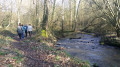
(S/E) Go down the steps between the town hall and the church to reach ‘the beach’. Turn right as you walk alongside the River Mayenne, then climb the path up the hillside. You’ll come across the cave of the Hermit Fraimbault, a6th-century evangelist. At the top of the hill, take the narrow lane to reach the village centre.
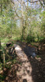
(1) Turn left to leave the village. A little further on, veer slightly to the right (after the path with the barrier), then turn left onto a footpath through the woodland that climbs and winds its way above the departmental road.
(2) Join the road and leave it at the first bend, keeping to the left towards Saint-Georges de l’Isle. At a place called Le Bois, enter the farm on the right.
(3) Take the path that climbs between two buildings. Follow the winding course of the path, keeping straight on all the time. You will then come to a small country road; turn left. You will arrive at Saint-Georges de l’Isle. ‘Now a care home, these buildings housed, from the
19th century an orphanage run by a community of nuns.”
(4) Turn left to go round the building and follow the road to a junction. Turn right towards the Saint-Fraimbault dam.
(5) Built in 1972, it provides a water reservoir covering an area of approximately 140 ha. It is situated at the confluence of three rivers: the Mayenne, the Varenne and the Colmont. Cross the car park, then take the path on the right towards Le Mezeray. Walk past the cemetery, then turn left at the corner by the cross. Follow the path, cross the Ruisseau de Pigray and head up towards La Mortevrie.
(6) Turn right onto the small tarmac road, then take the path ahead of you at a sharp left-hand bend. Then turn right until you reach the D266.
(7) Turn left, then leave the hamlets of Le Bignon and L’Anglècherie behind you. A path will then appear on the right; take it. You’ll reach the greenway.
(8) Turn right and carry on straight ahead along the Vélo Francette until you pass under the bridge.
(9) You can shorten your walk. If so, carry on straight on to the station.
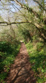
- Otherwise, turn left to leave the greenway and walk through the hamlet of La Grassière. At the edge of the woods, turn right (the path leading into the woods). Follow the path but take care, as this path leads onto the D202. Turn right and walk along the verge, then turn right again to rejoin a sunken track. Follow this track, then turn left. At the end of the track, turn left towards Les Molans.
(10) Take the greenway on the left again. Continue straight on to the Gare (a hamlet by the road after the bridge).
(11) “You can join another walk: Ollon du Ruisseau.
- Otherwise, turn right onto the D157, then take thefirst road on the right towards La Lande.
(12) In the hamlet, take the road furthest to the right, which continues as a track. After the river, turn left; you will then be looking down on a pond. Once out of the woodland, at the junction, turn left, head up towards the village of Saint-Fraimbault-de-Prières and you’ll reach the D157 near a wayside cross.
(13) Turn right onto this departmental road, then right again to reach the village centre. (S/E)

 Visorando Member
 Difficult
  Tourist office
 Easy
Easy