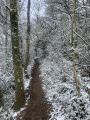
The Chatelard Trail from Civrieux

A return walk along a forest path, including a section crossing over an old railway line.

Details

n°585509
Creation:
Last update:
Last review:
  • Walking
    Activity: Walking
  • ↔
    Distance: 1.81 mi
  • ◔
    Average duration: 0h 55 
  • ▲
    Difficulty: Easy

  • ⚐
    Back to start: Yes
  • ↗
    Ascent: + 141 ft
  • ↘
    Descent: - 118 ft

  • ▲
    Highest point: 873 ft
  • ▼
    Lowest point: 748 ft

Photos

Description of the walk

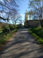
Park at the side of the Chemin de la Roche in Civrieux, near the last houses.

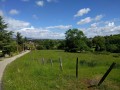
(S/E) The walk begins on the Chemin de la Roche, heading away from the village. The path runs almost in a straight line for 1.5 km and is marked with yellow signs.

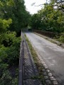
(1) Cross a bridge over a railway line and carry on.

(2) Turn back when you see a farm with greenhouses on your right. Return to the starting point via the same route you took on the way out (S/E).

Waypoints

  1. S/E : mi 0 - alt. 764 ft - Car park: Chemin de la Roche, Civrieux
  2. 1 : mi 0.27 - alt. 748 ft - Cross the bridge over the railway line
  3. 2 : mi 0.91 - alt. 873 ft - Farm with greenhouses
  4. S/E : mi 1.81 - alt. 768 ft - Car park on Chemin de la Roche in Civrieux

Notes

  • Wear sturdy footwear; in places the ground is uneven and rutted.
  • This path is not suitable for parents with pushchairs.
  • The path is shaded or runs through woodland.

Reviews and comments

3.8 / 5
Based on 3 reviews

Reliability of the description
4.3 / 5
Ease of following the route
5 / 5
Route interest
2 / 5
E. GAILLETON
E. GAILLETON

Overall rating : 2.5 / 5

Date of your route : Jan 21, 2021
Reliability of the description : ★★★★☆ Good
Ease of following the route : Not used / Not applicable
Route interest : ★☆☆☆☆ Very disappointing
Very busy route : No

A rather uninteresting and very muddy walk. We didn’t turn back, but completed the circular route by heading back via Dommartin, passing through the village, and returning to the starting point.

Machine-translated

Nutstreck
Nutstreck

Overall rating : 3.7 / 5

Date of your route : Jan 06, 2020
Reliability of the description : ★★★★★ Very good
Ease of following the route : ★★★★★ Very good
Route interest : ★☆☆☆☆ Very disappointing

More of a ‘granny’s walk’, or a place to let the dog run about! Why not suggest a (possible) circular route via Dommartin? On the other hand, if you just want to stretch your legs (which was my case) in the middle of a road trip, then this return walk will do… albeit cut short, as the path was too muddy at the end!

Machine-translated

Mamyse5
Mamyse5

Overall rating : 4.3 / 5

Date of your route : Mar 05, 2019
Reliability of the description : ★★★★☆ Good
Ease of following the route : ★★★★★ Very good
Route interest : ★★★★☆ Good

A very pleasant, quiet and varied walk (shaded) – easy

Machine-translated

Other walks in the area

For more walks, use our search engine .

The GPS track and description are the property of this route's author. Please do not copy them without permission.