Country:
 City:


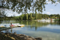
Lac du Conge car park in Saulxures-les-Bulgnéville.
(S/E) Follow the road for a few metres, then at the signpost, turn onto a track. Pass under a high-voltage power line and continue through the woodland. You’ll come to a track suitable for vehicles; take it to the right until you reach the bend.
(1) Turn left onto the track and, at the end, turn left. At the end of this, turn right, then left. Take a path crossing the stream and a track (often overgrown with ferns). Continue straight on until you reach a Fork in the road.
(2) Turn right. You’ll come to a junction (often a very damp area) and turn left. Continue along this track until you reach the edge of the forest.
(3) Turn right and you’ll reach the hamlet known as ‘Le Rond des Gendarmes’. Keep left, then immediately turn right to take the path crossing a stream. Then turn right onto a steep path leading to the start of the Bulgnéville fitness trail.
(4) Walk straight on along the fitness trail until you reach the footbridge, which takes you back up the track for over a kilometre. At the bend, carry on straight ahead until you reach a path.
(5) Turn right. At the end of this path, turn right again onto a path running alongside a high-voltage power line. At the track, turn right until you reach the signpost.
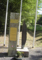
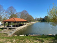
(6) Leave the track and take the path on the left. At the end of the path, turn right then left and rejoin the track leading to Lac du Conge (caution: slippery path!) When you reach the lake, turn left to walk round it and, once you are almost directly opposite the finish point at the lake, head towards the Royal Air Force memorial (a bomber shot down by a German fighter on 29 July 1944). Then walk back along the lake to reach the car park and the information board.

 Tourist office
 Moderate


 Difficult
 Visorando Member