Kastelberg snowfield trail

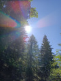
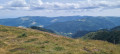
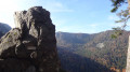
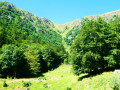
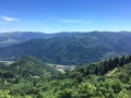
A magnificent, fairly easy hike on high moorland with sweeping views. From the summit of Kastelberg, you can see the main peaks of the Vosges and, on a clear day, the Alps.

Details

14868631
Creation:
Last update:
Last review:
  • Walking
    Activity: Walking
  • ↔
    Distance: 4.49 mi
  • ◔
    Average duration: 2h 45 
  • ▲
    Difficulty: Easy

  • ⚐
    Back to start: Yes
  • ↗
    Ascent: + 741 ft
  • ↘
    Descent: - 732 ft

  • ▲
    Highest point: 4,432 ft
  • ▼
    Lowest point: 4,022 ft

Photos

Description of the walk

Access: follow the D417 towards Colmar and the Col de la Schlucht. Just before the pass, turn right onto the Route des Crêtes towards Hohneck. After 4 km, at a place called Pâquis des Fées, park near the two inns, "Le Paquis" and "Pied du Hohneck".

Signposting: Yellow crosses / Yellow rectangles / Red rectangles crossed out in white

(S/E) Between the two inns, take the road that climbs up to Honneck and immediately turn right onto a path towards the ridge until you reach the Col du Wormspel.

(1) Continue right along the snowfield trail (yellow cross), on a ledge above the Wormspel valley.

(2) At a flat section before the Spitzkoepfe ridge, turn right. Continue along the ledge, go around the Kastelberg and reach a fork.

(3) Take the path on the right (the other leads down to the Kastelberg farmhouse inn). It runs along the side of the mountain, then descends through a wood. Join the track leading to the farm.

(4) Cross this track and, at the turnstile, take the path on the right (Blue Rectangle) which runs along the hillside through stubble and then into the forest. It comes out onto the pastures above the Firstmiss farmhouse and joins the Red Rectangle path with a white stripe.

(5) Follow it up to the right.

(6) Cross the access road to the Kastelberg farm again, which you crossed earlier at a car park. Continue opposite along the unmarked path that climbs alongside a wood. Follow the stubble to reach the summit of Kastelberg, marked by a ski lift.

(7) Turn left, following the ridge line, and descend to a vague pass.

(8) Join the trail marked with a red rectangle crossed out in white, which climbs slightly before dropping down to the Col du Wormspel below the summit of the Hohneck.

(1) Turn left and return to the ridge road and the car park between the two inns (S/E).

Waypoints

  1. S/E : mi 0 - alt. 4,085 ft - Le Pâquis des Fées - Car park
  2. 1 : mi 0.17 - alt. 4,193 ft - Col du Wormspel
  3. 2 : mi 0.49 - alt. 4,249 ft - Fork
  4. 3 : mi 1.5 - alt. 4,219 ft - Fork
  5. 4 : mi 1.96 - alt. 4,032 ft - On the right, Blue Rectangle
  6. 5 : mi 2.65 - alt. 4,072 ft - On the right, red rectangle with white stripes
  7. 6 : mi 2.89 - alt. 4,206 ft - Cross the road - Kastelberg
  8. 7 : mi 3.22 - alt. 4,432 ft - Kastelberg
  9. 8 : mi 4.08 - alt. 4,236 ft - Join the marked trail. Near the springs of - Moselotte (rivière)
  10. S/E : mi 4.49 - alt. 4,085 ft - Le Pâquis des Fées - Car park

Reviews and comments

4.8 / 5
Based on 38 reviews

Reliability of the description
4.8 / 5
Ease of following the route
4.7 / 5
Route interest
4.8 / 5
User 3580467

A lovely walk with superb views, no difficulties.
We set off on this walk from the Fontaine de la Duchesse car park, where there were fewer people trying to park.

Machine-translated

ozogiminy
ozogiminy

Overall rating : 5 / 5

Date of your route : Jul 08, 2026
Reliability of the description : ★★★★★ Very good
Ease of following the route : ★★★★★ Very good
Route interest : ★★★★★ Very good
Very busy route : No

A lovely walk. As for vertigo – I’m a bit prone to it – I didn’t have the slightest difficulty; you’re not right on the edge of a precipice.

Machine-translated

User 3580467

Overall rating : 5 / 5

Date of your route : Jul 05, 2026
Reliability of the description : ★★★★★ Very good
Ease of following the route : ★★★★★ Very good
Route interest : ★★★★★ Very good
Very busy route : Yes

A lovely walk with superb views, no difficulties.
We set off on this walk from the Fontaine de la Duchesse car park, where there were fewer people parking.

Machine-translated

jlo68
jlo68

Overall rating : 4.7 / 5

Date of your route : Jun 16, 2026
Reliability of the description : ★★★★★ Very good
Ease of following the route : ★★★★☆ Good
Route interest : ★★★★★ Very good
Very busy route : No

A lovely walk with some beautiful views.

Machine-translated

Jeammy
Jeammy

Overall rating : 4 / 5

Date of your route : Jun 22, 2026
Reliability of the description : ★★★★☆ Good
Ease of following the route : ★★★★☆ Good
Route interest : ★★★★☆ Good
Very busy route : Yes

A lovely walk during which we were lucky enough to spot some chamois. The path is lined with beautiful local flowers.

Machine-translated

vieuxman
vieuxman

Overall rating : 5 / 5

Date of your route : Oct 12, 2025
Reliability of the description : ★★★★★ Very good
Ease of following the route : ★★★★★ Very good
Route interest : ★★★★★ Very good
Very busy route : Yes

Yes, but.
Vertigo is debilitating.
It is not mentioned in any of the reviews.
So, I'm mentioning it.
CORNICE = A VACUUM OF HUNDREDS OF METRES AT YOUR SIDE.

Machine-translated

christophebr
christophebr

Overall rating : 4.3 / 5

Date of your route : Sep 19, 2025
Reliability of the description : ★★★★☆ Good
Ease of following the route : ★★★★☆ Good
Route interest : ★★★★★ Very good
Very busy route : Yes

A pleasant, easy hike in a beautiful setting

Machine-translated

Lolo2121
Lolo2121

Overall rating : 5 / 5

Date of your route : Aug 25, 2025
Reliability of the description : ★★★★★ Very good
Ease of following the route : ★★★★★ Very good
Route interest : ★★★★★ Very good
Very busy route : No

A beautiful hike at dawn after enjoying the sunrise at Hohneck. Magnificent scenery, well-marked and accessible trail. Only one small section on the side of the trail following a small landslide (only about a metre) caused me some concern due to my vertigo, but I was able to get around it. With children wearing suitable footwear and clothing, and after explaining the rules to them when on the side of the trail, this is a great route. The highlight: the chamois. Don't forget your binoculars!

Machine-translated

User 26749907

Overall rating : 5 / 5

Date of your route : Jul 31, 2025
Reliability of the description : ★★★★★ Very good
Ease of following the route : ★★★★★ Very good
Route interest : ★★★★★ Very good
Very busy route : Yes

👍

Machine-translated

Angèle 2
Angèle 2

Overall rating : 5 / 5

Date of your route : Aug 04, 2025
Reliability of the description : ★★★★★ Very good
Ease of following the route : ★★★★★ Very good
Route interest : ★★★★★ Very good
Very busy route : Yes

This route is easily accessible for young children, but can only be done in summer as it sometimes follows the ridge of valleys. The views are sublime and spectacular, alternating between pastures and woods. You can have lunch at the Kastelberg or Firstmiss inns, but be sure to book as the trails are very busy.
The description is reliable, but we still followed our progress on the Visorando GPS. The reward at the end: a blueberry tart at the Auberge des Paquis.

Machine-translated

User 16363907

Overall rating : 5 / 5

Date of your route : Aug 04, 2025
Reliability of the description : ★★★★★ Very good
Ease of following the route : ★★★★★ Very good
Route interest : ★★★★★ Very good
Very busy route : Yes

Stunning views on an easy hike.

Machine-translated

Nbornel
Nbornel

Overall rating : 5 / 5

Date of your route : Aug 03, 2025
Reliability of the description : ★★★★★ Very good
Ease of following the route : ★★★★★ Very good
Route interest : ★★★★★ Very good
Very busy route : Yes

A magnificent walk that is definitely worth the detour. You can enjoy incredible panoramic views as you change sides of the mountain several times. A must-do!

Machine-translated

AlainT
AlainT

Overall rating : 4.3 / 5

Date of your route : Jun 24, 2025
Reliability of the description : ★★★★☆ Good
Ease of following the route : ★★★★☆ Good
Route interest : ★★★★★ Very good
Very busy route : No

Hike to do in good weather to enjoy the magnificent view.

Machine-translated

jeandede
jeandede

Overall rating : 5 / 5

Date of your route : Jun 26, 2025
Reliability of the description : ★★★★★ Very good
Ease of following the route : ★★★★★ Very good
Route interest : ★★★★★ Very good
Very busy route : Yes

Very beautiful hike and stunning scenery.

Machine-translated

chatelet
chatelet

Not done because the weather wasn't very good on the day we were due to do it.
This route is pleasant in good weather, as there are some beautiful viewpoints.

Machine-translated

Other walks in the area

For more walks, use our search engine .

The GPS track and description are the property of this route's author. Please do not copy them without permission.