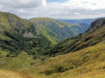
The Hohneck and the Frankenthal

This short hike is one of the most classic in the region and therefore deserves a brief description.
Ascent to the Hohneck from the Route des Crêtes, descent towards the Col du Schaeferthal then into the Frankenthal (and its alpine dairy) before climbing back up to the Col du Falimont via the magnificent Sentier de Falimont.
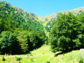
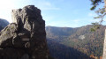
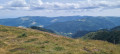
360° views, cliffs, pastures and, occasionally, chamois.

Details

101445962
Creation:
Last update:
Last review:
  • Walking
    Activity: Walking
  • ↔
    Distance: 3.21 mi
  • ◔
    Average duration: 2h 35 
  • ▲
    Difficulty: Moderate

  • ⚐
    Back to start: Yes
  • ↗
    Ascent: + 1,273 ft
  • ↘
    Descent: - 1,260 ft

  • ▲
    Highest point: 4,469 ft
  • ▼
    Lowest point: 3,346 ft

Photos

Description of the walk

(S/E) From the Pied du Hohneck car park on the Route des Crêtes (D340), take the road leading up to the Auberge du Hohneck for 150 metres.

(1) Turn right onto the path leading to the Col du Wormspel.

(2) Pass through the gate and the turnstile. Turn left and take the path that zigzags up to the summit of the Hohneck.

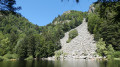
(3) After admiring the 360° view and checking out the orientation board, head down towards the Col du Schaeferthal along the path overlooking Lake Schiessrothried, taking in the rocks and cliffs that surround it on the western side. You might spot some chamois here – or you might not!

(4) At the Col du Schaeferthal, take the path that descends to the left across the pastures towards Schaeferthal, then heads into the woodland on a descent that can prove tricky in places or depending on the weather conditions.

(5) There’s an interesting optional detour to the left, a short round trip to the Grotte Dagobert, provided access isn’t restricted.
Continue along the path to the right. Further on, ignore the Sentier de la Bloy, which branches off to the right, and take the path to the left for a second section of the descent, which is a little tricky for little legs.

(6) Pass by the Marcaire du Frankenthal (drinks and snacks available in season). Carry on straight ahead for about 250 m.

(7) Turn left at the cross and brace your calves for the steep climb up to the Col du Falimont via the Sentier du Falimont. Here too, halfway up, you can sometimes spot chamois! Press on bravely to reach the Col du Falimont.

(8) Turn left and take the path leading back to the car park (S/E).

Waypoints

  1. S/E : mi 0 - alt. 4,085 ft - Car park at the foot of the Hohneck
  2. 1 : mi 0.07 - alt. 4,104 ft - Path on the right
  3. 2 : mi 0.23 - alt. 4,193 ft - Passage at the - Col du Wormspel (1275m)
  4. 3 : mi 0.67 - alt. 4,469 ft - Summit of the - Le Hohneck
  5. 4 : mi 1.21 - alt. 4,029 ft - Passage at the - Col du Schaeferthal (1224m)
  6. 5 : mi 1.68 - alt. 3,638 ft - Access to the - Grotte Dagobert
  7. 6 : mi 2.01 - alt. 3,383 ft - Trail marker - - Auberge du Frankenthal
  8. 7 : mi 2.08 - alt. 3,369 ft - Cross
  9. 8 : mi 2.76 - alt. 4,245 ft - Passage at the - Col de Falimont (1295m)
  10. S/E : mi 3.21 - alt. 4,085 ft - Car park at the foot of the Hohneck

Notes

Minimum duration: 3 hours 30 minutes with children aged 8 to 10 who are good walkers, including snack breaks, building cairns and nature spotting.
The descent and ascent are challenging for little legs.

This route passes through a protected area, which may be subject to special regulations:

Other walks in the area

For more walks, use our search engine .

The GPS track and description are the property of this route's author. Please do not copy them without permission.