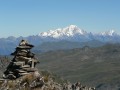
Lakes Trail from Pointe de la Masse

A downhill hike from the upper station of the Masse Cable Car to Les Ménuires. Access to the station costs €24 per adult (2024)

Details

n°36522573
Creation:
Last update:
Last review:
  • Walking
    Activity: Walking
  • ↔
    Distance: 5.15 mi
  • ◔
    Average duration: 2h 35 
  • ▲
    Difficulty: Moderate

  • ⚐
    Back to start: No
  • ↗
    Ascent: + 217 ft
  • ↘
    Descent: - 3,671 ft

  • ▲
    Highest point: 9,137 ft
  • ▼
    Lowest point: 5,663 ft

Description of the walk

Park in the car park at the La Masse Cable Car. Take the cable car to reach the upper station.

(S) Follow the ski run due west, and after a right-hand turn, you’ll come to a junction.

(1) Turn left and continue the descent to Lac Longet via the ski runs.

(2) Take the path on the left. Heading due north, reach Lac Noir.

(3) Continue slightly uphill, then go round the lake on the left. Finish the climb at the Col de la Bache

(4) Please note: there is no marked path to Lac Crintallia, but this presents no difficulty in dry weather for an experienced hiker. To get there, descend by sight, heading north-north-east: a GPS track is an advantage here. Arrive at Lac Crintallia.

(5) Continue the descent along the well-marked path until you reach the Château Philibert junction.

(6) Take the path on the right and continue down the fairly steep descent. After two hairpin bends, you’ll come to another crossroads at a place called Le Céseri.

(7) Head straight ahead and follow the hairpin bends to reach the Ruisseau des Enverses. Cross the stream and you’ll then come to a hairpin bend at the junction with a wider track.

(8) Take this track straight ahead. Once at the second hairpin bend, leave it to follow the path on the right, and complete the descent by arriving at the car park of the lower station of the Pointe de la Masse cable car (E).

Waypoints

  1. S : mi 0 - alt. 9,121 ft - Pointe de la Masse (2803m)
  2. 1 : mi 0.47 - alt. 8,737 ft - Trail junction
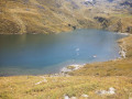
  3. 2 : mi 1 - alt. 8,327 ft - Lac Longet
  4. 3 : mi 1.48 - alt. 8,107 ft - Lac Noir
  5. 4 : mi 1.89 - alt. 8,284 ft - Col de la Bache
  6. 5 : mi 2.53 - alt. 7,943 ft - Lake Crintallia
  7. 6 : mi 2.94 - alt. 7,710 ft - Château Philibert
  8. 7 : mi 3.71 - alt. 6,860 ft - A place known as Le Céseri
  9. 8 : mi 4.62 - alt. 6,122 ft - Turn onto the track
  10. E : mi 5.15 - alt. 5,663 ft - Car park

Notes

Hiking poles may be useful to take the strain off your knees, given the significant descent.

Worth a visit

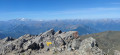
(4) Col de la Bache: the view of Lake Crintallia with Mont Blanc in the background is magnificent.
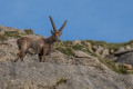
You may spot marmots during the hike.

Reviews and comments

3.7 / 5
Based on 2 reviews

Reliability of the description
3 / 5
Ease of following the route
3 / 5
Route interest
5 / 5
michel tout court
michel tout court

Overall rating : 5 / 5

Date of your route : Aug 05, 2025
Reliability of the description : ★★★★★ Very good
Ease of following the route : ★★★★★ Very good
Route interest : ★★★★★ Very good
Very busy route : Yes

The lift is quite expensive, but the descent is worth it for the scenery. You can easily link 3 to 5 to avoid the off-piste section from 4 to 5

Machine-translated

alambic73
alambic73

Overall rating : 1 / 5

Date of your route : Aug 13, 2024
Reliability of the description : ★☆☆☆☆ Very disappointing
Ease of following the route : ★☆☆☆☆ Very disappointing
Route interest : Not used / Not applicable
Very busy route : No

Access to the top station of the La Masse cable car (2,803 m): €24 per person – this is not clearly stated
in the description. For a family, the cost is too high for a single trip up.

Machine-translated

Other walks in the area

For more walks, use our search engine .

The GPS track and description are the property of this route's author. Please do not copy them without permission.