Country:
 City:


Start from the town hall car park.
Follow the yellow signposts
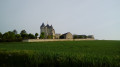
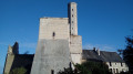
(S/E) With your back to the town hall and the sign, head down Rue du Frêne on the right. On your right, admire the Marmande Tower in Vellèches and the rolling countryside. At the next junction, turn right onto the D22, which runs from Leigné/Usseau to Vellèches. At the Stop sign, turn left onto the D22, follow the road carefully and cross the Pont de Gobet.
(1) Immediately after the bridge, turn right onto Route de Beaulieu. At the three-way junction, leave the road at the edge of the Bois d’Oiré and take the grassy path on the left. At the next junction, carry on straight ahead.
(2) Turn right at the next junction onto the path lined with conifers and ferns. At the ‘Sept Chemins’ junction, turn left and then immediately right onto a small path (hunting reserve on the left) and enter the Bois de Peu Blanc.
(3) A little further on, ignore the paths on the left and carry on straight ahead along this track.
(4) Walk down the ‘Sentier des Alisiers’ path, where a fine specimen of a service tree can be seen further down on the right (information board). Continue to the edge of the woodland. Ignore the path leading uphill to the left. At the bottom of the path, turn left between the field and the ditch and take in the surrounding landscape. Then turn right towards the road.
(5) Cross the D22 and head up the sandy path (old lime tree and cross on the right). Go straight on at the junction and head back down a grassier path. Lovely view towards the woodland. Ignore the next path on the right.
(6) Then, just after the entrance to the Bois de la Piette, go straight on at the junction. Walk through this beautiful spot with its variety of tree species. At the junction, go straight on whilst the alternative route turns right. Continue to the road
(7) Leave the path, cross the road and, immediately, take the track on the left (ACCA sign) lined with conifers and chestnut trees. Further on, ignore a path on the right and carry on straight ahead. Then, ignore a path on the left and continue straight ahead. At the next three-way junction, turn right, leaving the Leigné/Usseau route behind.
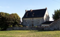
(8) On this new path, head towards the high-voltage power line. Opposite the electricity pylon, take the path on the right; at the end, rejoin the old road by turning left and follow the railway line. Then go through the tunnel under the high-speed rail line. At the exit, admire the view over the Touraine countryside. Continue straight ahead on the road, following the high-voltage power line. Walk past the imposing Boué farm.
(9) At the next junction on the right, head up to the right towards a quaint old house and enter a beautiful woodland with fir trees, amongst others. Continue along the path until you reach the small road, then veer slightly to the left to take a pleasant wooded track.
(10) Carry on straight ahead until you reach the road (D76). At the Stop sign, turn right and continue to the bridge. Just after the high-speed rail bridge, turn right. Depending on the season, you may see the beautiful buildings of Les Grands Barboteaux. Head uphill, following the high-speed rail line more or less closely, and follow the fenced-off water retention basins.
At the top of the hill, turn right and follow the ridge along a gravel path separating the Vienne from the Indre-et-Loire, and enjoy the lovely view.
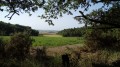
(11) The path alternates between various types of woodland and farmland until you reach the road. At the end of the path, at the junction, cross the D76 and take the path on the left between the field and the copse. Walk through a coniferous woodland. Further on, in the clearing on the right, walk past a small pond and take in the lovely view of several farms in the surrounding area. Continue to the cross.
(12) Turn right onto a stony path. A little further on, ignore the path on the left and head back down between the field and the woodland towards the plain. Take the opportunity to enjoy this idyllic landscape and spot the Marmande tower on your left. Continue to the road.
(13) When you reach the road, turn left, then head down to the right onto another road, cross a small bridge and take a right-hand bend.
(14) Carry on straight ahead at the next junction. Head up the small road, passing the old Jofinerie house and its pretty rectangular dovecote. You’ll arrive in this charming, authentic village, where a lovely picnic area is perfect for a break after this long walk (S/E).

 Visorando Member

 Tourist office
 Easy