Country:

 City:
City:


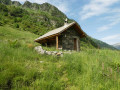
Park on the small square in the centre of the hamlet of La Chau.
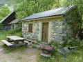
(S/E) Head up to the right of the shelter and follow the path on the right (signposted ‘Le Séchier’)
(1) Follow the path along the Canal des Herbeys, on the edge of the woods. It eventually joins a forest track which leads to Le Séchier.
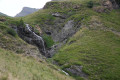
(2) When you reach the bridge over the Combe du Séchier stream, turn right and follow the D16.
(3) Follow signs for ‘l’Ubac’, staying on the D16.
(4) About 600 metres further on, take a wide path on the left, heading slightly downhill.
(5) About 200 metres further on, continue to the right (the path opposite leads to the banks of the Séveraisse); the path runs alongside meadows and woods and reaches the first houses below the Chaup clearing, the end point (S/E).

 Visorando Member
 Difficult
 Moderate