Campérié–Puilaurens Discovery Trail

At the Col de Campérié, there is a discovery route through the Fonges Forest (set up by the forestry services), ideal in hot weather or with children. Largely shaded. Very easy parking. Yellow markings. Around ten information points about the forest.

Details

n°1348823
Creation:
Last update:
Last review:
  • Walking
    Activity: Walking
  • ↔
    Distance: 1.70 mi
  • ◔
    Average duration: 1h 10 
  • ▲
    Difficulty: Easy

  • ⚐
    Back to start: Yes
  • ↗
    Ascent: + 459 ft
  • ↘
    Descent: - 459 ft

  • ▲
    Highest point: 2,201 ft
  • ▼
    Lowest point: 1,739 ft

Photos

Description of the walk

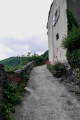
At the Col de Campérié, cross the railway line via a stone bridge (a gravel track that is perfectly passable in a passenger car) to reach a car park (on the right) next to the information board for the nature trail. This is the starting point

(S/E) Take the path marked ‘Sentier’ opposite the car park and follow this first section until the path branches off to the left. Up to this point, it is accessible by car; you can also park here if you wish to shorten the duration of the walk. At this point, turn right onto a footpath.

(1) This is where the circular path begins (still signposted in yellow); turn right if you wish to follow the trail in the direction recommended by the Forestry Commission. Climb up a small valley under the canopy of trees and join a forest track.

(2) Turn left onto this path and continue to the next junction.

(3) Leave the track and turn left onto the path (follow the yellow markings carefully) which descends back into the forest. There are a few slightly steep sections.

(1) From here, follow the same path as on the way out, overlooking the Fabournet stream, to reach the car park (S/E).

Waypoints

  1. S/E : mi 0 - alt. 1,742 ft - Car park at the Col de Campérié
  2. 1 : mi 0.4 - alt. 1,916 ft - Junction of the “discovery” circular loop
  3. 2 : mi 0.72 - alt. 2,165 ft - Junction on a forest track
  4. 3 : mi 0.9 - alt. 2,201 ft - Junction, take the path on the left
  5. S/E : mi 1.69 - alt. 1,742 ft - Car park at the Col de Campérié

Notes

No water source.
Closed-toe shoes are required as the first section is a path with a lot of small gravel.

Reviews and comments

5 / 5
Based on 1 review

Reliability of the description
5 / 5
Ease of following the route
5 / 5
Route interest
5 / 5
juro66
juro66

Overall rating : 5 / 5

Date of your route : Oct 22, 2020
Reliability of the description : ★★★★★ Very good
Ease of following the route : ★★★★★ Very good
Route interest : ★★★★★ Very good
Very busy route : No

A lovely walk through a magnificent forest!!! So many different species of trees! Well worth doing in the autumn to see all those beautiful colours!
I’m going to take my Year 5 pupils there when term starts.
It’s the first time I’ve found a proper walk right in the middle of the forest whilst following a path!!!

Machine-translated

Other walks in the area

For more walks, use our search engine .

The GPS track and description are the property of this route's author. Please do not copy them without permission.