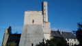
A stroll through Ormois

Set amongst plains, beautiful old houses and scenic viewpoints, follow these paths, some of which run alongside theGR®655. Then take a moment to explore the town hall’s magnificent wooded park and the heritage trail.

Details

3148552
Creation:
Last update:
Last review:
  • Walking
    Activity: Walking
  • ↔
    Distance: 7.65 mi
  • ◔
    Average duration: 3h 45 
  • ▲
    Difficulty: Moderate

  • ⚐
    Back to start: Yes
  • ↗
    Ascent: + 269 ft
  • ↘
    Descent: - 249 ft

  • ▲
    Highest point: 371 ft
  • ▼
    Lowest point: 154 ft
  • ⚐ Country: France
  • ⚐ City: Les Ormes (86220)
  • ⚑
    Start/End: N 46.973442° / E 0.604623°
  • ❏
    IGN map(s): Ref. 1824SB, 1825SB
  • Hour-by-hour weather

Description of the walk

Park in the car park near the town hall, on Rue de la Chevretterie.

(S/E) Opposite the hiking sign, turn left, then immediately left again onto Rue de la Chevretterie and follow it to the traffic lights. Cross the road and head up towards the bridge over the railway line.

(1) At the end of the bridge, head down the path on the right to join theGR®655.

(2) Follow the railway line, then pass the silo and head out into the countryside along a gravel track. After a climb, you’ll reach a road.

(3) Turn left towards Poizay, ignoring the hamlet of La Mardelle. Turn right onto thefirst grassy track and climb gently through open country, enjoying unobstructed views, notably of the spire of the village of Dangé-Saint-Romain. Pass some buildings (Vaugaudin) and then arrive at the outer wall of the Château de Fontaine.

(4) Follow the wall to the left, with a view of the village of Saint-Sulpice further on. In front of the château’s main entrance, turn left towards the pretty village and its evocative street names. At the village entrance sign, head up the main street of this former commune.

(5) At the foot of the square, leave theGR®655and head straight ahead, then turn left onto the Chemin de la Garde, a pleasant sandy path leading out into the countryside. At the three-way junction, take the stonier path down to the left and you’ll reach a cross-path.

(6) Take in the sweeping panorama, turn left and rejoin the road. Leave the path on your left and walk past the Petit Dumeray farmhouse. Ponds and old buildings line the road all the way to Poizay.

(7) At the hamlet, take a break at the wash house with its picnic area. Then walk past a cross on the left and an information board about the village, before crossing the adjacent streets. Leave Poizay by heading up the road.

(8) Ignore the road on the left leading to Bois Pouzin and the next one on the right heading for La Bataillerie, then climb an old gravel road. At the top of the hill, turn left, skirting a copse. At the pleasant bend, there’s a viewpoint offering a view of the village of Les Ormes and its imposing château. Join the D1a, Rue de Madrid.

(9) Cross it and head towards a wood. Walk back down alongside a pond, enjoying another view of the villages around Tours and numerous water towers, until you reach a three-way junction.

(10) Join theGR®655. Turn sharply left onto it, heading towards Les Ormes. Keep very carefully to the left-hand side of the road and walk down to Bois Pouzin.

(11) Then turn right at the bus shelter on Rue de Madrid, then right onto Route du Bois Pouzin (D1a). At the three-way junction, keep to the right to reach the starting point bridge.

(1) Cross the bridge, then cross the departmental road and continue along Rue de la Chevretterie until you reach the start of the walk sign (S/E).


Waypoints

  1. S/E : mi 0 - alt. 154 ft - Hiking trail sign
  2. 1 : mi 0.16 - alt. 184 ft - Road bridge. Joint A/R junction
  3. 2 : mi 0.26 - alt. 164 ft - GR655
  4. 3 : mi 1.27 - alt. 174 ft - La Mardelle
  5. 4 : mi 2.59 - alt. 213 ft - The grounds of Fontaine Castle
  6. 5 : mi 3.33 - alt. 289 ft - Place du Pilori
  7. 6 : mi 4.02 - alt. 305 ft - Cross-country path
  8. 7 : mi 5.4 - alt. 217 ft - Poizay
  9. 8 : mi 5.64 - alt. 243 ft - Poizay exit
  10. 9 : mi 6.21 - alt. 338 ft - D1a
  11. 10 : mi 6.66 - alt. 325 ft - GR655 ‘Three-Way Junction’ route
  12. 11 : mi 7.11 - alt. 249 ft - Bois Pouzin
  13. S/E : mi 7.65 - alt. 154 ft - Hiking trail sign

Notes

Bakeries.
Full-service grocery shop.
Caterers.
Restaurants.
Campsite.

Worth a visit

Places to visit: Château des Ormes, La Poste aux chevaux, the church, heritage trail, Musée de la Falaise.
Nearby: Marmande Tower, the troglodyte village of Saint-Rémy-sur-Creuse.

Always be cautious and plan ahead when you're outdoors. Visorando and the author of this route cannot be held responsible for any accidents occurring on this route.

The GR® and PR® markings are the intellectual property of the Fédération Française de Randonnée Pédestre.

Reviews and comments

4.4 / 5
Based on 3 reviews

Reliability of the description
4.7 / 5
Ease of following the route
4.7 / 5
Route interest
4 / 5
nicole.l
nicole.l

Overall rating : 4.7 / 5

Date of your route : Sep 07, 2025
Reliability of the description : ★★★★★ Very good
Ease of following the route : ★★★★★ Very good
Route interest : ★★★★☆ Good
Very busy route : No

The route is mostly flat except at the end, where there is a wooded section on well-maintained paths and a few roads. There are a few viewpoints and the village of Poizay is rather pleasant

Machine-translated

Roro86
Roro86

Overall rating : 5 / 5

Date of your route : Apr 04, 2025
Reliability of the description : ★★★★★ Very good
Ease of following the route : ★★★★★ Very good
Route interest : ★★★★★ Very good
Very busy route : No

A very pleasant walk offering the chance to explore Fontaine Castle and the pretty villages of St Sulpice and Poizay-le-Joli. A lovely picnic area near the wash house in Poizay.
In summer, make sure you bring water and sun cream.

Machine-translated

Oggynette
Oggynette

Overall rating : 3.7 / 5

Date of your route : Aug 14, 2023
Reliability of the description : ★★★★☆ Good
Ease of following the route : ★★★★☆ Good
Route interest : ★★★☆☆ Average
Very busy route : No

Machine-translated

Other walks in the area

For more walks, use our search engine .

The GPS track and description are the property of this route's author. Please do not copy them without permission.