Dosches nature trail

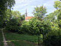
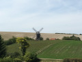
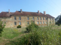
At the foot of the windmill, the picturesque village of Dosches has preserved a fascinating heritage. The interpretive trail traces life in days gone by and its traditional trades, winding its way past half-timbered houses, the two churches and Rosson Castle.

Details

2217499
Creation:
Last update:
Last review:
  • Walking
    Activity: Walking
  • ↔
    Distance: 2.61 mi
  • ◔
    Average duration: 1h 20 
  • ▲
    Difficulty: Easy

  • ⚐
    Back to start: Yes
  • ↗
    Ascent: + 138 ft
  • ↘
    Descent: - 135 ft

  • ▲
    Highest point: 561 ft
  • ▼
    Lowest point: 449 ft
  • ⚐ Country: France
  • ⚐ City: Dosches (10220)
  • ⚑
    Start/End: N 48.320505° / E 4.248236°
  • ❏
    IGN map(s): Ref. 2817SB
  • Hour-by-hour weather

Photos

Description of the walk

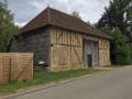
Starts from the village square in Dosches. Trail sign on the east façade of the Dosches barn.

Signposting: sheep symbol.

(S/E) With your back to the barn, turn right onto Rue Grand Cernay and walk for 150 metres until you reach thesecond information board on the trail. At the “Maison d’André”, turn round, head towards the town hall, then turn right at the war memorial.

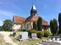
(1) At the ‘sheep’ signpost, with your back to the war memorial, walk up the street for about twenty metres, then turn left onto the grassy path. At the end of the path and the climb, cross the cemetery and take the opportunity to explore the Church of Saint John the Baptist.

(2) Ignore the road on the left and carry on straight ahead towards the hamlet known as “Le Faubourg”.

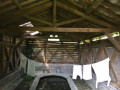
(3) When you reach a wooden shelter and the sign marking the exit from Dosches, turn right onto the Route du Balcon du Parc towards Rosson.

(4) At the entrance to Rosson, take Rue des Templiers on the right. Then, after about 80 metres, turn left onto the grassy path.

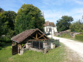
(5) Turn right towards the wash house, then take the path on your left until you reach the Route du Balcon du Parc. At the junction, turn left onto Rue l’Orme.

(4) Back at the entrance to Rosson, retrace your steps to Dosches.

(2) At the junction before the cemetery and the church, turn right, follow Rue des Buchettes, then turn left towards the village square (S/E).

Waypoints

  1. S/E : mi 0 - alt. 463 ft - Village square, Dosches barn
  2. 1 : mi 0.25 - alt. 459 ft - War memorial
  3. 2 : mi 0.45 - alt. 495 ft - Junction, go straight on
  4. 3 : mi 0.87 - alt. 518 ft - Bus shelter
  5. 4 : mi 1.12 - alt. 469 ft - Entrance to Rosson
  6. 5 : mi 1.21 - alt. 453 ft - Washing house
  7. S/E : mi 2.61 - alt. 463 ft - Dosches village square

Notes

Unpaved paths: 57.6%
Starting point: picnic tables under the market hall.

Leaflet available at the town hall, the mill and the Maison du Parc.

Worth a visit

- Dosches Windmill.

Reviews and comments

4.3 / 5
Based on 3 reviews

Reliability of the description
4.7 / 5
Ease of following the route
4 / 5
Route interest
4.3 / 5
PG10
PG10

Overall rating : 3.7 / 5

Date of your route : Mar 02, 2026
Reliability of the description : ★★★★☆ Good
Ease of following the route : ★★☆☆☆ Disappointing
Route interest : ★★★★★ Very good
Very busy route : No

A delightful little trail with very interesting and enjoyable information boards describing the living conditions, solidarity and conviviality of past generations.
Just one minor criticism of the description:
- two nearby buildings could be called barns... so I couldn't find the right starting point.
- Didn't see the town hall.
- In fact, once at the war memorial, I lost my bearings and took the route backwards.
Not a big deal in itself. But why, when we are at a crossroads, not guide walkers with directional signs or street names... that would have been much simpler and clearer.
Nevertheless, thank you to the creators of this very pleasant route.

Machine-translated

gerard.michel0908@orange.fr

Overall rating : 4.7 / 5

Date of your route : May 15, 2021
Reliability of the description : ★★★★★ Very good
Ease of following the route : ★★★★★ Very good
Route interest : ★★★★☆ Good
Very busy route : No

During the pandemic, we were on our own and the eco-museum and the mill were closed; nevertheless, the route is a good way to gain an insight into life in this region, and the two villages have plenty to offer; the route is easy for families to follow and we still managed to make our way up to the mill despite the changeable weather (no shelter available)

Machine-translated

clem200
clem200

Overall rating : 4.7 / 5

Date of your route : Jul 06, 2020
Reliability of the description : ★★★★★ Very good
Ease of following the route : ★★★★★ Very good
Route interest : ★★★★☆ Good
Very busy route : No

A lovely, quiet route. We did it as a group of four in 1 hour 40 minutes (including a few stops to take photos)
We extended the walk by heading up to the windmill above the town (entrance fee applies, €6)
Very exposed to the sun, so be careful in the height of summer

I’d recommend it.

Machine-translated

Other walks in the area

For more walks, use our search engine .

The GPS track and description are the property of this route's author. Please do not copy them without permission.