


 Country:
 City:
City:


(Start/Finish) Our walk begins at Otto-Hellinghausen-Platz in Mudersbach, right on the banks of the River Sieg.
We walk through the village of Mudersbach past the former smithy (now a florist’s) and the village church, built in 1862. To do this, we first cross the River Sieg, as well as ‘Siegstraße’ and ‘Koblenzer Straße’, before turning right into the street ‘Am Seifen’.
(1) We turn right onto ‘Bergstraße’ and then left onto ‘Bussardweg’, walking through the Ölsbach Valley on a steady climb towards Giebelwald, where we soon come across the Mudersbach municipal waterworks and the ore adit.To reach this, we first turn left, cross a stream, then turn right at the next opportunity and continue along the path until we leave the main track to the left. A sharp right-hand bend follows, and the path continues steadily uphill to the Erzquell adit, from which the Erzquell Brewery draws its brewing water.
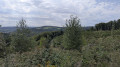
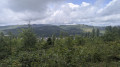
(2) Our walking route now descends once more towards the Sieg Valley, with gaps in the trees repeatedly offering magnificent views into the valley. We follow the path, turn sharply right at the next fork and then make a left-hand bend. We continue along the main path until we reach a junction where four paths converge. Here we turn right; at the next junction, we turn sharply left and then take the second option on the right.
(3) We continue along the main path, ignoring the next few turn-offs. After crossing the Schindebach, we turn left and then sharply right. At the next fork, we turn left again.
(4) Through the Schindetal valley, we pass a La Tène archaeological site on our way to the Mariengrotte above Mudersbach, and then walk above the village, enjoying a magnificent view over it, to the Mudersbach cemetery.
(5) Experienced walkers continue the walk, following the path alongside the B62 district road; in Niederschelden, they reach ‘Lindenstraße’, then turn right onto the street ‘Am Wald’, passing the Catholic church.
(6) Then turn right again onto “Mittelstraße”, past the Erzquell brewery. We cross the district road; the path descends once more towards the banks of the River Sieg, which we cross.
(7) The path climbs steadily through the village of Birken along “Hauptstraße”, then “Kapellenweg”, and finally turns left onto “Waldstraße”, which leads into the forest.
(8) We set out to climb the Birker Ley. We therefore join the Birker-Ley-Steig, which takes us up a steep 800-metre ascent to the viewing point. To do this, we turn sharply right at the first junction and then sharply left.
(9) The return route takes us back onto the main footpath and past an educational apiary to the Birker Ley ore adit.
(10) We then turn right; the path slopes downwards again and we reach Birken via the ‘Ginsterweg’, before turning left into ‘Löhrstraße’ to follow the Birker Backe on the opposite side of the valley and reach the Hohe Ley.
(11) We cross a stream, turn left and, at the next fork, turn sharply right; we follow the path and turn sharply left onto the Hohe Ley.
(12) We then turn right, continue along the path, which soon leads to the left and then sharply to the right along the Findlingsstollen.
(13) At the next junction, we turn left and then immediately left again; after a sharp right-hand bend, we reach the Ecker Grundstollen and return to the banks of the Sieg. We walk a short distance along the Sieg to the right.
(14) Here we come to the SGV Wilhelmslust slate tunnel. A short walk then takes us back to the starting point of the walk via the road ‘Im Hüttenwald’. (Start/Finish)
 Visorando Member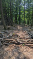
 Easy
Easy 

 Association / Club / Walk leader
