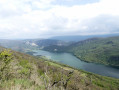
Charmines and Oignin Waterfalls: dam, waterfalls and potholes

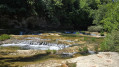
A nature getaway offering breathtaking natural scenery. Once you reach the riverbank, prepare to be amazed. Numerous waterfalls and natural potholes, carved out by the water, await you. These pools are perfect for a refreshing swim and even a few jumps for the more daring. The perfect setting for a dip in crystal-clear waters surrounded by lush greenery – a true haven of peace.

Details

88428108
Creation:
Last update:
Last review:
  • Walking
    Activity: Walking
  • ↔
    Distance: 1.11 mi
  • ◔
    Average duration: 0h 45 
  • ▲
    Difficulty: Easy

  • ⚐
    Back to start: Yes
  • ↗
    Ascent: + 240 ft
  • ↘
    Descent: - 236 ft

  • ▲
    Highest point: 1,270 ft
  • ▼
    Lowest point: 1,060 ft

Photos

Description of the walk

On leaving Matafelon-Granges, on the D18 towards Izernove, and at the bend before crossing the Oignin, carry on straight on towards the Charmines dam. The road turns into a stony track. Pass a garage; there is a small car park just after it, on the right.

(S/E) From the car park, follow the gravel track to the right. Turn right again to reach the Charmines dam, animpressive structure from which you’ll have a lovely view of the Oignin reservoir.

(1) Return to the white path and continue to the right.

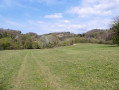
(2) Cross the meadow (yellow markings) to the edge of the forest, then take a path that winds through the trees. At a junction, leave the yellow markings and take the path leading down to the right: there is a Yellow Cross on a stone on the ground.

(3) After a steeper descent, a first access point – by climbing a small hillock on the right – leads to the stunning area of potholes and numerous waterfalls: this is the most interesting route. You can dip your feet in the water, have a swim or cross over to the other bank. Be careful, however, of any water releases from the dam, which are indicated by signs. Retrace your steps, then set off to the right.

(4) A little further down, a second access point – though slightly less spectacular – also allows you to reach the Oignin and view the waterfalls from below. Then follow the route back in the opposite direction to return to the car park (S/E).

Waypoints

  1. S/E : mi 0 - alt. 1,266 ft - Car park
  2. 1 : mi 0.15 - alt. 1,234 ft - Charmines Dam
  3. 2 : mi 0.35 - alt. 1,240 ft - Crossing through meadows
  4. 3 : mi 0.61 - alt. 1,086 ft - First access point: potholes and waterfalls
  5. 4 : mi 0.62 - alt. 1,066 ft - Second access point to the potholes and waterfalls
  6. S/E : mi 1.11 - alt. 1,266 ft - Car park

Notes

A easy route, but do make sure you wear sturdy shoes as the slope can be slippery.

Be aware of any signposted water releases from the dam.

Worth a visit

(1) The Charmines Dam is an important site for both hydroelectric power and walking. It is situated on the Oignin, a tributary of the Ain, and is linked to the Moux hydroelectric power station. The dam was built in 1950 and is 22 metres high, with a maximum head of 78 metres. It has two vertical-axis Francis turbines, each with a capacity of 13 megawatts, and a 1,550-metre headrace. The reservoir covers an area of 77 hectares and is situated between the municipalities of Samognat and Matafelon-Granges.

Other walks in the area

For more walks, use our search engine .

The GPS track and description are the property of this route's author. Please do not copy them without permission.