Country:

 City:
City:


Park in the centre of Thoirette.
Yellow markings
(S/E) Take the Montée des Fontaines towards Turgon.
(1) At a place called La Condamine, carry on straight ahead along a road that ends in a dead end, then continues as a path. You’ll come to a Fork in the road.
No markings
(2) Turn left onto a path that gradually descends towards La Valouse and reach a fork.
(3) Turn left and continue down a forest track for about a hundred metres.
(4) Turn right onto a forest track that runs alongside the Valouse and turns into a footpath after 1 km. Please note that 500 m from the end of the footpath there is a section partially blocked by numerous trees that fell during the storm in November 2023: however, getting round them does not pose any particular difficulties. You will reach a stream.
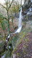
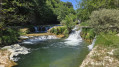
(5) Cross the stream (dry in summer). You can head up to the right to see a lovely little waterfall. Cross the field until you reach a track suitable for vehicles, which leads to the D202.
(6) Turn right onto this road and follow it for about 500 metres until you reach a track on the right.
(7) Follow this for about 500 m: It is also possible to continue straight on along the road to the hamlet of Villette and rejoin the route at point (10) as the path between points (8) and (9) can be difficult to find.
(8) Turn left. Follow the fence, climb through a copse for about thirty metres to rejoin the path in the field above on the right. Follow the path until you reach a track suitable for vehicles.
(9) Follow this track down to the hamlet of Villette. Beautiful view of Cornod Castle and its valley.
(10) Turn right and take the road leading up to the hamlet of Turgon.
(11) On leaving the hamlet, turn left to climb up to the viewpoint overlooking the Ain Gorges and Conflans Castle. It is possible to do a round trip, though the descent through the fields can sometimes be difficult.
Yellow signposts
(12) Carry on straight ahead and head down into the field, following the fence on the left until you reach an old track.
No markings.
(13) Turn right and continue for about 500 m along this grassy track until it joins a track suitable for vehicles.
(14) Follow it to the right for about 500 m, until you reach a fork.
Yellow markings
(15) Leave this track, turn left to follow the path down towards Thoirette and return to the fork you passed on the way there.
(2) Retrace your steps along the route you took on the way out to return to the car park (S/E).



 Visorando Member

 Easy
Easy 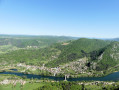
 Difficult