Country:
 City:


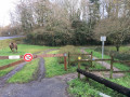
The waterfall car park on the D26, Rue de la Vallée in Sautron.
(S/E) From the Vallée car park, cross the road at the pedestrian crossing (take care as it is a very busy road) to join the path leading off to the right which runs alongside the River Cens. Follow this path as it winds round the Moulin l’Évêque, a large estate with a pond. Cross the small road leading to the property and, after a short climb, continue into La Hubonnière. Turn right and walk through the hamlet until you reach, straight ahead, a wide path; follow this to the end after crossing the street in a residential area.
(1) At the junction, turn right and carry on straight ahead due south along this path, ignoring the turnings on both the left and right. The path becomes Rue de la Pentecôte, which you follow straight ahead until you reach a large roundabout on Avenue de la Pentecôte. Cross the avenue (caution: busy road) using the pedestrian crossing to the right of the roundabout. Head off to the right towards Sautron. You will very soon find, on the left, the entrance to Chemin du Diable, marked by a cross.
(2) Follow the long, straight stretch of this path heading south-west, ignoring the turnings on both the right and left. When you reach a large roundabout, go round it on the left; once you have crossed Rue des Tisserands and passed a turning on your left, you will find a footpath heading in the same south-westerly direction as the Chemin du Diable. You’ll soon reach a passage under the Nantes–Brest motorway (later renamed the “expressway”).
(3) At the end of the underpass, turn right onto a path that runs alongside the expressway. Follow it until you reach a small road (Rue de la Chézine); take this on your right to cross the expressway via a bridge.
(4) At the end of the bridge, cross Rue de la Chézine (with care) to take a path on the left. Follow this path, which runs alongside the expressway, until you reach a Fork in the road (marked by a signpost for
hiking trail).
(5) Turn right here, then, a few metres further on, turn left. Continue straight on along this path, which runs alongside the dual carriageway but at a fair distance from it. Ignore any side paths until you reach a junction with a path coming from the right (the Chemin du Tertre).
(6) Take the passage marked by a wooden gate and head off to your left. The path continues to run alongside the dual carriageway at a distance; it is soon separated from it by a high fence. Carry on
until you reach a road. You’ll see, on your left, a passageway under the motorway.
(7) Take this passage, keeping to the left-hand side, until you reach a four-way junction. Then cross the road (carefully!) to find a car park on your right. Slightly to your left, take the path almost directly opposite Rue de la Helberderie.
(8) The path runs alongside the fence of a lovely property (on your left). Follow it until you reach a small road, then follow it to the right. You’ll go round the hamlet of La Sorbière. As you follow the road, take a right-angle left-hand bend and pass through the Bois des Landes. A little further on, after a right-angle bend to the right, you’ll come to a junction with a small road (marked with a directional arrow pointing back towards La Sorbière). Turn right onto this road until you reach a large bridge crossing over the dual carriageway.
(9) At the end of the bridge, cross the road (take care) to find, below on your left, a path leading back towards the motorway. Take this path. A first right-hand bend takes you alongside the dual carriageway for about a hundred metres, then a second right-hand bend takes you away from the dual carriageway for good. Follow this path, which, after a final right-hand bend, leads you to Rue de Bretagne. On your right you’ll see a leisure park.
(10) Cross the road (take care – it’s a very busy road) then head off to your left. After a few dozen metres, take the path on your right. Carry on straight ahead until you reach Rue de la Forêt, which you take to the left. Follow this street until you reach Route de Bongarant (Stop sign). Turn right and follow this road (whichis quite busy and has no proper pedestrian crossing) until you reach Rue de la Chapelle on your right. Follow this street, which leads straight to the Notre-Dame-de-Bongarant Chapel.
(11) Take the street that runs alongside the chapel on its left. After passing a row of beautiful stone houses, the street turns into a path that descends to a ford. Continue along this path, which begins to climb more or less steeply until you reach a crossroads with four paths. Carry on straight ahead. The track turns into a street (Rue des Goulets). Walk past the Serres du Cens until you reach a Fork in the road (there is a path entrance on the left, signposted ‘Les Goulets’).
(12) Carry on straight ahead until you reach Rue de la Forêt, then, on your left, Rue des Acacias. Follow this street down to a left-hand bend and, on your right, just before the bend, you’ll find a wide path entrance.
(13) Turn right onto this path. Quite soon, the path begins to descend steeply, takes a right-angled bend to the left, and continues downhill to a junction leading, on the left, to a footbridge. Ignore it, go straight on past a right-angled bend to the right, then carry on straight ahead. You’ll walk alongside the Cens for quite a while, until you reach a Fork in the road with a footbridge on the left.
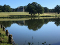
(14) Take this footbridge to walk along the Étang de la Bretonnière on your right-hand side.
Once you’ve passed the lake, walk along a meadow on your right-hand side, then cross the Cens via a small bridge. A little further on, take the steps on your left, which will lead you back to the Vallée car park (S/E).

 Visorando Member
 Easy