Country:
 City:
City:


The route starts at a tram stop to avoid travelling by car. However, there is a park-and-ride facility just by the roundabout marking the terminus on Boulevard Marcel Paul. You will pass through four parks and follow five paths marked with a Yellow Cross.
Starting point: Tram No. 3 terminus ‘Marcel Paul’.
(S/E) Walk up the quay for a few metres towards Nantes and take the path on the right.
(1) Follow Rue du Danube to the left for 150 metres. Turn left, then right to enter Parc de la Savèze. Follow the path running below the blocks of flats to reach the area below the Sillon de Bretagne esplanade.
(2) Turn right, go down the stairs, then follow the path on the right until you reach Rue du Danube, with a small bridge on your right. Cross the road and follow the path opposite, which leads to Rue du Zambèze – in theory, to a junction marked by a yew tree in the centre of the street. Alternatively, if you have strayed from the path and find yourself facing the Allée des Landes Notre-Dame, turn left onto Rue du Zambèze and continue until you reach the yew tree. Cross Rue du Zambèze and carry on along the path until you reach the posts marked ‘Route Hermeland’, at the entrance to Parc de la Chézine.
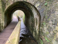
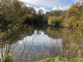
(3) Cross Boulevard du Val de Chézine at the pedestrian crossing to join the Chézine on the left, a path marked with a Yellow Cross. Follow the river for 400 metres until, after climbing a few steps, you reach a footbridge which you should cross. Turn right, then leave the banks of the Chézine on the left via the path marked with a Yellow Cross; walk alongside a pond and climb a few steps, continuing whilst keeping the stream on your right. The path is fenced off on the right after a pond; pass under the road through the tunnel to reach the Hôtel de la Marine on Allée Prosper Mérimée.
(4) At the entrance to the Parc de la Bégraisière, keep the playgrounds on your right and walk along Rue François Rabelais, then take the path on the right which leads you to the Charles-Gautier Hermeland Media Centre, passing in front of the Bégraisière farmhouse.
Walk along the north side of the media centre and take the small path slightly to the right. Follow it until you reach Avenue Madame de Sévigné.
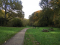
(5) Cross at the pedestrian crossing to follow the path opposite, leaving two paths on your left. Continue along the path marked with a Yellow Cross to complete a lovely anti-clockwise circular loop. Keep to the left as you pass the Fork in the road to reach a junction, then turn left to reach the Quatre Vents picnic area. Take the path heading due north, then turn right to reach the pedestrian crossing on Rue Madame de Sévigné.
(5) Cross Rue Madame de Sévigné and follow the tracks and paths running alongside Avenue Louis Guilloux on your left. When you reach a zigzagging footbridge, cross it and continue until you cross the River Chézine.
(6) Turn left under the road bridge. Follow the Chézine, keeping it on your left, cross a private road and continue to the road bridge.
(7) Do not go under the bridge but take a path marked with a Yellow Cross on the right, after a large metal gate in poor condition. The path is narrow and grassy, then tarmac-surfaced as it reaches a road. Follow the road until you reach a car park on the right, which you should cross, then walk alongside the stadium until you reach the first pedestrian crossing.
(8) Cross Rue du Zambèze and take the path opposite, which initially runs alongside a picnic area and children’s play equipment. Follow the start of the fitness trail. When you reach the pull-up bars, take the bridge on the left.
(1) Cross the road and follow the path marked with a Yellow Cross as far as the tram and the terminus of Tram No. 3, ‘Marcel Paul’ (S/E).

 Visorando Member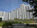
 Moderate