Country:
 City:


Starting from Place François Baudry, bus stop, TAN 69 bus to Sautron.
(S) From the square, head north along Rue de l’Église. Walk between the church and the school until you reach the junction with Rue du Doussais (at the top of the steps). Walk a few metres to the left, then turn right onto Rue de la Vallée. Follow this road until you reach the Vallée car park on your left, the starting point for many walks.
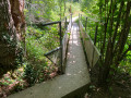
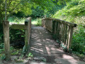
(1) After crossing the car park, turn right, cross the Cens via a small bridge and continue along the path straight ahead. Go round the Étang de la Bretonnière on the right. Cross the Cens via a footbridge on the right, then continue along the river on your right-hand side. You’ll cross a small footbridge, then reach a Fork in the road. Take the right-hand branch, which descends quite steeply. After a right-angled bend to the left, you’ll come to a bridge with wooden railings on your right.
(2) Take “Laennec pont” and continue along the path, which climbs slightly, bends to the right and then runs alongside a group of houses on its left, protected by a wire fence. When you reach a crossroads, turn left to reach a small square, which marks the start of Rue des Acacias. Walk up this street on the right-hand side, then turn right into the first street you come to. The street climbs slightly, then turns into a path that leads into a housing estate. Turn left to leave the estate and head diagonally right onto Chemin des Goulets. Continue until you reach the first entrance on your right, marked with a sign reading “les Goulets”.
(3) Turn right onto the path. After a mostly flat section, the path begins to descend quite steeply to a series of two footbridges.
(4) Cross them and carry on straight ahead. The path begins to climb steeply, ends in a flight of steps and, after a nearly flat section, reaches a road which you take on your left. Follow the road, keeping to the right-hand side, and cross the Guillaudière. At the first junction, turn right until you come to a small, fairly busy road. Turn right again carefully until you see, on your left, the entrance to the Chemin du Fief.
(5) Take this path and follow it until you come to another path joining from the left. Turn right onto this new path and continue until you reach a road. Turn left onto this fairly busy road, keeping well to the left-hand verge. Walk on until you find, on your right, the entrance to a new path, the Chemin Vert. Cross carefully to take this path. A little further on, you’ll come to the Chemin des Landes. Turn right. The path takes a right-angled bend to the left, leading to a Fork in the road. Continue to the right along the Chemin des Landes until you reach a road (your landmark will be a large pylon).
(6) Turn right, towards La Grée, until you come to the Chemin de la Thomasière on your left. At the end of this tarmac road, turn right onto a dirt track which can sometimes be very muddy. After a relatively flat section, the track curves slightly to the left, then begins to descend quite steeply. Continue straight ahead until you reach a footbridge.
(7) Cross the footbridge and take the path that begins immediately after it. This path runs alongside a small stream, winding slightly until it meets a wide path coming from the right, which you’ll take by heading left. Follow this path, which runs alongside the Cens, until you reach a picnic area very close to a footbridge.
(8) Do not cross this footbridge, but take the path that starts immediately on your right and runs along the right bank of the Cens. Continue straight ahead on this path, which varies in width, until you reach another footbridge on the left.
(9) Cross the Cens via this footbridge and turn immediately right at the end of it to join a wide path leading off to the left. Carry on straight ahead to the Pont Marchand, marked, amongst other things, by a footbridge on the right which you must not take.
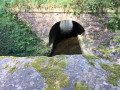
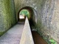
(10) Carry on straight ahead and follow the River Cens on your right, keeping more or less close to it. Pass through the passageway under the Pont aux Prêtres. At the exit, use the footbridge on your right.
(11) Cross the river and turn left to follow the wide path ahead. After passing the Rocher du Diable, just before a small bridge, turn right and continue along the Cens on your left. You’ll arrive, near a dyke, at a crossroads with a bench and an information board. At the dyke, walk a few metres to the left and pass under the motorway on the right.
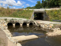
(12) Take the path straight ahead, crossing over a structure that allows the River Cens to flow through. Walk alongside a retention basin and, at its corner, turn right as you come out from under a small bridge. Walk alongside a stream on your right. Cross two small wooden bridges. The path turns left, then, a little further on, turns right. It begins to climb, levels out slightly and, finally, leads you to a footbridge at the start of the Étang de la Cholière.
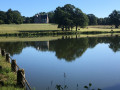
(13) Walk round the pond on the left, then follow the residential area on your left. Cross Rue du Général de Gaulle and continue along the path that starts opposite. At the end of this path, turn right onto Allée des Cèdres and, as you emerge from the woods, you’ll reach the Tredegar roundabout. Turn left onto Avenue de la Cholière, then, at the next roundabout, turn right onto Rue de Saint-Ouen. You will reach Place d’Auteuil, in the Petit Chantilly neighbourhood of Orvault (E).

 Visorando Member
 Easy