


Refine your search for walks in Sarrancolin
Sarrancolin walks


 Pic de Montaut via the Coq ridge and the Cabane de Collantigue
 Visorando Member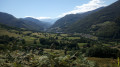
 9.10 mi
 +3,583 ft
 -3,583 ft
 7h 20
7h 20
 Difficult
 Departure from Sarrancolin (Hautes-Pyrénées)
A lovely hike done clockwise for a gradual and gentler climb. With two options available, this hike can be adapted to suit different levels. The aim is to meet up at the Collantigue hut to share a meal and a rest.
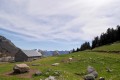
Col de Beyrède from Sarrancolin
 10.20 mi
+2,644 ft
-2,621 ft
7h 00
10.20 mi
+2,644 ft
-2,621 ft
7h 00
 Average
Departure from Sarrancolin (Hautes-Pyrénées)
Average
Departure from Sarrancolin (Hautes-Pyrénées)
A fairly long circular hike from Sarrancolin. This ascent to the Col de Beyrède from the Arreau Valley allows you to rediscover the old paths that once enabled shepherds to drive their flocks up to the summer pastures. Of course, some sections of these paths have been modified by motorised vehicles.Please note: this walk is unmarked from (3). The GPX track may prove useful, particularly from (10) to (14).
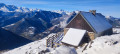
Collantigue hut
 6.04 mi
+2,651 ft
-2,651 ft
5h 05
Average
Departure from Ilhet (Hautes-Pyrénées)
6.04 mi
+2,651 ft
-2,651 ft
5h 05
Average
Departure from Ilhet (Hautes-Pyrénées)
Climb up to this beautiful hut, which is in perfect condition. It is closed and private. However, there is a small hut in good condition available below this spot.
Please note: part of the hike is unmarked, so a good sense of direction is necessary.This hike can be done in average snow conditions. However, this requires even better orientation skills.
Pla de la Peyre
4.06 mi
+1,483 ft
-1,470 ft
3h 10
Average
Departure from Sarrancolin (Hautes-Pyrénées)
A short walk starting from Sarrancolin, offering a beautiful view of the Aure Valley and leading to the Pla de la Peyre. A significant climb and little shade towards the end.
Sur les hauteurs de la Neste d'Aure au départ de Camous
 2.15 mi
+561 ft
-538 ft
1h 30
2.15 mi
+561 ft
-538 ft
1h 30
 Easy
Departure from Camous (Hautes-Pyrénées)
Easy
Departure from Camous (Hautes-Pyrénées)
Petite balade facile au départ de Camous.
Tour of the three villages: Rebouc, Hèches and Héchettes
 Association / Club / Walk leader
 5.70 mi
+817 ft
-843 ft
3h 20
Easy
Departure from Hèches (Hautes-Pyrénées)
5.70 mi
+817 ft
-843 ft
3h 20
Easy
Departure from Hèches (Hautes-Pyrénées)
the route is no longer marked or maintained!between points 4 and 5, there may be sections of around 20 metres of tall grass between June and September, but it remains passable all year round. The path may be muddy 100 metres before point 5.
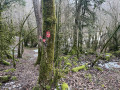
The circular is accessible on foot or by bike. You will discover Rebouc, Hèches and Héchettes, villages that have remained almost unchanged since 1820-1860, as evidenced by the inscriptions carved in marble on the doors. This route will also allow you to discover the winding and sometimes steep paths that connected each of these villages. Between villages, forests and meadows, the walk will be bucolic!
Short circular loop from Larrieu to Rebouc
 2.62 mi
+285 ft
-285 ft
1h 25
Easy
Departure from Hèches (Hautes-Pyrénées)
2.62 mi
+285 ft
-285 ft
1h 25
Easy
Departure from Hèches (Hautes-Pyrénées)
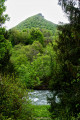
This route is no longer signposted, but a GPS or map will suffice. This beginner-level route presents no difficulties apart from the elevation gain. It will allow you to explore the hills of Rebouc whilst staying on a tarmac road that is very quiet. Ideal for getting some fresh air, requiring no special equipment and suitable for all fitness levels.
The Aure Valley from Rebouc
 5.38 mi
+1,522 ft
-1,526 ft
3h 50
Difficult
Departure from Hèches (Hautes-Pyrénées)
5.38 mi
+1,522 ft
-1,526 ft
3h 50
Difficult
Departure from Hèches (Hautes-Pyrénées)
The route is no longer marked or maintained!!!Between May and October: tall, dense ferns between points 4 and 6 make the route very difficult.
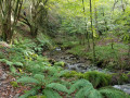
A summary of what the valley entrance has to offer: breathtaking 360° views, highlighting the incredible alignment of the valley. Discover steep paths, fords, shaded areas, mossy areas, ridges, meadows, forests and scrubby moorland, ending with a passage along a turbulent stream with multiple waterfalls.
Fréchet-Aure - Sarrancolin
 3.18 mi
+446 ft
-807 ft
1h 50
Easy
Departure from Fréchet-Aure (Hautes-Pyrénées)
3.18 mi
+446 ft
-807 ft
1h 50
Easy
Departure from Fréchet-Aure (Hautes-Pyrénées)
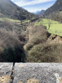
Fourth stage of the Ténarèze: this section of the route takes you back to the GR®105 from Fréchet-Aure.
The route continues through Camous, a picturesque village with a rich mining heritage. You will then take a path towards Ilhet, following the old railway line, an industrial relic that adds a touch of nostalgia to the hike.
The walk continues to Sarrancolin, the end point of this stage.
Family route at the Col d'Aspin
 2.09 mi
+509 ft
-509 ft
1h 25
Easy
Departure from Aspin-Aure (Hautes-Pyrénées)
2.09 mi
+509 ft
-509 ft
1h 25
Easy
Departure from Aspin-Aure (Hautes-Pyrénées)
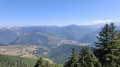
On holiday in the Pyrenees, the weather is fine and dry, so why not take a walk to the Col d'Aspin with our two children (aged two and a half and five and a half).
Col d'Aspin, Aspin-Aure, Hourquette d'Arreau
 9.60 mi
+2,667 ft
-2,644 ft
6h 45
Difficult
Departure from Aspin-Aure (Hautes-Pyrénées)
9.60 mi
+2,667 ft
-2,644 ft
6h 45
Difficult
Departure from Aspin-Aure (Hautes-Pyrénées)
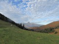
A long circular route passing through a small village typical of the Hautes-Pyrénées. The route passes beneath small peaks that can be easily climbed, depending on your fitness level.
Plo del Naou
 3.76 mi
+978 ft
-974 ft
2h 35
Average
Departure from Aspin-Aure (Hautes-Pyrénées)
3.76 mi
+978 ft
-974 ft
2h 35
Average
Departure from Aspin-Aure (Hautes-Pyrénées)
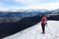
From the Col d'Aspin, this short round-trip hike will take you along the ridges between the Campan and Aure valleys for a superb view of the Pic du Midi de Bigorre, the Arbizon and the Perdiguère peaks.
Signal de Bassia route on the Baronnies side
 4.28 mi
+2,513 ft
-2,507 ft
4h 10
Average
Departure from Esparros (Hautes-Pyrénées)
4.28 mi
+2,513 ft
-2,507 ft
4h 10
Average
Departure from Esparros (Hautes-Pyrénées)
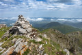
Pass by the Puits de la Pindorle, then follow the ridge to Cap de Castillon. 360° view of the ridge from the Signal de Bassia. Caution: steep descent from Cap de Castillon.
 Col d’Artigue Couade
 8.92 mi
+2,320 ft
-2,329 ft
6 hrs
Difficult
Departure from Jézeau (Hautes-Pyrénées)
8.92 mi
+2,320 ft
-2,329 ft
6 hrs
Difficult
Departure from Jézeau (Hautes-Pyrénées)
A fairly challenging snowshoe hike in a little-known valley.
This hike is classified as difficult as it takes place off the marked trails. During my hike, there was a lot of snow. Some cars had been buried under a thick layer of snow.
A good sense of direction is absolutely essential. But the scenery is spectacular.
There is no danger whatsoever if you follow this description and this GPS track.
Pic de Mont Aspet from the Nistos Cap Nestès cross-country ski resort
 5.49 mi
+958 ft
-974 ft
3h 20
Average
Departure from Sarrancolin (Hautes-Pyrénées)
5.49 mi
+958 ft
-974 ft
3h 20
Average
Departure from Sarrancolin (Hautes-Pyrénées)
A hike without too much elevation gain that leads to Pic de Mont Aspet (1,849 m), where you will have a magnificent 360° view.
Pic de Montaut from Nistos Cap Nestès
 6.20 mi
+2,277 ft
-2,257 ft
4h 50
Average
Departure from Sarrancolin (Hautes-Pyrénées)
6.20 mi
+2,277 ft
-2,257 ft
4h 50
Average
Departure from Sarrancolin (Hautes-Pyrénées)
A beautiful ridge hike offering superb views of the Aure Valley, to be done on foot or with snowshoes.
No fewer than four peaks along the route, a real rollercoaster ride in the Pyrenees.
More walks in Sarrancolin
Select a point of interest below: