Pla de la Peyre

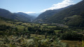
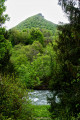
A short walk starting from Sarrancolin, offering a beautiful view of the Aure Valley and leading to the Pla de la Peyre. A significant climb and little shade towards the end.

Details

11961202
Creation:
Last update:
Last review:
  • Walking
    Activity: Walking
  • ↔
    Distance: 4.06 mi
  • ◔
    Average duration: 3h 10 
  • ▲
    Difficulty: Moderate

  • ⚐
    Back to start: Yes
  • ↗
    Ascent: + 1,483 ft
  • ↘
    Descent: - 1,470 ft

  • ▲
    Highest point: 3,507 ft
  • ▼
    Lowest point: 2,064 ft

Description of the walk

(S/E) Set off from the bridge over the Canal de la Neste, behind the Esplantats chapel. The trail is marked in yellow. Follow the shaded road that runs alongside the canal, then veers away from it to climb in hairpin bends.

(1) At the crossroads, follow the yellow sign for “Pla de la Peyre via Panets”.

(2) Cross the Ruisseau de l’Arrivet and head towards the Panets farmstead.

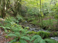
(2) Walk between the two farmsteads. Don’t forget to say hello to the dogs, if they’re there. Go under the fences to climb the steep but shaded slope.

(4) Leave the barn on your left. This is a good spot for a break before tackling the final climb. Take the path that winds its way up through the ferns. Please note that this path is not shaded and accounts for a significant part of the hike’s elevation gain.

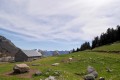
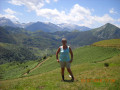
(5) Pla de la Peyre, view over the Aure valley. You can take a stroll across the plateau, which offers a few different vantage points.
The return journey follows the same route back to the car park, via the bridge over the Canal de la Neste (S/E).

Waypoints

  1. S/E : mi 0 - alt. 2,064 ft - Car park by the bridge over the - Canal de la Neste
  2. 1 : mi 0.81 - alt. 2,438 ft - Crossroads
  3. 2 : mi 1.16 - alt. 2,628 ft - The Arrivet stream
  4. 3 : mi 1.43 - alt. 2,648 ft - Panets farmstead
  5. 4 : mi 1.59 - alt. 2,963 ft - Cowshed
  6. 5 : mi 2.03 - alt. 3,507 ft - Pla de la Peyre
  7. S/E : mi 4.06 - alt. 2,064 ft - Car park by the bridge over the Canal de la Neste

Notes

No water sources. You can take shelter in the barn, provided the cows aren’t there.

Worth a visit

The medieval village of Sarrancolin.

Reviews and comments

4.4 / 5
Based on 3 reviews

Reliability of the description
5 / 5
Ease of following the route
5 / 5
Route interest
3.3 / 5
PaulaGauthier
PaulaGauthier

Overall rating : 4.3 / 5

Date of your route : Dec 08, 2025
Reliability of the description : ★★★★★ Very good
Ease of following the route : ★★★★★ Very good
Route interest : ★★★☆☆ Average
Very busy route : No

Short hike to continue towards the Artiguluz hut, then Cap de Paou and the summit of Bardououdou
Very little snow at 1,780 metres

Machine-translated

chespeel
chespeel

Overall rating : 4.7 / 5

Date of your route : Aug 14, 2023
Reliability of the description : ★★★★★ Very good
Ease of following the route : ★★★★★ Very good
Route interest : ★★★★☆ Good
Very busy route : No

An easy walk; the path is well signposted; lovely views of the Pic du Midi; watch out for the Patou – it can be a bit aggressive after the pig farm

Machine-translated

tuquoquemifili
tuquoquemifili

Overall rating : 4.3 / 5

Date of your route : Mar 26, 2023
Reliability of the description : ★★★★★ Very good
Ease of following the route : ★★★★★ Very good
Route interest : ★★★☆☆ Average
Very busy route : Yes

A very easy walk, with a lovely view of the Pène Haute and the Pic de Montaut at the end.
Well worth doing if you’re planning a picnic at the summit.

Machine-translated

Other walks in the area

For more walks, use our search engine .

The GPS track and description are the property of this route's author. Please do not copy them without permission.