Sant’Anna Valdieri – Livio Bianco Mountain Hut

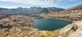
A picturesque climb through a deciduous forest leading out into an alpine valley. Nestled at the far end of this valley, in the hollow of an imposing mountain cirque, lies the refuge. What a delight it is, in the evening, to sit on the terrace and gaze at the reflection of the peaks in the mirror-like surface of the lake.

This walk is part of a multi-day hike: Tour of the Argentera

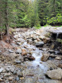
Details

n°2784592
Creation:
Last update:
Last review:
  • Walking
    Activity: Walking
  • ↔
    Distance: 4.46 mi
  • ◔
    Average duration: 4h 35 
  • ▲
    Difficulty: Moderate

  • ⚐
    Back to start: No
  • ↗
    Ascent: + 2,943 ft
  • ↘
    Descent: - 0 ft

  • ▲
    Highest point: 6,207 ft
  • ▼
    Lowest point: 3,264 ft
  • ⚐ Country: Italy
  • ⚐
    Area: Alps
  • ⚐ City: Valdieri 
  • ⚑
    Start: N 44.24308° / E 7.320351°
  • ⚑
    End: N 44.246054° / E 7.247953°
  • Hour-by-hour weather

Photos

Description of the walk

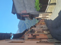
In Sant’Anna, park as best you can so as not to disrupt local life for the next five days. The hike starts at the far end of the village (towards Terme di Valdieri); at the crossroads on the way out of the village, look out for the start of the trail on the right, heading towards Valle della Meris.

Note: From the start in Sant’Anna to the Rifugio Livio Bianco: red and white markings.

(S) Head up this tarmac road, winding its way past the houses, then the road gives way to a good
stony path that winds through the forest.

(1) Stay on the main path at all times; ignore the signposted path branching off to the right. Continue along the path which
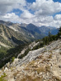
leaves the forest to reach the Gias del Prato mountain pastures. The view opens out over the Valle della Meris.

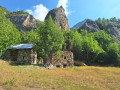
(2) Continue along the main path, which winds through the mountain pasture and climbs up the hillside. You’ll reach the chalets of Ex case reali del Chiot.

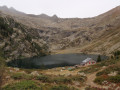
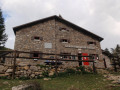
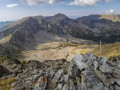
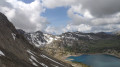
(3) Stay on this path, which runs parallel to the Meris stream, until you reach a glacial moraine at a crossroads. Ignore the path leading straight ahead and turn left. Cross the stream flowing out of the lake and complete the ascent to reach the mountain hut, overlooking the large Lago Sottano della Sella (E).

Waypoints

  1. S : mi 0 - alt. 3,264 ft - Starting point for hikes to Valle della Meris
  2. 1 : mi 0.41 - alt. 3,694 ft - Crossroads: ignore the path on the right
  3. 2 : mi 2.28 - alt. 4,997 ft - Gias del Prato
  4. 3 : mi 3.42 - alt. 5,574 ft - Formerly known as Case Reali del Chiot.
  5. E : mi 4.46 - alt. 6,207 ft - Rifugio Livio Bianco

Notes

  • Watch out for ‘La Nebbia’, the very damp mist that rises from the valley around midday, particularly in summer. This has little impact on this 3-hour route, which is well-marked and leads to a mountain hut. Bring rainwear.
  • There are no water sources during the ascent.
  • At the mountain hut, rest up as the next day’s stage will be the longest of this Tour de l’Argentera (9 hours), featuring a pass at nearly 2,900 metres.

Worth a visit

  • From the refuge, head down to see the lake.

Reviews and comments

4.7 / 5
Based on 2 reviews

Reliability of the description
4.5 / 5
Ease of following the route
4.5 / 5
Route interest
5 / 5
Duprez Michel
Duprez Michel

Overall rating : 4.3 / 5

Date of your route : Jul 01, 2024
Reliability of the description : ★★★★☆ Good
Ease of following the route : ★★★★☆ Good
Route interest : ★★★★★ Very good
Very busy route : No

A lovely walk that can be done as a day trip.

Machine-translated

bertojot
bertojot

Overall rating : 5 / 5

Date of your route : Aug 27, 2021
Reliability of the description : ★★★★★ Very good
Ease of following the route : ★★★★★ Very good
Route interest : ★★★★★ Very good
Very busy route : Yes

Distance as per the Visorando description
Route description also
Walking time 2 hours 15 minutes compared to the advertised 2 hours 30 minutes; we are slightly above-average walkers
Walking time: 2 hours 15 minutes (compared to the advertised 2 hours 30 minutes)
A warm welcome at the mountain hut

Machine-translated

Other walks in the area

For more walks, use our search engine .

The GPS track and description are the property of this route's author. Please do not copy them without permission.