Aisone Caves Trail

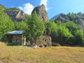
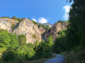
This trail passes through the Aisone Caves Nature Reserve, established by the Piedmont Region in 2019 to protect and promote the biodiversity and archaeological site. The route passes through a beautiful mixed woodland on the hillside, skirting several caves, including the famous Shelter 10, where traces of a seasonal Neolithic settlement have been found. The return journey takes you above the rocky outcrops of La Comba, passing through the small hamlet of Pirone.

Details

102817991
Creation:
Last update:
Last review:
  • Walking
    Activity: Walking
  • ↔
    Distance: 3.33 mi
  • ◔
    Average duration: 2h 55 
  • ▲
    Difficulty: Moderate

  • ⚐
    Back to start: Yes
  • ↗
    Ascent: + 1,558 ft
  • ↘
    Descent: - 1,558 ft

  • ▲
    Highest point: 3,386 ft
  • ▼
    Lowest point: 2,762 ft

Photos

Description of the walk

Park at the Aisone car park, situated below the Italian post office and the public gardens.

(D/E) The trail starts at the Taverna delle Grotte, a bar and shop. Cross the public gardens and continue along Via Occhie for a few metres.

(1) Leave this road and go down a small flight of steps on the left, where the “Sentiero delle Grotte” begins. The path continues along the hillside, passes through a mixed woodland and leads to a crossroads: ignore the turn-off for Ciancamentes and continue downhill, following the signs for “Sentiero delle Grotte”.

(2) Continue along the path to the tarmac road at Case Piron and follow the road uphill to a wide left-hand bend, where the path resumes.

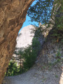
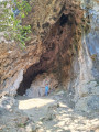
(3) Head down to the left along the rock faces, where you’ll come across a few caves, until you reach the famous Shelter 10 (signposted), where traces of a Neolithic seasonal settlement have been found.

(4) Continue to a narrow gap between the rocks, then descend a steep section. Cross through the woods to the dirt track leading up from Gravers. Follow it uphill to La Comba, a small village surrounded by walls and watchtowers. Head towards Pirone, leaving the turn-off for Castellar di Vinadio.

(5) Follow a small valley, which you must leave almost immediately to climb to the right along the steep path that crosses the rocky bastions of La Comba and leads to Pirone.

(6) Walk through the small village (fountain), passing in front of the little church, and head down the tarmac road to the crossroads you passed on the way up.

(3) Return to the starting point via the reverse route (D/E).

Waypoints

  1. S/E : mi 0 - alt. 2,779 ft - Starting point
  2. 1 : mi 0.05 - alt. 2,795 ft - Start of the trail
  3. 2 : mi 0.53 - alt. 2,825 ft - Route
  4. 3 : mi 0.71 - alt. 3,041 ft - Junction of the Case de Pirone road and the footpath
  5. 4 : mi 1.18 - alt. 2,943 ft - Shelter 10
  6. 5 : mi 1.61 - alt. 2,976 ft - Steep climb towards Pirone
  7. 6 : mi 1.9 - alt. 3,386 ft - Pirone fountain
  8. S/E : mi 3.33 - alt. 2,762 ft - Arrival

Notes

A route with no technical difficulties, featuring shaded sections in the forest. The path is well-maintained in steep sections (steps). Allow around 2 hours 15 minutes to complete the circular route. You can top up your water supplies at the fountain in the hamlet of Pirone.

Official website of the nature reserve

Worth a visit

The small village of Vinadio, situated 4 km west of Aisone, is the perfect place to enjoy Italian cuisine (at the Locanda di Vinadio restaurant) and do your shopping at the local market on Wednesdays.

The Valdieri thermal park, where you can cool off in picturesque surroundings.

Shelter 10 (sign)

Other walks in the area

For more walks, use our search engine .

The GPS track and description are the property of this route's author. Please do not copy them without permission.