Country:
 City:
City:


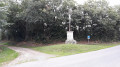
Parking is available in the car park next to the Place de la Mairie in Augé.
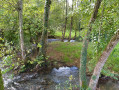
(S/E) Leave the car park and join the Route de Saint-Maixent (D6), following it carefully to the right as it descends. On leaving Augé, take the old road on the right, cross the Ligueure stream and head for the junction immediately afterwards.
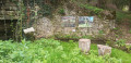
(1) At the crossroads, turn right and, at the end of the straight stretch, take the farm track straight ahead on the left-hand side, which climbs and passes through the hamlet known as l’Aunée d’Augé. See the source of the Aunée d’Augé at the foot of the house (private wash house). Continue straight on up the track until you reach a small road. Turn left towards La Cour d’Augé. After the right-angled bend to the right, turn right towards La Renolière until you reach the first farm track on the left. At a bend in the road, at elevation 95, note the spring and the washhouse that belonged to La Renolière.
(2) Turn left and follow the farm track until you return to the road leading to La Cour d’Augé, with its traditional houses and a wash house. This track serves as a drainage channel in the event of heavy rain. Follow the road carefully for about thirty metres to the right, then turn right onto a farm track heading south-east. The track veers to the left and offers lovely views of the village of La Cour d’Augé.
Further on, turn right onto the first path leading uphill on the right. Follow it straight on until you reach a road.
(3) Cross it carefully and continue along the path opposite, slightly to the left and downhill. Carry on straight ahead to the crossroads in Perré. Before entering Perré, near a bamboo grove on the left-hand side of the path, take a short detour to see the spring that feeds the Perré washhouse (the spring is protected by a metal cover). As you enter Perré, the path becomes a tarmac road with the charming name of Chemin de Tartifume.
(4) Turn right and follow a small road along the edge of the plateau with care. After leaving the hamlet, you’ll see several Protestant family cemeteries. Continue to the next crossroads. Turn left towards Mautré and proceed with caution to the next crossroads, where there is a road on the left.
(5) Turn left onto this small road, Rue des Champs de la Reine. Continue by taking the path on the left just as the road veers to the right. The track descends steeply down the hillside, passing a wash house (on the right-hand side), then a family cemetery, before joining a farm track at the bottom of the valley where the Chambon flows. Turn right for about a hundred metres, then turn left and join the road leading to Puy Belin just before the bridge over the Chambon. Follow the road across the Chambon and continue to the Puy Belin wash house on the left-hand side of the road.
(6) A little further on, before the entrance to the village, turn right onto the steep lane leading up to the village with its typical farmhouses.
When you reach Rue de la Fosse aux Loups, turn right and do the same at the next junction. Shortly afterwards, turn right onto a path known as Rue des Greux. Continue along the hillside until you reach a T-junction.
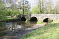
(7) Turn right and follow the wooded hillside of Font à Chaux, which overlooks the Chambon. The path joins a farm track; take this by turning right towards the Chambon. Shortly afterwards, cross the Chambon via a remarkable old bridge of Roman origin, not far from the confluence of the Chambon and the Ligueure. The farm track soon joins a road.
(8) Turn right and follow the road carefully to reach the former noble dairy farm of Valette. Continue straight ahead along a stony track that descends towards the La Ligueure stream before running alongside it.
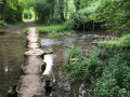
(9) Just as the farm track makes a sharp turn to the right, take the path on the left heading towards the stream; cross it via a bridge at a ford, and climb towards La Rochette until you reach its wash house on the left-hand side of the path.
(10) When you reach a forest track, turn right towards Peumont. As you approach Peumont, at a place called Les Échassières, the track gives way to a small road. There is a lovely view of the Moulin de Coutard below on the right-hand side. When you reach the first buildings in Peumont, turn right onto the stony path leading downhill. It can sometimes be very damp due to the spring that bubbles up at the foot of the hillside.
The path leads to the remains of the old tram line from Champdeniers to Saint-Maixent,
built in 1913 but never used because of the war. Continue along the track to the Route de Coutant (D174). Follow it carefully to the right for about twenty metres until you reach the junction with Rue du Stade.
(11) Cross the D174 very carefully and turn left into Rue du Stade. Continue straight on along a stony track that follows on from it. At the T-junction with a road leading to Monteuil on the left, turn right and walk alongside the sawmill until you come out onto the D6, Rue de Champdeniers, at the top of the village of Augé. Turn right and follow Rue de Champdeniers with great care. Pass on the left at Chemin de la Foye and continue for about fifty metres.
(12) Then turn left onto Rue Serpentine, which climbs steeply. Turn right onto Rue de la Croisée and, a little further on, turn right onto the Sentier des Rocailles, marked by stars on the ground. Continue to the cliff without going down to the D6 road. When you can see the church, climb the steps on the left up to Rue de la Croisée, where there is a fountain on the right. Turn right and follow Rue de la Croisée north-eastwards, passing a pump-operated fountain. Turn right down Rue Mélusine and, a little further on, turn right into Ruelle des Escaliers. There is a viewpoint overlooking the valley that encircles the village of Augé and the turrets of Champmargou Castle.
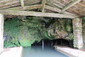
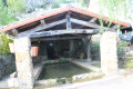
Continue to the village washhouse and Rue du Lavoir Saint-Grégoire. Turn left and continue until you reach Rue de Cueille Bellevue on the left a little further up. Follow this road until you rejoin Rue Mélusine. Walk down Rue Mélusine. Just past the junction with Rue du Lavoir Saint-Grégoire, turn right onto Ruelle Saint-Grégoire, which leads to the church. Then walk back up Rue de l’Église, turning to the right , and you’ll see a 17th-century house on your right. Turn left onto Ruelle des Passeroses, which slopes downwards, just before you reach Rue du Lavoir Saint-Grégoire again. Pass Place Michel Jamonneau (a native of Augé, “La liberté”, 1658–1708, who was a soldier and pioneer in Canada).
Continue to Rue de la Poste. Turn right onto this street and follow it carefully until you reach the junction with the D6 road. Cross the junction with care, head towards the town hall square on the right and return to the car park (S/E).

 Visorando Member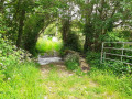

 Easy
Easy 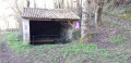
 Association / Club / Walk leader