Between Ligueure and Chambon in Azay-le-Brûlé

This walk takes place largely within the commune of Azay-le-Brûlé and, to a very small extent, in Augé.
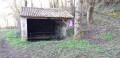
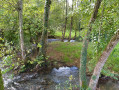
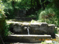
It follows paths that mostly run alongside the Ligueure and Chambon streams. It takes you through a few pretty hamlets with restored houses, and you’ll come across wash houses and footbridges.

Details

19160358
Creation:
Last update:
Last review:
  • Walking
    Activity: Walking
  • ↔
    Distance: 7.24 mi
  • ◔
    Average duration: 3h 55 
  • ▲
    Difficulty: Moderate

  • ⚐
    Back to start: Yes
  • ↗
    Ascent: + 630 ft
  • ↘
    Descent: - 627 ft

  • ▲
    Highest point: 384 ft
  • ▼
    Lowest point: 154 ft

Photos

Description of the walk

The car park is located at the Roman bridge, which can be reached via the D8 (the road linking Saint-Maixent-l’École to Cherveux), then by turning right just after the Bédane bridge, having travelled approximately 1.5 km from Cerzeau.

(S/E) Set off along the access path to the Roman bridge heading north-west. At the road, turn left, then at the bend, take the path opposite leading uphill, which is closed to all motorised vehicles. Ignore the path on the right and continue to the road. Turn right and follow this road carefully for 250 m until you reach the first unpaved track on the right.

(1) Follow this track straight on to La Rochette.

(2) Head left towards Coutant. At the entrance to the village, take Rue de la Forge, then, at the next junction, turn right onto Chemin des Borderies and walk downhill to the wash house.

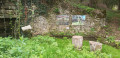
(3) Turn right, walk past the wash house, then cross the Ligueure via the footbridge.

(4) At the dirt track, go straight on, negotiate the left-hand bend, then keep to the right at the Fork in the road. Reach La Cotinière, continue along the small road to the junction with the access road to La Folie. Turn right onto the descending track until you reach a crossroads.

(5) Follow the path on the left until you reach the road. Turn right towards La Rénolière, continue straight on along the uphill road, ignoring the path on the right at the bend, and you’ll reach Mautré.

(6) Turn right onto Chemin des Champs Baudière until you reach the next junction. Turn left onto Rue de la Rénolière. Walk past the pesticide-free area and turn right onto Chemin des Filatières until you reach the T-junction, ignoring the road on the left.

(7) Turn left onto Rue de la Grande Cheintre, cross the road carefully and head straight on down the path. Ignore the path on the right and continue to the small road. Turn left onto it and, opposite No. 34, take the path on the right leading downhill. Pass a wash house on the right and continue until you reach a dirt track after passing between large stones twice.

(8) Turn right, then left opposite the bins to rejoin the road. Cross the bridge over the Chambon and carry on to the first path on the left, which you take. At the next three-way junction, turn right until you reach the next three-way junction.

(9) Take the path on the left which climbs up to the road. Just before the road, you can visit the Puy Belin wash house, situated at the end of the path on the left. At the road, turn left, ignore the Impasse du Beugnon, then turn right onto the Chemin du Pommier.

(10) Take the path on the right towards the Chemin du Procheteau. Walk past the Fosse aux Loups and continue to the road, which you follow to the right.

(11) Turn left, then immediately keep left onto Rue des Champs Chartier. Ignore the road on the right and continue along a path lined with walls until you reach a four-way junction. Turn right.

(12) Carry on straight ahead along the path which will soon overlook Le Chambon. At the next junction, continue downhill until you reach the Roman Bridge (S/E).


Waypoints

  1. S/E : mi 0 - alt. 157 ft - Roman bridge at Azay-le-Brulé. Cross the - Ligueure (cours d'eau) - Affluent du Chambon
  2. 1 : mi 0.64 - alt. 328 ft - Junction of the D8 and the track
  3. 2 : mi 1.81 - alt. 276 ft - La Rochette
  4. 3 : mi 2.36 - alt. 226 ft - Crossroads at the Rochette washhouse
  5. 4 : mi 2.63 - alt. 187 ft - White track
  6. 5 : mi 3.37 - alt. 262 ft - Crossroads
  7. 6 : mi 3.96 - alt. 384 ft - Mautré, Chemin des Champs Baudière
  8. 7 : mi 4.31 - alt. 374 ft - CR de la Grande Cheintre
  9. 8 : mi 4.88 - alt. 177 ft - Crossroads. Towards the bridge at - Chambon (rivière)
  10. 9 : mi 5.5 - alt. 197 ft - Three-way junction
  11. 10 : mi 5.81 - alt. 328 ft - Junction of Chemin du Pommier and Chemin du Procheteau
  12. 11 : mi 6.12 - alt. 315 ft - Turn left at the fork
  13. 12 : mi 6.41 - alt. 299 ft - Crossroads
  14. S/E : mi 7.24 - alt. 157 ft - Pont romain d'Azay le Brulé

Notes

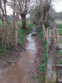
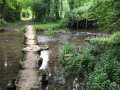
As this walk takes place on paths, some of which may be quite wet in wet weather, and also on stony sections, you should wear suitable footwear.

You’ll be walking along a short stretch of the D8, so please take care.

This route is not signposted. If you come across any yellow signposts, ignore them. It is safer to follow the written description.

There are no water points or toilets, though there may be a shelter at Mautré.

(5) In wet weather, you can avoid this section by turning right and then immediately left onto the path leading up to the road.

Worth a visit

Azay-le-Brûlé is a commune with a population of almost 2,000, covering an area of 22 km². It is known as the ‘commune of 12 villages’.
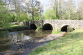
There are around twenty wash houses. The priory church of Saint-Barthélémy is no longer used for worship. The Roman bridge spanning the Chambon not far from Valette replaced a ford on the route linking Poitiers to the sea and was restored in the early 1990s.
The site of the former Ricou quarry has been developed as part of the ‘Man and Stone’ project and is open to the public free of charge.

Reviews and comments

4.6 / 5
Based on 3 reviews

Reliability of the description
4.3 / 5
Ease of following the route
4.3 / 5
Route interest
5 / 5
Hortial
Hortial

It just had to rain… and it’ll have to rain again throughout the year!
But this is something for future hikers to bear in mind. My wife and I have actually been thinking about coming back here with some friends.

Machine-translated

philouis
philouis

Thank you for going on this walk.
Sorry for the inconvenience, but it was bound to rain.

Machine-translated

Hortial
Hortial

Overall rating : 4.7 / 5

Date of your route : Jan 29, 2023
Reliability of the description : ★★★★★ Very good
Ease of following the route : ★★★★☆ Good
Route interest : ★★★★★ Very good
Very busy route : No

A very pleasant walk that alternates between plains and valleys and takes you through some ‘charming’ little villages.
Please note that the (long-awaited) rain at the start of January has turned some paths into streams, forcing us to cut across fields in places.

Machine-translated

jlfaure
jlfaure

Overall rating : 5 / 5

Date of your route : Oct 21, 2022
Reliability of the description : ★★★★★ Very good
Ease of following the route : ★★★★★ Very good
Route interest : ★★★★★ Very good
Very busy route : No

This route follows part of the yellow-marked Le Chambon and La Ligueure trail (Deux-Sèvres General Council route guide). It’s a route we’ve already done several times. However, this particular outing allowed us to discover other paths alongside the marked ones, which were just as interesting. With my club, we’ve done it twice this week. The second time, we took a few shortcuts:

  1. at La Rochette, via the path between (2) and (3), which leads straight down to the wash house;
  2. at point (5) to go directly to point (6) as indicated in the route description;
  3. to the road after point (7), where a path leads directly down from the road to point (8) (never mind the wash house);
  4. and finally to the point (9) by taking the path that climbs to the right, crossing the road to reach the point (11).

This brings us back to 9.39 km with an elevation gain of 145 m.
Everyone really enjoyed this walk, which offers some lovely rural scenery.
I’d like to add that the Visorando app was very useful to us (as always), especially in the hamlets.

Machine-translated

philouis
philouis

OK. Thanks for clarifying.

Machine-translated

jcmonchy1955
jcmonchy1955

Overall rating : 4 / 5

Date of your route : Feb 28, 2022
Reliability of the description : ★★★☆☆ Average
Ease of following the route : ★★★★☆ Good
Route interest : ★★★★★ Very good
Very busy route : No

a few controversial guidelines...

Machine-translated

Other walks in the area

For more walks, use our search engine .

The GPS track and description are the property of this route's author. Please do not copy them without permission.