Sainte-Suzanne-et-Chammes from Voutré station

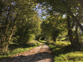
There is no public transport serving Sainte-Suzanne-et-Chammes, which is listed among the ‘Most Beautiful Villages of France’ and the ‘Small Towns of Character’. This route allows you to reach this fortified village from the stations on the Laval–Le Mans line. It can be done on foot or by bike in any season, as it follows small tarmac roads and paths for almost its entire length. The route allows you to explore an unspoilt rural area, with its working farms, wooded countryside, the Erve valley, as well as elements of local heritage.

Both Voutré and Évron stations have car parks and are served by several trains a day, with Évron having slightly more TER stops than Voutré.

Details

n°61184696
Creation:
Last update:
Last review:
–
  • Walking
    Activity: Walking
  • ↔
    Distance: 12.51 mi
  • ◔
    Average duration: 6h 10 
  • ▲
    Difficulty: Difficult

  • ⚐
    Back to start: No
  • ↗
    Ascent: + 502 ft
  • ↘
    Descent: - 627 ft

  • ▲
    Highest point: 604 ft
  • ▼
    Lowest point: 341 ft
  • ⚐ Country: France
  • ⚐ City: Voutré (53600)
  • ⚑
    Start: N 48.13428° / W 0.292425°
  • ⚑
    End: N 48.155603° / W 0.396991°
  • ❏
    IGN map(s): Ref. 1518SB, 1618SB
  • Hour-by-hour weather

Photos

Description of the walk

Start from the car park at Voutré railway station.

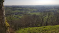
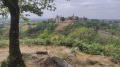
(S) Walk on to Rue Bidard and turn left onto this street to leave the village. Pass under the railway line, then walk carefully alongside the D125 for about 800 metres, until you reach the signposted path on the right. From the junction, you’ll have your first panoramic view of the fortified village of Sainte-Suzanne.

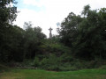
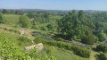
(1) Take the path across the fields.To the north, there is a view of the Coëvrons range, including Mont Rochard and its distinctive mast. Ignore a path on the right and carry on to the end to reach the railway bridge.

(2) Take the small road that climbs to the left without going under the bridge, then follow the railway line and continue for some time along the same road towards the south. Ignore the signposted path on the left and carry on past the hamlets of Le Grand and Le Petit Monfeu, then Bouzaine.

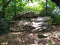
(3) At the end of the road, turn left: in the field on the right lies the collapsed dolmen of Les Îles. Continue to the junction with the D125. Turn right and walk carefullyalongside this road for about 500 metres until you reach Ambriers.

(4) Take the Chemin du Vau on the left. Continue along the small tarmac road, passing the chicken farm, until you reach the D9.

(5) Turn right and follow this road carefully for 600 m, until you reach the next junction on the left.

(6) Turn left to follow the small road which climbs towards the Forêt de la Grande Charnie. Reach the edge of the forest.

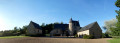
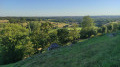
(7) Take the road on the right to walk along the lower edge of the forest. To the north, a sweeping panorama of the Coëvrons unfolds, with, starting on the right, the levelled hills of the Voutré quarries, then Mont Rochard and its antenna, and Montaigu, topped with trees and a chapel. In the distance, the Mont des Avaloirs, then the Neau quarry and, on the horizon, the wind turbines at Martigné (30 km) and Oisseau (40 km). Continue straight on until you reach the junction just after passing the Château de la Fousillère on your left.

(8) Cross the junction and carry on straight ahead along the Chemin de la Pageotière. At La Saltière, the path on the left leads to Tertre Ganne, a viewpoint and picnic spot which also provides access to the town via a steep path. Carry on straight ahead to reach, on the left, the narrower Chemin de la Butte des Poulies, which leads to a bridge over the River Erve; cross this bridge. Walk past the paper mill and you’ll come to a junction of paths offering various routes up to the town.

(9) Take the Chemin de la Mule Blanche straight ahead; it bends to the right and climbs up to the ramparts walk.

(10) Go through the Guichet postern gate and continue straight on along the Grande Rue. Follow the Chemin des Granges, which descends to the right, then take the grassy path on the left to go round the cemetery. You’ll emerge onto Rue du Camp des Anglais at the corner; turn right and walk alongside the large car parks.

(11) Turn left onto the Chemin de la Madeleine, continue along the path that follows on from the tarmac road and reach the junction with the Chemin de Poil de Brebis.

(12) Take this track to the right and follow the signs for Camp des Anglais to pass under the county road. You’ll reach the junction with Route du Bocage.

(13) Turn left and carry on straight ahead, leaving the turn-off for Camp des Anglais and the Château Neuf chapel on your right. Pass through the hamlets of La Touche Piquet and then La Doderie.

(14) Carry on straight ahead, following the cycle route sign, and turn left after La Pierre to continue along the Route du Bocage. Pass the access road to Haut Rocher on your right, carry on straight ahead along the small tarmac road and pass Les Bussons.

(15) At the three-way junction, take the right-hand route along the one-way road marked for cyclists, known as the Chemin de la Retardière. After 2 km, the path passes close to the little chapel at Launay-Cochin, then takes a 90° left-hand bend. Head to the right to cross a small housing estate and join Rue Galilée in the middle of it. You’ll emerge onto Rue de Sainte-Suzanne (D7).

(16) Turn right towards the centre of Évron. Go round the roundabout on the right and continue straight ahead towards the town centre, staying on Rue de Sainte-Suzanne.

(17) Go round another roundabout, continue straight ahead past the sixth-form college and secondary school on your left. Keep left at the junction.

(18) Turn right onto Rue Léon Courcelle, then right again onto Rue du Général de Gaulle to reach Évron station directly (E)

Waypoints

  1. S : mi 0 - alt. 466 ft - Voutré railway station - Gare de Voutré
  2. 1 : mi 0.73 - alt. 587 ft - Marked path on the right
  3. 2 : mi 1.55 - alt. 430 ft - Railway bridge – road on the left - Erve (rivière) - Affluent dela Sarthe
  4. 3 : mi 2.72 - alt. 427 ft - The Îles Dolmen Route
  5. 4 : mi 3.32 - alt. 420 ft - Chemin du Vau
  6. 5 : mi 4.38 - alt. 443 ft - D9
  7. 6 : mi 4.77 - alt. 489 ft - Turn left towards the forest
  8. 7 : mi 5.2 - alt. 554 ft - Edge of the forest, on the right
  9. 8 : mi 6.09 - alt. 548 ft - Crossroads – Chemin de la Pageotière opposite
  10. 9 : mi 6.55 - alt. 397 ft - Chemin de la Mule Blanche
  11. 10 : mi 6.7 - alt. 515 ft - Poterne du Guichet
  12. 11 : mi 6.85 - alt. 492 ft - Chemin de la Madeleine
  13. 12 : mi 7.04 - alt. 449 ft - Chemin de Poil de Brebis
  14. 13 : mi 7.36 - alt. 427 ft - Bocage Route
  15. 14 : mi 8.72 - alt. 397 ft - La Doderie, straight ahead
  16. 15 : mi 9.99 - alt. 374 ft - Chemin de la Retardière
  17. 16 : mi 11.55 - alt. 387 ft - Rue de Sainte-Suzanne
  18. 17 : mi 12.04 - alt. 354 ft - Roundabout
  19. 18 : mi 12.33 - alt. 354 ft - Rue Léon Courcelle
  20. E : mi 12.5 - alt. 371 ft - Evron railway station - Gare d'Evron

Notes

Both the starting and finishing stations are served several times a day by TER trains on the Le Mans–Laval line. It is also possible to travel by car and then take the TER from Évron back to the car park in Voutré.

The entire route is accessible all year round, although some sections of sunken paths may be muddy in wet weather.

The two sections – one running from Voutré to Sainte-Suzanne, and the other from Sainte-Suzanne to Évron – can be completed independently, following the same route back as on the outward journey. The Évron–Sainte-Suzanne route is flatter and more direct, whilst the Voutré–Sainte-Suzanne route passes through more undulating terrain, offering panoramic views of the Coëvrons range and a greater variety of landscapes.

Worth a visit

(S) In Voutré, several reminders of life in days gone by have been preserved: the weighbridge near the station, the sign for the old post office, and the washhouse. The church, rebuilt at the end of the 19th century, never saw its bell tower completed.

(3) The Îles dolmen, situated in a field near the road, is one of two dolmens in the area, the other being the Erves dolmen on the outskirts of Sainte-Suzanne. The Îles dolmen cannot be viewed up close as it is on private land and has partially collapsed.

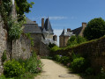
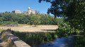
(9) Sainte-Suzanne, nicknamed the “Pearl of the Maine”, is famous for its castle, which comprises a Romanesque keep and a Renaissance residence. The town has preserved much of its ramparts, which surround numerous old houses, manor houses and the former salt store. The Chemin de la Mule Blanche, on the route, leads to a medieval-inspired garden, whilst the paper mill forms part of a vast complex of water mills that can be explored by walking along the River Erve at the foot of the town.

The Camp des Anglais, accessible via a short detour on the way out of Sainte-Suzanne, is an earthwork fort built by William the Conqueror during the siege of Sainte-Suzanne, which lasted from 1083 to 1086, without the town ever surrendering. The earthen ramparts are still clearly visible.

On arriving in Évron, you pass a small chapel, of the sort found in great numbers in the surrounding area. This one, the Chapel of Launay-Cochin, was built in the 17th century and then rebuilt in 1885. Women from the neighbourhood used to come here to pray to the Virgin Mary that their young children might learn to walk.

(E) The town of Évron comprises a few old streets surrounding the basilica, a former abbey church notable for three features: the Romanesque Chapel of Saint-Crépin, adorned with frescoes; the Romanesque nave topped by a bell tower built for defence; and the Gothic choir. A seminary now occupies the adjacent former monastic buildings, which were rebuilt in the 18th century.

Other walks in the area

For more walks, use our search engine .

The GPS track and description are the property of this route's author. Please do not copy them without permission.