The Grande Charnie Forest

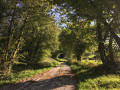
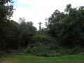
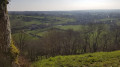
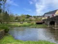
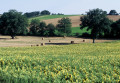
From Torcé-Viviers-en-Charnie, follow the lush green paths through the Mayenne countryside and gently make your way into the Charnie Forest. You’ll enjoy a view of the forest from its highest point and be transported back centuries as you come across the megaliths along the route.

Details

3163467
Creation:
Last update:
Last review:
  • Walking
    Activity: Walking
  • ↔
    Distance: 10.81 mi
  • ◔
    Average duration: 5h 40 
  • ▲
    Difficulty: Moderate

  • ⚐
    Back to start: Yes
  • ↗
    Ascent: + 797 ft
  • ↘
    Descent: - 797 ft

  • ▲
    Highest point: 925 ft
  • ▼
    Lowest point: 420 ft

Photos

Description of the walk

Park in the church car park.

(S/E) From the car park, head east, going round the church, then turn right onto Rue de Neuvillette and right again onto Rue de l’Avenir. The road turns into a track at a left-hand bend, which very quickly goes round a pond on the left-hand side and joins the D9 (Route de Neuvillette).

(1) Cross with care and continue straight ahead. Follow the track. Cross Rue de Bouillé and continue straight ahead.
At Chemin de l’Anjuine, turn right. Ignore the first track on the right and cross the stream to go round Bouillé.
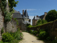
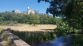
On the right, you can see the ruins of the old castle (15th and 16th centuries), of which only a tower remains, now converted into a residential house.

(2) Join the Route de Bouillé (D161) and turn left. Follow it for about 500 m.
Turn right towards La Tellerie and Le Petit Fourneau. At the crossroads, carry on straight ahead heading due south.

(3) Cross the D9 departmental road and carry on straight ahead. Pass through La Cormerie.
At a bend to the right, carry on straight ahead so that the edge of the forest is on your right.
At the D9, turn right and follow it for 250 m.

(4) Take the path on the left and, at the lake, turn right. Continue to the Haute Croix Maillard. Just past the first house, turn left and carry on straight along the path, heading almost due south.

(5) Once you reach the top of the incline, head right and, at the first junction, turn left. Follow the path as it curves widely to the left, then turn right onto the path heading due west towards the Sacré-Cœur.

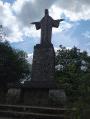
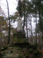
(6) Walk to the Sacré-Cœur statue and back, then continue to a wide forest track on the right.
Follow it to the right and head due north down to Les Tuileries.
At the junction, turn left and walk past the hamlets of Anguecherie and Les Baillés.

(7) 50 metres before the D-road, turn left onto an uphill track. Follow the track as it bends to the right and ignore a turn-off on the left. The path joins the D230.
Follow it south-west to Gros Fouteau.

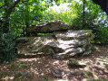
(8) Turn right and keep right at the Y-junction. At the crossroads, continue to the left. At the crossroads with a road to the right, take the path to the left (signpost indicating ‘Table des Diables’ 800 m ahead) and at the next Y-junction, continue to the right. Take a short detour to the left to visit the Table des Diables.

(9) Return to the main path and, after 100 m, turn right (see note on signposting). The path joins a road at La Gauberdière.

(10) Follow this road to the left, then turn right towards La Mulochère, ignoring the road to the left. Pass through the hamlet and follow the path due north to the D9 county road.

(11) Please note that this road is very busy; make sure you stay on the left-hand verge. Cross the road and head right, then turn left at the first road towards La Haute Farinière. Pass the farm and walk alongside a shed on your right. Turn right and, immediately afterwards, ignore a path on the left to follow the tree-lined track heading east-southeast. Continue straight ahead on the road.

(12) In the middle of a right-hand bend, turn onto the path on the left and head east to reach the D618 departmental road.
Follow it to the right for 200 m, then turn left.

(13) At the wayside cross, let Route No. 2 head off to the left and carry on straight ahead along the Chemin de la Brunette. Enter Torcé-Viviers-en-Charnie.
At the crossroads, turn right towards the post office and the town hall and carry on to the church car park (S/E).

Waypoints

  1. S/E : mi 0 - alt. 535 ft - Church car park
  2. 1 : mi 0.42 - alt. 502 ft - Route de la Neuvilette
  3. 2 : mi 1.02 - alt. 463 ft - Road on the left
  4. 3 : mi 2.02 - alt. 486 ft - Crossing the D9
  5. 4 : mi 2.56 - alt. 636 ft - Path on the left
  6. 5 : mi 3.44 - alt. 883 ft - Top of the elevation profile
  7. 6 : mi 3.94 - alt. 922 ft - Return trip to the Sacré-Cœur statue
  8. 7 : mi 4.94 - alt. 676 ft - 50 m before the D10
  9. 8 : mi 5.63 - alt. 748 ft - Le Gros Fouteau
  10. 9 : mi 6.65 - alt. 771 ft - La Table des Diables
  11. 10 : mi 7.17 - alt. 614 ft - La Gauberdière
  12. 11 : mi 8.12 - alt. 420 ft - Junction with the D9
  13. 12 : mi 9.52 - alt. 630 ft - Junction on the path
  14. 13 : mi 10.52 - alt. 489 ft - At the wayside cross
  15. S/E : mi 10.81 - alt. 535 ft - Church car park

Notes

Note on local signposting
This route uses several local routes shown on the map next to the church. These are, in order, routes No. 26, 29 and then 27, and run largely parallel to the mixed (walking and cycling) route No. 2.
The latter, which is 42 km long, comprises two circular loops, a section of which they share, starting after the junction following our waypoint (9). At this junction, the signposting is somewhat confusing, as it refers to route No. 2 twice using different symbols.
For our route, simply ignore this signposting and turn right at a 90° angle, as described.

Worth a visit

The 15th-century Church of Saint-Pierre in Torcé houses a 15th-century Virgin and Child and a 17th-century painting (The Virgin of the Rosary), both listed as historic monuments.

The Sacré-Cœur.

The Table des Diables dolmen.

Reviews and comments

4.2 / 5
Based on 3 reviews

Reliability of the description
4.7 / 5
Ease of following the route
3.3 / 5
Route interest
4.7 / 5
User 6043102

Overall rating : 4.7 / 5

Date of your route : Mar 25, 2026
Reliability of the description : ★★★★★ Very good
Ease of following the route : ★★★★☆ Good
Route interest : ★★★★★ Very good
Very busy route : Yes

A pleasant walk with a bit of an uphill climb; the area is really lovely with beautiful views of the bocage. We did this in March after a very wet winter and only came across one really muddy spot. The signposting is a bit patchy, so it’s best to use the app to guide you.
In the village of Torcé, there is a bakery and a bar-cum-grocery shop; please note that in the afternoon, it opens at 4.30 pm.

Machine-translated

charlie53
charlie53

Overall rating : 3.7 / 5

Date of your route : Mar 18, 2025
Reliability of the description : ★★★★☆ Good
Ease of following the route : ★★★☆☆ Average
Route interest : ★★★★☆ Good
Very busy route : No

A lovely walk, 70℅ of which is along sunken paths and forest tracks
Make sure to follow the route description, as this route follows routes 26, 27 and 29. There are lots of changes of direction.
At point number 5, it’s quite difficult to find your way after turning left without a GPS… otherwise, follow routes 26 and 27
Muddy around La Mulochère
A quick beer at the Bar de Torcé is a must as a reward!! 😅😅😅

Machine-translated

balou72
balou72

Overall rating : 4.3 / 5

Date of your route : Aug 29, 2022
Reliability of the description : ★★★★★ Very good
Ease of following the route : ★★★☆☆ Average
Route interest : ★★★★★ Very good
Very busy route : No

You’ll need a map or a GPS track; the signposting is rather haphazard

Machine-translated

Other walks in the area

For more walks, use our search engine .

The GPS track and description are the property of this route's author. Please do not copy them without permission.