


Refine your search for walks in Saint-Juéry
Saint-Juéry walks
 The forgotten paths of Cayla
 Visorando Member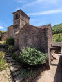
 5.06 mi
 +1,152 ft
 -1,122 ft
 3h 20
3h 20
 Moderate
 Departure from Martrin (Aveyron)
A short, scenic walk through the lush countryside of the Gousilles and Gos valleys and the surrounding hills.
On the paths of the women of the earth, starting from Viala du Dourdou.
4.32 mi
+653 ft
-676 ft
2h 35
 Easy
Departure from Calmels-et-le-Viala (Aveyron)
Easy
Departure from Calmels-et-le-Viala (Aveyron)
In the heart of the Rougier, the village of Viala du Dourdou, in a dominant position, offers easy hiking and surprising views in the Grands Causses Regional Natural Park.
Cayla Trail
 AONB
AONB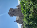 8.55 mi
+1,375 ft
-1,381 ft
5h 10
Moderate
Departure from Martrin (Aveyron)
8.55 mi
+1,375 ft
-1,381 ft
5h 10
Moderate
Departure from Martrin (Aveyron)
Set against a backdrop of rolling hills, stretching from the Martrin ridges to the Gos Valley, this walk offers a wealth of local heritage, dominated by the wine-coloured Romanesque church of Cayla
The superb village of Martrin welcomes you for a long hike to the hamlet of Le Cayla, perched on a rock overlooking the Gos Valley. From the Hospital Tower in Martrin to the paved slanting streets of Le Cayla, via the magnificent site of Saint-Exupère and the dry-stone walls, a hidden heritage unfolds before your eyes
The Château de Saint-Izaire trail
 10.39 mi
+1,188 ft
-1,168 ft
5h 50
Moderate
Departure from Saint-Izaire (Aveyron)
10.39 mi
+1,188 ft
-1,168 ft
5h 50
Moderate
Departure from Saint-Izaire (Aveyron)
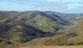
In the heart of the Rougier de Camarès and crossed by the Dourdou, the medieval village of Saint-Izaire welcomes us with its imposing suspension bridge, its red sandstone church and its 14th-century castle (former residence of the bishops of Vabres l'Abbaye). You will be charmed by this delightful village, where the sun gives the red stone facades a flamboyant appearance.
Route around Saint-Izaire
 1.66 mi
+295 ft
-295 ft
1h 00
Easy
Departure from Saint-Izaire (Aveyron)
1.66 mi
+295 ft
-295 ft
1h 00
Easy
Departure from Saint-Izaire (Aveyron)
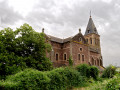
A short walk, though with some elevation gain, which will allow those looking for a gentle stroll in the morning or afternoon to discover beautiful trails, a magnificent view of the medieval village of Saint-Izaire, and a superb panorama of the Dourdou valley. The route is also suitable for mountain bikes.
Circuit around Combret-sur-Rance
 10.31 mi
+1,762 ft
-1,749 ft
6h 15
Moderate
Departure from Combret (Aveyron)
10.31 mi
+1,762 ft
-1,749 ft
6h 15
Moderate
Departure from Combret (Aveyron)
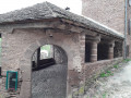
Very interesting hike as much for the landscapes (Rance valley, Rougier de Camarès) as for the culture (village of Combret, Notre-Dame d'Orient, numerous crosses).
Some portions on tarmac, but with the magnificence of the small paths and the beauty of the landscape, you'll quickly forget them.
A circuit from Saint-Sernin-sur-Rance
 8.84 mi
+1,565 ft
-1,552 ft
5h 25
Moderate
Departure from Saint-Sernin-sur-Rance (Aveyron)
8.84 mi
+1,565 ft
-1,552 ft
5h 25
Moderate
Departure from Saint-Sernin-sur-Rance (Aveyron)
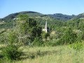
This hike, mostly in tree-shade, takes you through coombs and valleys to the south of Saint-Sernin-sur-Rance. Beautiful paths, some of them forgotten or seldom used, add a pleasant touch of wilderness. A breath of fresh air in absolute calm, in an unspoilt natural setting, not forgetting the two menhir statues at Pousthomy, which add a touch of historical interest to this walk.
Route of nature and heritage around the Rance starting from Pousthomy
 11.56 mi
+2,093 ft
-2,100 ft
7h 10
Moderate
Departure from Pousthomy (Aveyron)
11.56 mi
+2,093 ft
-2,100 ft
7h 10
Moderate
Departure from Pousthomy (Aveyron)
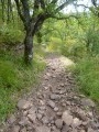
Starting from the small village of Pousthomy, this walk alternates between sections through woodland and along the ridge, where the view opens up to 360°. In terms of heritage, the Monastery of Notre-Dame d’Orient at the start of the route, three menhir statues along the way and a visit to Combret at its remarkable site will delight lovers of beautiful stonework and provide an excellent addition to this nature walk.
Circular route to the north-east of Mas de Montet to Belmont-sur-Rance
2.55 mi
+417 ft
-240 ft
1h 30
Easy
Departure from Belmont-sur-Rance (Aveyron)
An unpretentious walk with little elevation gain. It offers a glimpse of a scattered rural landscape made up of isolated farmsteads amidst cultivated fields. Some buildings are in a state of disrepair, whilst others are still inhabited by farmers.
Hills and valleys around Coupiac
10.98 mi
+1,732 ft
-1,739 ft
6h 35
 Difficult
Departure from Coupiac (Aveyron)
Difficult
Departure from Coupiac (Aveyron)
This route, set amid stone landscapes and valleys, allows you to discover the Occitan crosses that mark the entire route around Coupiac and its castle. A patchwork of hills and valleys along the route will delight the eye.
The Graouzou Aqueduct
2.80 mi
+374 ft
-374 ft
1h 35
Easy
Departure from Vabres-l'Abbaye (Aveyron)
At the start, the village of red sandstone offers a walk featuring medieval ruins and 19th-century buildings. The route is shaded by oak woods. The canal bridge halfway along the route now serves as a footbridge spanning the Graouzou.
A circular walk starting from Montlaur
 5.71 mi
+413 ft
-443 ft
3h 00
Easy
Departure from Montlaur (Aveyron) (Aveyron)
5.71 mi
+413 ft
-443 ft
3h 00
Easy
Departure from Montlaur (Aveyron) (Aveyron)
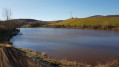
An easy route to explore a corner of Rougier.
Circular Campels loop via Verrières
2.76 mi
+210 ft
-210 ft
1h 25
Easy
Departure from Montlaur (Aveyron) (Aveyron)
This walk, with little change in altitude, offers a lesser-known side to the Rougier de Camarès canyons. It is a journey into the world of sheep and the farmers who work to supply milk to the cheese dairies.
Brousse-le-Château along the Tarn valley
 4.96 mi
+1,122 ft
-1,109 ft
3h 15
Moderate
Departure from Brousse-le-Château (Aveyron)
4.96 mi
+1,122 ft
-1,109 ft
3h 15
Moderate
Departure from Brousse-le-Château (Aveyron)
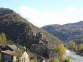
Perched on a rocky promontory, at the confluence of the Tarn and Alrance rivers, the magnificent small village of Brousse-le-Château is noted for its exceptional location.
By the hills and dales around Belmont-sur-Rance
 5.55 mi
+955 ft
-955 ft
3h 25
Moderate
Departure from Belmont-sur-Rance (Aveyron)
5.55 mi
+955 ft
-955 ft
3h 25
Moderate
Departure from Belmont-sur-Rance (Aveyron)
In the shade of the pink sandstone collegiate church and the surrounding woods, a peaceful escape on bushy paths, mills and hamlets, forest trails wind their way along the river Rance.
Yellow markings and a ford on the Rance.
⚠️To be avoided in periods of heavy rain, otherwise one passes at ease by taking off one's shoes.
The mountain trail starting from Montfranc
 5.49 mi
+630 ft
-607 ft
3h 05
Moderate
Departure from Montfranc (Aveyron)
5.49 mi
+630 ft
-607 ft
3h 05
Moderate
Departure from Montfranc (Aveyron)
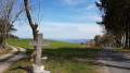
Perched on a plateau at over 800m, Montfranc and the spire of its mountain-style church look out towards the Tarn and the Aveyron. A short, unpretentious walk, with lovely paths and views of the Monts de Lacaune.
Saint-Igest trail in the Tarn valley
 6.47 mi
+1,421 ft
-1,437 ft
4h 15
Moderate
Departure from Montclar (Aveyron) (Aveyron)
6.47 mi
+1,421 ft
-1,437 ft
4h 15
Moderate
Departure from Montclar (Aveyron) (Aveyron)
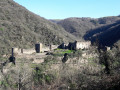
Overhanging path offering magnificent views of the Tarn valley, Brousse-le-Château and the Lévézou.
Yellow markings along the entire route.
Circular walk starting from Lavabre, in the commune of Connac
 5.91 mi
+1,191 ft
-1,161 ft
3h 45
Moderate
Departure from Connac (Aveyron)
5.91 mi
+1,191 ft
-1,161 ft
3h 45
Moderate
Departure from Connac (Aveyron)
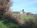
A former vineyard belonging to Vabres Abbey, the site of a major battle against the Norman invaders in 864,
you start this walk in the hamlet of Lavabre, where an old Templar barn still stands.
From Lincou to Brousse-Le-Château, following the river...
 8.02 mi
+331 ft
-322 ft
4h 00
Moderate
Departure from Réquista (Aveyron)
8.02 mi
+331 ft
-322 ft
4h 00
Moderate
Departure from Réquista (Aveyron)
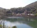
A very pleasant stroll, there and back along the banks of the River Tarn, connecting two charming villages: Lincou and Brousse-le-Château. The latter is listed among the "Most Beautiful Villages of France".
The banks of the Tarn, my way, starting from Lincou
 9.39 mi
+1,535 ft
-1,529 ft
5h 40
Moderate
Departure from Réquista (Aveyron)
9.39 mi
+1,535 ft
-1,529 ft
5h 40
Moderate
Departure from Réquista (Aveyron)
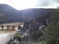
Beautiful views over the Tarn valley and charming villages: Lincou, Connac, Lavabre.
The last three kilometres are a very pleasant stroll along the Tarn. Beautiful stone crosses all along the route. Yellow markings on certain sections of the path.
From the Sentier des Candes to Le Catous
11.43 mi
+2,159 ft
-2,159 ft
7h 10
Difficult
Departure from Saint-Sever-du-Moustier (Aveyron)
A magnificent route at the junction of the Monts de Lacaune and the Rougier de Camarès. This circular route winds around a remarkable village where Art Brut and the Arts Buissoniers intermingle. The paths and forest tracks are often wide and shaded. 85 per cent of the route is off-road and offers beautiful panoramic views of southern Aveyron! The GPX track may prove very useful.
Combradet Trail
 5.81 mi
+1,102 ft
-1,089 ft
3h 40
Moderate
Departure from Réquista (Aveyron)
5.81 mi
+1,102 ft
-1,089 ft
3h 40
Moderate
Departure from Réquista (Aveyron)
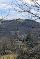
Combradet, a hamlet in the commune of Réquista, is built on a ridge overlooking the La Croux Dam on the River Tarn.This circular walk offers numerous views of the Tarn valley.
From Combradet to Frayssines
 4.88 mi
+951 ft
-968 ft
3h 05
Easy
Departure from Réquista (Aveyron)
4.88 mi
+951 ft
-968 ft
3h 05
Easy
Departure from Réquista (Aveyron)
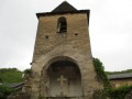
Two small villages nestled on the slopes of the Tarn, amidst magnificent and peaceful countryside. The River Tarn winds its way through the valley, and the paths lined with low dry-stone walls that once linked the two villages are steeped in history.
Les Raspes du Tarn
 10.30 mi
+3,123 ft
-3,104 ft
7h 25
Difficult
Departure from Le Truel (Aveyron)
10.30 mi
+3,123 ft
-3,104 ft
7h 25
Difficult
Departure from Le Truel (Aveyron)
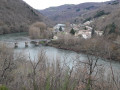
This route alternates between climbs (sometimes steep...), descents (just as steep...!), narrow paths and tracks, and a bit of road too.
You pass through steep-sided valleys and very pretty hilltop villages, and most of the time you walk along a balcony-like path above the Tarn, a river with emerald-green waters (well, almost...).
From the Ségala plateau to the Tarn valley
 9.12 mi
+1,637 ft
-1,627 ft
5h 35
Moderate
Departure from Réquista (Aveyron)
9.12 mi
+1,637 ft
-1,627 ft
5h 35
Moderate
Departure from Réquista (Aveyron)
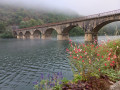
From Réquista, situated to the south of the Ségala plateau, to Lincou, on the banks of the Tarn.
Numerous viewpoints overlooking the Tarn valley and the Réquista countryside, a land of livestock farming, particularly the Lacaune sheep, whose milk is used to make Roquefort.