Country:

 City:
City:




(S/E) Car park in the village of Martrin
(1) From the square, go round the back of the cross and take the road between the two houses. Above the sports ground, head towards the housing estate. At the top of the village, turn left. Then follow the ridge path on the left until you reach the road linking Coupiac to Martrin.
(2) At the junction by the Amandier cross, carry on straight ahead along the tarmac road, then take a dirt track to the right. At the bottom of the track, on the left, take the path lined with low walls towards Monteillet.
(3) Walk through the hamlet and take the path lined with boxwood trees at the cross. At Saint-Exupère Church, join the road and turn left towards the bridge.
(4) When the water level is low, do not cross the bridge; instead, follow the road for 350 metres and turn right towards Pouillé. Walk through the hamlet (old mill). Follow the track for over 1 km. Walk alongside a field running parallel to the stream. Ford the stream and join the D106.
(5) Alternative route: during periods of high water or if you’d rather not get your feet wet, cross the bridge and follow the road to the left.
(6) Head towards Le Cayla via the road. Take the narrow streets towards the church. Turn left and take the tarmac track on the right. Take the dirt track on the left, then cross the stream. Further on, cross another stream just before a path on the right; follow this path to the fields.
(7) Turn left, then left again, and walk past the Livignac farm. Shortly afterwards, follow the path on the left which runs alongside the sheepfold. As you emerge from the forest, continue along a field and join a dirt track on the left leading to the tarmac road.
(8) At the large chestnut tree, turn right onto the road to Martrin, then turn off towards La Parenque. Walk behind the buildings and head back up towards Martrin along a sunken path. Cross the village road to reach the village square (S/E)
 Visorando Member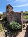

 Difficult