Country:

 City:
City:


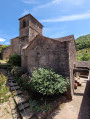
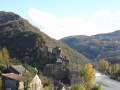
Head to the hamlet of Cayla, in the commune of Martrin. There is free parking at both entrances to the hamlet. The start point is in front of the old Saint-André Chapel: you reach it by walking up the paved slanting street.
(S/E) Walk down the paved slanting street. Once you reach Place des Pipelettes, follow the road to the left, cross the bridge over the Gos and head towards the junction of the D501 and the D106.
(1) Take the path on the left which leads uphill. Walk alongside a meadow on your left. Then take a wide, slightly downhill path to the left, before heading back uphill at the next junction.
(2) Turn right onto a path that climbs steeply through the woodland. Walk alongside a meadow towards the hamlet of Salvignol. You’ll come out onto a wider track.
(3) Follow it to the left to quickly reach the hamlet. Continue south for 500 m along the village track, which slopes down slightly.
(4) Then turn left onto a farm track. Walk eastwards to reach Cazourgettes.
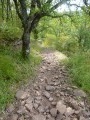
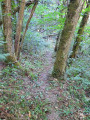
(5) Cross a small road and take a track to the left, passing a cowshed on your right. Turn left after the buildings and head down through the meadows along a stony track. Turn right to enter a woodland and walk gently downhill along a grassy, fully shaded path to a bridge over the Ruisseau de Goussilles.
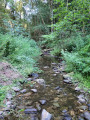
(6) Cross the bridge and take a path on the left that leads uphill. Shortly afterwards, at a Fork in the road, take the forest track on the left which leads back down towards the stream. Follow the Ruisseau de Goussilles as it winds to your left until you reach a ford.
(7) Cross it and continue along the forest path which runs flat alongside the stream, which now winds to your right. Alternate between a few short ascents and descents, then turn right to head back down towards the stream. Ford the Ruisseau de Goussilles and head back up to join the D501 (menhir statue).
(8) Follow the road to the left, heading downhill until you reach a road bridge.
(9) Leave the road just before the bridge and take a track on the right. At a fork in the road not shown on the map, follow the track going uphill straight ahead (ignore the one going downhill to the left) until you reach the next junction (not shown on the map).
(10) Follow the path on the left that goes downhill (ignore the path straight ahead). At the bottom, turn right and walk alongside the meadows on your left. Then enter the woods again. At a fork not shown on the map, turn left to head down towards the Ruisseau du Gos.
(11) Ford the river and head up the path opposite through the woods. Pass by a Templar cross and you’ll soon reach a junction.
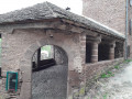
(12) Take the path that leads down to the left. Cross a track twice and enter the hamlet of Cayla from the top (wash house on the left). This will take you to the chapel (S/E).


 AONB
AONB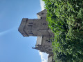

 Visorando Member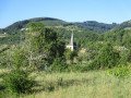
 Difficult