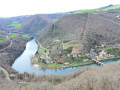
Montclar circular

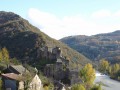
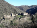
A lovely, easy walk to explore the village of Montclar in the Aveyron and its surroundings.

Details

n°11428255
Creation:
Last update:
Last review:
  • Walking
    Activity: Walking
  • ↔
    Distance: 2.56 mi
  • ◔
    Average duration: 1h 35 
  • ▲
    Difficulty: Easy

  • ⚐
    Back to start: Yes
  • ↗
    Ascent: + 443 ft
  • ↘
    Descent: - 449 ft

  • ▲
    Highest point: 2,106 ft
  • ▼
    Lowest point: 1,614 ft

Description of the walk

Start from the village hall car park.

(S/E) From the car park, go round the back of the village hall then follow the road to the left, heading south-east for almost 300 m until you reach a three-way junction.

(1) Turn right, walk past a farm on your left, then continue south along a farm track.
This then turns due west and enters the woodland. You’ll reach the start of a path on the right at the 90° left-hand bend (near an abandoned car).

(2) Take this narrow path which descends through the woods to the bottom of the valley.

(3) Continue downhill alongside the river for about 200 metres until you come to the start of a path on the right.

(4) Follow it uphill through the woodland, then walk alongside a field on your left. Pass the entrance, on the right, to a building and carry on until you reach a three-way junction a few metres further on.

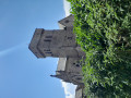
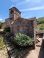
(5) Turn right and keep right until you reach the road. At the three-way junction at the entrance to the village, turn right. Walk past the church and then the town hall. Head towards the village exit on the right and make your way to the village hall car park (S/E).

Waypoints

  1. S/E : mi 0 - alt. 2,047 ft - Village hall
  2. 1 : mi 0.2 - alt. 2,031 ft - Three-way junction
  3. 2 : mi 0.99 - alt. 1,818 ft - Path on the right
  4. 3 : mi 1.14 - alt. 1,627 ft - Watercourse
  5. 4 : mi 1.27 - alt. 1,624 ft - Junction
  6. 5 : mi 1.57 - alt. 1,900 ft - Three-way junction
  7. S/E : mi 2.56 - alt. 2,041 ft - Village hall

Notes

Don’t forget to bring a camera.

Worth a visit

Tour of the village of Montclar.
Viewpoint: a former windmill offering a 360° panoramic view.
Village restaurant.

Reviews and comments

5 / 5
Based on 1 review

Reliability of the description
5 / 5
Ease of following the route
5 / 5
Route interest
5 / 5
Azimut71
Azimut71

Overall rating : 5 / 5

Date of your route : May 17, 2022
Reliability of the description : ★★★★★ Very good
Ease of following the route : ★★★★★ Very good
Route interest : ★★★★★ Very good
Very busy route : No

The path is signposted from point <2>.
A lovely walk. It’s a shame we start with a descent and finish with a climb!

Machine-translated

Other walks in the area

For more walks, use our search engine .

The GPS track and description are the property of this route's author. Please do not copy them without permission.