Circular route: Sentier du Solitaire – Cheminée de Corde – Arpison Viewpoint

A lovely circular route through little-known and little-visited parts of the Chartreuse, following old paths… which, sadly, are sometimes on the verge of disappearing.

Details

1544098
Creation:
Last update:
Last review:
  • Walking
    Activity: Walking
  • ↔
    Distance: 6.35 mi
  • ◔
    Average duration: 5h 45 
  • ▲
    Difficulty: Difficult

  • ⚐
    Back to start: Yes
  • ↗
    Ascent: + 3,297 ft
  • ↘
    Descent: - 3,274 ft

  • ▲
    Highest point: 4,806 ft
  • ▼
    Lowest point: 1,867 ft

Photos

Description of the walk

Park at the side of the CD 520b immediately after crossing the Pont St Bruno when coming from Saint-Laurent-du-Pont.

(S/E) A few dozen metres further up the hill, take the forest track that climbs from the road up the slope and cross the timber storage area. Continue straight ahead along the skid track up a steep slope.

(1) When it changes direction to turn right, take the Sentier du Solitaire, which climbs through the forest between the track and the cliffs overlooking the Guiers Mort.
The start of the path is tricky to find: avoid taking a vague track right at the edge of the cliff, which is very exposed, but take the more clearly marked path about ten metres higher up: it starts just after the bend in the track, via a small hairpin bend to the left, marked by a discreet cairn.
This path climbs steadily and joins the forest track: do not look for its trail on the opposite side, which appears to have disappeared, but follow the track uphill for about a hundred metres. When it turns right, continue straight on through the forest along the Sentier du Solitaire, which you will find again (small cairn near the start).
It continues to climb more or less close to the cliff and, at around 1070m, reaches a ridge where the path coming from the Cheminée de Fétrus joins it on the opposite side. Turn right to climb the few metres up the ridge to reach the 1097m point, on the forest track which passes over a pass here.

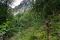
(2) From this pass, the start of the access path leading up to the Cheminée seems to have disappeared: head up the wooded ridge opposite (south-east) to ensure you find this path. It winds its way slightly upwards through the forest before crossing the slopes to the right to reach the foot of the Cheminée de Corde (also known as the Cheminée du Solitaire), a wide, steep, grassy and earthy couloir winding its way between two rocky ridges to the left.
NB: the Cheminée is significantly further south than indicated on the IGN map, which misleads many people!

From the foot of the couloir, climb up it heading north-east, generally straight up the slope, sometimes on the left-hand side at the bottom, then on the right-hand side further up. Old cables along the side rocks help you climb the slope, but they are in very poor condition and missing in several places. This climb can be very slippery when the ground is wet (in any case, the chimney, flanked by cliffs, gets little sun).

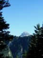
The exit onto the ledge is obvious, in a more wooded section: it opens out onto the beautiful Corde meadow (which narrows as the forest encroaches), where you usually see the sun again after it was hidden during the ascent (you can climb up to the left to the Rocher du Solitaire for a more unobstructed view).
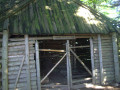
Head out across the meadow and climb up the paths towards the ridge overlooking it: you’ll reach a curious structure – the Chapelle de Corde, built from rough-hewn logs. Then veer to the right, staying close to the ridge, until you cross the path coming from Habert further down, which crosses the ridge at a threshold.

(3) From this threshold, the path descends to the left, keeping to the side of the slope and running along the foot of the Rochers de Montheur. Once at the bottom of the valley, follow the signposted path towards Arpison carefully: climb up a rocky area on the right, then ascend more directly up the north-north-westerly slope and, via a series of switchbacks, emerge onto the Arpison meadow.

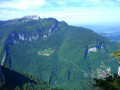
(4) Take the path on the left which climbs towards the rocks to reach the Belvédère d’Arpison.

(5) Retrace your steps back to the meadow.

(4) Continue north-east and cross the meadow at the far end, passing close to a chasm and then near the Habert d’Arpison.

(6) At the end of the crossing, do not head back up towards the Col d’Arpison path (coming from La Ruchère), but turn left to follow the valley floor, which is initially flat and then slopes gently downwards. Always keep left at junctions: the path winds its way downwards beneath the foothills of the Rochers d’Arpison and joins the track coming from Le Pertuis; follow this to the left, climbing slightly, until you reach the Col de Fétrus, which is more grassy than wooded.

(7) At Fétrus, turn right to follow the broad, almost horizontal ridge. Before reaching the Rochers de Fétrus, the signposted path veers sharply left, descending via well-marked switchbacks down the slope through the forest. Further down, it crosses a torrent (usually dry) and continues to wind its way down to a junction.

(8) There, at around 1090m, let the signposted path branch off to the right – heading down towards the Cheminée de Fétrus – and take the forest track opposite instead. Follow the often-dilapidated track, first slightly downhill, then uphill to reach the 1097m pass which you crossed on the way up. This section of the route is easy, except for a stream crossing where the path has been washed away; you’ll rejoin it on the other side.

(2) At the junction of the forest track and the Sentier du Solitaire, there are two options:
- either head back down via the path taken on the ascent,
- or, more comfortably – although the track has been damaged by storms – follow the forest track down a gentle slope (this is the route shown on the map). After a few wide hairpin bends, you’ll reach the original junction.

(1) Continue along the track and then take the road on the right to return to the starting point (S/E).

Waypoints

  1. S/E : mi 0 - alt. 1,870 ft - Pont St Bruno (car park upstream) - Guiers (rivière)
  2. 1 : mi 0.15 - alt. 1,962 ft - Forest track x Sentier du Solitaire
  3. 2 : mi 1.25 - alt. 3,556 ft - Start of the access route to the Cheminée de Corde
  4. 3 : mi 1.71 - alt. 4,698 ft - Summit of the Corde meadow
  5. 4 : mi 2.31 - alt. 4,800 ft - End of the Prairie d’Arpison
  6. 5 : mi 2.37 - alt. 4,754 ft - Arpison Viewpoint
  7. 6 : mi 2.71 - alt. 4,682 ft - Crossroads
  8. 7 : mi 3.4 - alt. 4,554 ft - Col de Fétrus
  9. 8 : mi 4.33 - alt. 3,586 ft - Junction at the lower end of the Combe de Fétrus
  10. S/E : mi 6.35 - alt. 1,870 ft - Pont St Bruno

Notes

Suitable for all seasons, provided the ground is not excessively damp: the ascent up the Cheminée de Corde can be problematic in very damp weather (steep, clayey terrain).
Difficulties in finding your way at several points due to the partial disappearance of historic paths (low footfall, tree felling, etc.)

Worth a visit

Viewpoint at the Rocher du Solitaire near the exit of the Cheminée de Corde.
An unusual wooden structure: the Chapelle de Corde (reportedly built by Scouts).
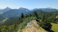
Arpizon viewpoint, overlooking this part of the Chartreuse.
In Corde, as in Arpizon, daffodils are guaranteed in spring.

Reviews and comments

3.8 / 5
Based on 5 reviews

Reliability of the description
4.2 / 5
Ease of following the route
3.3 / 5
Route interest
4 / 5
ludo
ludo

Overall rating : 3 / 5

Date of your route : Jul 15, 2025
Reliability of the description : ★★★☆☆ Average
Ease of following the route : ★★★☆☆ Average
Route interest : ★★★☆☆ Average
Very busy route : No

I strongly advise against taking the Corde chimney route.
It isn’t really a chimney: it’s impossible to keep your footing on the rock, and even after several days without rain, the steep slope of earth and scree remains so unstable that it makes progress dangerous even for an experienced walker.
The rather mediocre ‘aesthetic’ appeal does not justify taking such a risk.

Machine-translated

jpc38
jpc38

Overall rating : 4 / 5

Date of your route : Nov 17, 2023
Reliability of the description : ★★★★★ Very good
Ease of following the route : ★★★☆☆ Average
Route interest : ★★★★☆ Good
Very busy route : No

In very damp conditions (such as today, after three weeks of rain), avoid descending via the Cheminée de Corde. Either take the route round via Arpison or head down to the Pont des Allemands.
Lots of (magnificent) fallen trees may block the path, so it’s best to be able to read the map properly ;-)

Machine-translated

D. N.
D. N.

Overall rating : 3.7 / 5

Date of your route : Sep 10, 2023
Reliability of the description : ★★★★☆ Good
Ease of following the route : ★★★☆☆ Average
Route interest : ★★★★☆ Good
Very busy route : No

Hello, I did this hike on Sunday 10 September 2023. Didn’t see a soul.
I walked up the forest track to point 2: no problems. I didn’t spot the Solitaire path, but it’s true I wasn’t really looking for it. The small cairn indicating that you need to turn right towards the Corde chimney is at the top of the slope. If you miss it, the path goes downhill again and soon disappears; avalanches and rockfalls have swept it away.
Up to the foot of the chimney, no problems: a line of cairns and a faint, winding path.
The chimney is more than just difficult – it’s downright dangerous: a steep slope of loose earth. There’s a cable in places, but not for long. I clung to every little pebble, the stinging nettles and the dead trees (gloves recommended). After that, it’s lovely: the Corde chapel, the forest, chamois, the viewpoint and the Arpison meadow.
The route round the Arpison rocks and the descent from the Fétrus clearing are well marked and signposted. The path even seems to have been re-laid.
I came back via the Fétrus ‘chimney’ as, as mentioned above, the path had been washed away between 2 and 8.
No problems in the Fétrus chimney. At the bottom of the chimney, at the ‘St-Laurent-du-Pont’ sign, turn immediately left onto an old, disused path which is still there.
When it joins a wide track, be sure to take it to the right and not to the left (the track disappears further on).
After crossing a small, dry stream, you’ll come onto a track suitable for vehicles, which winds down to the Orcière Bridge factory.
In summary: a very beautiful, challenging and wild route that requires you to keep a close eye on the terrain.

Machine-translated

AureLynx
AureLynx

Overall rating : 4 / 5

Date of your route : May 28, 2021
Reliability of the description : ★★★★☆ Good
Ease of following the route : Not used / Not applicable
Route interest : ★★★★☆ Good
Very busy route : No

I had no trouble finding the start of the chimney, thanks to the directions provided – in particular, the advice to leave the forest track at an altitude of 1097 to climb up to the foot of the chimney. You can’t really see where the path starts, but you can make out the trail just above it. However, the chimney itself is frankly dangerous. The few remaining cables are in poor condition, and, more importantly, there are none in the sections where they’re needed. It’s steep, slippery and there are stinging nettles to make matters worse. I’m used to ‘rocky’ chimneys, which I feel comfortable on. This, however, is more of a steep gully of earth and scree that isn’t exactly pleasant to climb. Keeping to the left side of the rock provides a bit more security by offering a few handholds… In short, you’re glad when you reach the top – provided you haven’t given up further down. In practical terms, it’s either give up at the foot of the chimney or go all the way to the top, as it’s tricky to get back down once you’ve started. Definitely not to be attempted in wet weather, of course.

For your information, on that day I did a lovely circular route starting from La Ruchère: Riondette car park > Col Sariette > Rocher de Fétrus > Cheminée de Corde > Arpison viewpoint > Habert de Billon > Col Ruchère > Petit Som > Pas du Loup > descent via the Pré de la Morte. (21km, 1600m elevation gain)

Machine-translated

Pierrotk10d
Pierrotk10d

Overall rating : 4.7 / 5

Date of your route : Jul 28, 2020
Reliability of the description : ★★★★★ Very good
Ease of following the route : ★★★★☆ Good
Route interest : ★★★★★ Very good
Very busy route : No

Hello,
A very beautiful, fairly challenging hike. The start of the ‘Sentier du Solitaire’ and the path leading to the foot of the Corde chimney are difficult to find. Once you reach the pass at an altitude of 1,097 metres, there is a sign pointing towards Corde. You need to climb the grassy hillock and look for the path as you head uphill, keeping to the right. Once you’ve found the path, there are small cairns all the way to the foot of the Cheminée. At the bottom of the Cheminée, on the right-hand side, there’s a cable in fairly good condition, but this section is easy. Further up, there’s another one – quite short but very rusty, with bits of steel sticking out. Watch your hands. In the middle section, watch out for stinging nettles. They sting, so avoid wearing shorts or Bermuda shorts! After that, it’s plain sailing – just follow the paths back down. A lovely descent through the Col de Fetrus forest, marked in yellow. Actual walking time: 4 hours 15 minutes
Pierrot

Machine-translated

JCParavy
JCParavy
• Edited:

As I wasn’t particularly happy with the description of the start of the Sentier du Solitaire – which differs quite a bit from what’s shown on the IGN map – I went back to record a track on site and made a few adjustments to the route and the description, which I think will now be clearer and therefore safer in this steep section.

Machine-translated

janvier38
janvier38

Thank you for your reply.
Are you from St Genix sur Guiers?

We’re based in Novalaise and enjoy hikes where you have to work out the route from time to time.

We saw that you recently climbed the Dent de Cons in the Bauges, setting off from the Raffort car park.
We’ll add it to our itinerary next year to complete the 14 peaks over 2,000 metres in the Bauges.
We did the Pralinoise recently – the long route.

Perhaps we’ll be lucky enough to bump into you.

Machine-translated

JCParavy
JCParavy

The route known as the ‘5 Haberts’ route mainly follows the south-eastern slope, starting from the Pont des Allemands. There is indeed a common section, from Corde to Arpison, but before that it comes from Chartoussette and afterwards it switches to Billon.
The ‘cheminée’ is certainly the trickiest section of the route: I make no secret in the guidebook of the dilapidated state of the cable fixings – you’ll have to make do without them for most of the ascent. But it’s manageable: walking poles prove useful to prevent you from slipping back down with every step, and if the ground is damp, why not use an ice axe, as some shepherds used to do in the old days?
On this face, there is no easier route: the IGN map is incorrect. The only easy route up to Corde is from the Pont des Allemands or the convent.
But if you’ve found the base of the chimney, that’s not half bad: personally, it took me several attempts to find it, which is why I’ve provided such a detailed description.

Machine-translated

janvier38
janvier38

Hello,

Two years ago, I tried to do this hike known as the ‘5 Haberts’, but it was impossible to continue via the Corde Chimney (with the rusty cables coiled along the rock face and the terrain being very steep and stony).
You mention another, easier route further up the Cheminée – do you have a more detailed description?

Thanks in advance, as I’d like to try it again, but next year – it’s too late for that now, given the time of year.

Renault

Machine-translated

Other walks in the area

For more walks, use our search engine .

The GPS track and description are the property of this route's author. Please do not copy them without permission.