


Refine your search for walks in Saint-Jean-la-Fouillouse
Saint-Jean-la-Fouillouse walks


 The Patus Forest
 Tourist office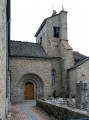
 9.31 mi
 +755 ft
 -745 ft
 4h 55
4h 55
 Moderate
 Departure from Saint-Jean-la-Fouillouse (Lozère)
This route takes you through several typical villages of the Margeride region with their rich and varied heritage, as well as the wonderful Patus Forest where you can enjoy unspoilt nature.
Exploring the area around La Fouillouse
 7.22 mi
+781 ft
-761 ft
4h 00
Moderate
Departure from Saint-Jean-la-Fouillouse (Lozère)
7.22 mi
+781 ft
-761 ft
4h 00
Moderate
Departure from Saint-Jean-la-Fouillouse (Lozère)
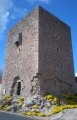
This route will take you on a journey of discovery through the local heritage (the Cellier Tower, the bread oven, the cross) and the wild, unspoilt landscapes around the Ruisseau de la Fouillouse.
The upper Langouyrou valley via Cheylard-l'Évêque
 Visorando Member
 12.50 mi
+1,549 ft
-1,565 ft
7h 05
Moderate
Departure from Cheylard-l'Évêque (Lozère)
12.50 mi
+1,549 ft
-1,565 ft
7h 05
Moderate
Departure from Cheylard-l'Évêque (Lozère)
A very pleasant hike through meadows and woods, the latter being very diverse. There are many landscapes and viewpoints, notably over the Mercoire forest and the Moure de la Gardille. All seasons are interesting: spring with its rushing rivers, summer with its refreshing forests, autumn marked by a symphony of colours.
Margeride and its hamlets
 Association / Club / Walk leader
 5.98 mi
+466 ft
-446 ft
3h 10
Moderate
Departure from Grandrieu (Lozère)
5.98 mi
+466 ft
-446 ft
3h 10
Moderate
Departure from Grandrieu (Lozère)
Starting from the village of Grandrieu, this hike allows you to discover the small Margeride massif (formerly Gévaudan) and its typical granite villages. The route described was completed in half a day by young people (aged 7 to 11) from the Sentiers en Margeride hiking club. Difficulty: E2/T2/R1 (according to FFrandonnée classification).
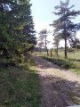
Cheylard-l'Évêque - Notre-Dame-des-Neiges Abbey
 12.97 mi
+1,988 ft
-2,090 ft
7h 40
12.97 mi
+1,988 ft
-2,090 ft
7h 40
 Difficult
Departure from Cheylard-l'Évêque (Lozère)
Difficult
Departure from Cheylard-l'Évêque (Lozère)
Fifth stage of a complete journey on the Chemin de Stevenson between Le Puy-en-Velay and Alès. This stage includes significant changes to the GR®70 signposting. Alternatives exist, notably to go directly to La Bastide-Puylaurent without passing through Notre-Dame-des-Neiges.
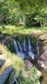
Lake Langogne and Donozau Waterfall
 7.69 mi
+427 ft
-427 ft
3h 55
Moderate
Departure from Langogne (Lozère)
7.69 mi
+427 ft
-427 ft
3h 55
Moderate
Departure from Langogne (Lozère)
This hike offers beautiful views of the Naussac Reservoir and the Rac de Langogne, and you can discover the small Donozau waterfall along beautiful paths.
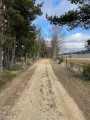
Route du Langouyrou in Langogne
 4.43 mi
+400 ft
-394 ft
2h 25
4.43 mi
+400 ft
-394 ft
2h 25
 Easy
Departure from Langogne (Lozère)
Easy
Departure from Langogne (Lozère)
Discover, in a single hike and in turn, the upper Allier valley and then the torrential Langouyrou valley, following in the footsteps of the writer and traveller Robert Louis Stevenson. Open to all, this walk is also accessible with a pushchair or wheelchair.
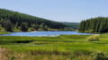
Tour of Lake Charpal
 5.32 mi
+52 ft
-52 ft
2h 30
Easy
Departure from Rieutort-de-Randon (Lozère)
5.32 mi
+52 ft
-52 ft
2h 30
Easy
Departure from Rieutort-de-Randon (Lozère)
Hike around Lake Charpal in a completely unspoilt protected natural site. The path does not stray far from the lake, so the elevation gain is very low and the route is easy. Much of the route is through woodland, ideal in summer when it is hot.
Tour of Truc de Fortunio
7.40 mi
+1,053 ft
-1,050 ft
4h 20
Moderate
Departure from Rieutort-de-Randon (Lozère)
Tour du Truc de Fortunio, a hike of moderate difficulty due to the limited elevation gain. The scenery is varied: wild and surrounded by nature.
A breathtaking view upon reaching the highest point.
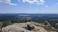
 Lac de Charpal and Truc de Fortunio
 16.02 mi
+1,286 ft
-1,299 ft
2.5 hrs
Moderate
Departure from Rieutort-de-Randon (Lozère)
16.02 mi
+1,286 ft
-1,299 ft
2.5 hrs
Moderate
Departure from Rieutort-de-Randon (Lozère)
A very smooth mountain bike ride that follows the route around Lac de Charpal, then climbs to reach the peaks of the Margeride. No technical difficulties, no sections where you need to carry your bike, but a good climb on a tarmac track before reaching the Truc de Fortunio.
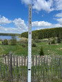
Tour of Lake Charpal
 5.70 mi
+141 ft
-131 ft
2h 45
Easy
Departure from Rieutort-de-Randon (Lozère)
5.70 mi
+141 ft
-131 ft
2h 45
Easy
Departure from Rieutort-de-Randon (Lozère)
Tour of Lake Charpal in Lozère. An easy route on a relatively flat path, despite being at an altitude of over 1,300 metres. Beautiful views of the lake along the entire route, alternating between forest, meadows and peat bogs.
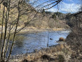
Starting point at the Gorges de l'Allier in Pomeyrols
 2.84 mi
+479 ft
-472 ft
1h 45
Easy
Departure from Naussac (Lozère) (Lozère)
2.84 mi
+479 ft
-472 ft
1h 45
Easy
Departure from Naussac (Lozère) (Lozère)
You can discover the beauty of the Allier Gorges in Pomeyrols, a hamlet in the commune of Naussac-Fontanes, situated 8 km north of Langogne.
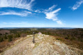
Le Moure de la Gardille and the sources of the Allier
 7.17 mi
+817 ft
-810 ft
4h 00
Moderate
Departure from Saint-Frézal-d'Albuges (Lozère)
7.17 mi
+817 ft
-810 ft
4h 00
Moderate
Departure from Saint-Frézal-d'Albuges (Lozère)
A beautiful route around the little-known sources of the Allier.
Moure and the Gardille Forest
13.96 mi
+1,634 ft
-1,624 ft
7h 50
Difficult
Departure from Chasseradès (Lozère)
A long route on good paths, allowing you to maintain a good walking pace, all at an altitude of over 1,100 metres.
A long, steady climb leads to the Moure de la Gardille: a superb view!
You then descend to the source of the Allier, before setting off on a long trek through the forest. It’s cool, perhaps a little monotonous (few viewpoints), but the winding route means you need to stay alert. The app is highly recommended.
You then walk along the Allier to reach Chabalier.
The final stretch is fairly easy, but it gets hot on the narrow roads and well-maintained paths.
Chasseradès - Le Bleymard
 11.24 mi
+1,775 ft
-2,070 ft
6h 45
Difficult
Departure from Chasseradès (Lozère)
11.24 mi
+1,775 ft
-2,070 ft
6h 45
Difficult
Departure from Chasseradès (Lozère)
Seventh stage of a complete journey on the Chemin de Stevenson between Le Puy-en-Velay and Alès. This stage may include significant changes to the GR®70 signposting, and represents the end of the section corresponding to the crossing of the Gévaudan.