


Refine your search for walks in Saillans
Saillans walks


 The Chabrier mountain
 Visorando Member
 6.08 mi
 +1,742 ft
 -1,726 ft
 4h 20
4h 20
 Moderate
 Departure from Saillans (Drôme)
Tour of the Montagne de Chabrier starting from Saillans.
Saint-Christophe and Les Trois Bornes - Pays de Saillans
 Local authority8.75 mi
+1,535 ft
-1,539 ft
5h 20
Moderate
Departure from Saillans (Drôme)
Local authority8.75 mi
+1,535 ft
-1,539 ft
5h 20
Moderate
Departure from Saillans (Drôme)
From the lively village of Saillans with its narrow streets, arcades and fountains, passing by the turquoise blue pools of Rieussec, climb up to the Saint-Christophe Chapel. It faces the Trois Becs!
Tour de Chabrier from Saillans to Pas de la Bernarde
 8.64 mi
+2,612 ft
-2,612 ft
6h 15
Moderate
Departure from Saillans (Drôme)
8.64 mi
+2,612 ft
-2,612 ft
6h 15
Moderate
Departure from Saillans (Drôme)
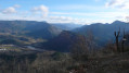
An extension of the classic Tour de Chabrier hike, this figure-of-eight hike (with the Col des Vallons at its centre) takes you to the Pas de la Bernarde (magnificent views of the Vercors, Montagne de Glandasse and Drôme Valley on the Vercheny side) and into the Fond de Chabrier. In total, the Col des Vallons will have been explored from all four cardinal points!
Another Tour de Chabrier from Saillans
 7.38 mi
+2,224 ft
-2,247 ft
5h 20
Moderate
Departure from Saillans (Drôme)
7.38 mi
+2,224 ft
-2,247 ft
5h 20
Moderate
Departure from Saillans (Drôme)
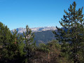
Variation on the classic Tour de Chabrier hike via the Col des Vallons and the Pas de la Bernarde, with a return via a tiny path overlooking the Drôme and the D93 between Saillans and Vercheny. Splendid views guaranteed over the Drôme Valley, the Massif des Trois-Becs and the Vercors.
Circular Three Passes Route from Saillans
 7.76 mi
+1,378 ft
-1,368 ft
4h 45
Moderate
Departure from Saillans (Drôme)
7.76 mi
+1,378 ft
-1,368 ft
4h 45
Moderate
Departure from Saillans (Drôme)
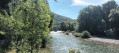
This is a lovely walk, with a route that differs from the other itineraries starting from Saillans. The path takes you over three passes. You start off on the Chemin de la Clairette, then head via the Col des Beaux. The ridge walk, after the Col de Pourcheton, offers views of the Diois and the Rhône Valley. At the Col de Sauzet, you descend towards Jomare to join a wide path that leads back to the village.
Tour of the Rochers de Cresta and Auberts from Saillans
 8.84 mi
+3,406 ft
-3,415 ft
7h 00
8.84 mi
+3,406 ft
-3,415 ft
7h 00
 Difficult
Departure from Saillans (Drôme)
Difficult
Departure from Saillans (Drôme)
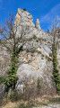
A beautiful but long hike around the Rochers de Cresta, with the added bonus, if you feel up to it, of climbing to the top of the ridges: breathtaking views of the Trois Becs massif, the Drôme valley, the Vercors, Glandasse, and even a glimpse of Grand Ferrand... But only do this in dry weather with very good footwear that grips well, as there are steep slopes and secure rocks...
The Chestnut Tree of Bellieux
 8.67 mi
+1,604 ft
-1,594 ft
5h 25
Moderate
Departure from Saillans (Drôme)
8.67 mi
+1,604 ft
-1,594 ft
5h 25
Moderate
Departure from Saillans (Drôme)
During this hike, the land of Clairette wine offers us a surprising encounter with a centuries-old chestnut tree. Standing alone at the foot of the Trois Becs and the Rocher de la Laveuse, a sign indicates its age and characteristics. One cannot help but admire this witness to history, which was most certainly a contemporary of Joan of Arc!
Les Trois Becs and the Saou Forest
 11.61 mi
+5,443 ft
-5,420 ft
10h 05
Difficult
Departure from Chastel-Arnaud (Drôme)
11.61 mi
+5,443 ft
-5,420 ft
10h 05
Difficult
Departure from Chastel-Arnaud (Drôme)
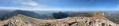
Like a ship, the massif rises at the foot of the Vercors and offers a panoramic view over the Drôme and Rhône valleys. In fine weather, you can see the snow-capped peaks of the Alps and, on the opposite side, the Cévennes. Several moments of contemplation are needed to take in these landscapes.
⚠️ The route passes through a wildlife sanctuary. Certain sections are off-limits between 15 May and 15 July. Specific signage and a diversion from the GR®9 have been put in place to guide walkers; see here.
⚠️ Between 1 July and 15 September, Prefectural Order DDT-SEF-2026-0176 of 4 June 2026 concerning the temporary restriction of access to the Saoû forest and the Ambel plateau in the event of a fire risk, which is assessed daily. A map is published every evening (around 5.30 pm) for the following day.
The promontories and summit of Cresta
 4.24 mi
+2,602 ft
-2,598 ft
4h 15
Moderate
Departure from Espenel (Drôme)
4.24 mi
+2,602 ft
-2,598 ft
4h 15
Moderate
Departure from Espenel (Drôme)
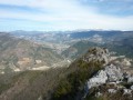
A beautiful hike above the village of Espenel, providing access to the three peaks on the Cresta ridges.
Tour de Pégarnier
 4.76 mi
+1,273 ft
-1,270 ft
3h 20
4.76 mi
+1,273 ft
-1,270 ft
3h 20
 Easy
Departure from Espenel (Drôme)
Easy
Departure from Espenel (Drôme)
A lovely little hike to the summit of Pégarnier, which offers magnificent views of the villages of Espenel, Vercheny and Aurel en Diois.
Saint-Sauveur-en-Diois
 2.96 mi
+400 ft
-430 ft
1h 45
Easy
Departure from Saint-Sauveur-en-Diois (Drôme)
2.96 mi
+400 ft
-430 ft
1h 45
Easy
Departure from Saint-Sauveur-en-Diois (Drôme)
Walk through the Clairette de Die vineyards.
Views of the Trois Becs, the Glandasse, and the Drôme valley.
Les 3 Becs from Les Auberts via Col de la Motte
 10.05 mi
+5,528 ft
-5,531 ft
9h 25
Difficult
Departure from Chastel-Arnaud (Drôme)
10.05 mi
+5,528 ft
-5,531 ft
9h 25
Difficult
Departure from Chastel-Arnaud (Drôme)
Another route across the ridges of the 3 Becs, which is quieter and more unspoilt.It is possible to do this without completing the return leg (a shorter route) by descending to the Col de la Chaudière; in this case, two cars are recommended (or hitchhiking).
⚠️ The route passes through a wildlife sanctuary. Certain sections are off-limits between 15 May and 15 July. Specific signage and a diversion from the GR®9 have been put in place to guide walkers; see here.
⚠️ Between 1 July and 15 September, Prefectural Order DDT-SEF-2026-0176 of 4 June 2026 concerning the temporary restriction of access to the Saoû forest and the Ambel plateau in the event of a fire risk, assessed on a daily basis. A map is published every evening (around 5.30 pm) for the following day.
Saint-Christophe Chapel from Véronne
 10.08 mi
+1,854 ft
-1,867 ft
6h 15
Moderate
Departure from Véronne (Drôme)
10.08 mi
+1,854 ft
-1,867 ft
6h 15
Moderate
Departure from Véronne (Drôme)
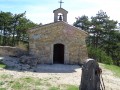
Alternating between trails and forest tracks, you will discover the small Saint-Christophe Chapel and its tiny cemetery, perched on the heights of Véronne in the Grand Barry Forest, as well as the Roury Forest House, all in a setting of absolute tranquillity.
Ridges of Grand Barry-Gaudichart from Vercheny-le-Temple
 10.30 mi
+2,585 ft
-2,589 ft
7h 00
Moderate
Departure from Vercheny (Drôme)
10.30 mi
+2,585 ft
-2,589 ft
7h 00
Moderate
Departure from Vercheny (Drôme)
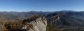
Starting from Vercheny-le-Temple (or Vercheny le Haut), a very pleasant hike along easy paths and trails, providing access to one of the ridges of the Grand Barry-Gaudichart, as well as the ruined Château du Barry. Exceptional views over the Vercors, the Baronnies and the Diois.The return route follows partly along the western slope, offering another view of the Saoû ridges, and finishes on the eastern slope via the Pas de la Bernarde, a path carved out between the rocks (no equipment required).
Barry Castle from Vercheny
 7.97 mi
+1,942 ft
-1,942 ft
5h 20
Moderate
Departure from Vercheny (Drôme)
7.97 mi
+1,942 ft
-1,942 ft
5h 20
Moderate
Departure from Vercheny (Drôme)
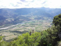
A very beautiful circuit, mostly in the forest and therefore quite shaded, with a magnificent view once you reach the ruins of Barry Castle.
Saint-Michel - Pays de Saillans
 4.23 mi
+899 ft
-899 ft
2h 45
Moderate
Departure from Aubenasson (Drôme)
4.23 mi
+899 ft
-899 ft
2h 45
Moderate
Departure from Aubenasson (Drôme)
On the foothills of the perched syncline of the Saoû forest and through vineyards, forests and ridges, this route offers beautiful views of the Trois Becs.
Faraud Mountain and Sadous Chapel from Chastel-Arnaud
 9.81 mi
+2,877 ft
-2,867 ft
7h 00
Difficult
Departure from Chastel-Arnaud (Drôme)
9.81 mi
+2,877 ft
-2,867 ft
7h 00
Difficult
Departure from Chastel-Arnaud (Drôme)
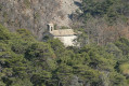
Montagne de Faraud offers magnificent views of the Trois Becs and all the surrounding mountains. This hike offers an alternative to the classic hike, starting from the hamlet of Saint-Moirans (Chastel-Arnaud) rather than La Chaudière. At the start, you will have the opportunity to visit the 12th-century Church of Saint-Moirans and, during the hike, the charming Chapelle des Sadous chapel. The hike follows good paths or tracks, with a few slightly steep sections.