Country:

 City:
City:


From Nice, head towards the Paillon Valley, then on to the village of Lucéram. As you leave the village, turn left onto the D2566 towards the Col Saint-Roch. At Col Saint-Roch, turn left onto the D73 towards Lauda and the Col de la Porte. Park at the Col de la Porte, situated 2 km from the junction, in the designated car park. Please note that the Col de la Porte is not signposted.
(S/E) From the Col de la Porte, marker 189, take the track heading north-west to reach the location of marker 194, which no longer exists at present: this path has recently been renovated over a short stretch and is not yet signposted.
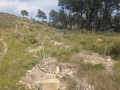
(1) Leave the track and take the path that climbs to the left, along the mountainside, then leads to a plateau covered in pine trees and ends at marker 449 at the Col de l’Obe.
(2) Carry on straight ahead, ignoring the path that branches off to the left towards the Cime de Rocca Siera.
The path climbs gently and leads to the Plat de la Liberté.
(3) The path then descends southwards, before climbing gently again to reach the Col de l’Autaret.
(4) Continue straight on, following the mountain’s contour towards the south-west. The path descends gently to marker 447.
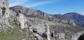
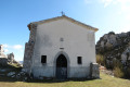
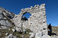
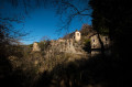
(5) Carry on straight ahead to the ruins of the old village of Rocca Sparvièra and the Chapel of Saint-Michel.
(6) Turn round and return to the car park (S/E) by following the same route back as on the way there.



 Visorando Member

 Difficult
  Easy
Easy