Country:

 City:
City:


Park in the Col de la Porte car park.
(S/E) Head for marker 189. Follow the signs for Lucéram along theGR®510, marked in white and red. You’ll reach the Ruisseau de Nugo, where there’s a cairn.
(1) Leave theGR® here and turn right onto the path running parallel to the stream. Move away from the stream and reach a T-junction, where there is also a cairn.
(2) Continue to the right, following the faint traces of very faded yellow markings. Carry on down a gentle slope and cross the bed of a stream. You will then reach, after an uphill climb, the ruins of the Maïranesca barn.
(3) Turn right and begin a steeper climb along a path that is barely visible but clearly there. You will reach the junction marked with signpost 194.
(4) Turn left and head towards the Cime de Rocca Sièra along the track suitable for vehicles, marked with yellow signposts. You’ll reach another junction, where there’s also a cairn.
(5) Turn left at a 90° angle and continue uphill to reach the Croix de Plan de Ribert.
(6) Continue uphill to the right along the path, passing beneath the sparse trees, and head for marker 449 at the Col de Lobe.
(7) Take the path on the left and continue along this ascending, occasionally rocky track to reach the summit of the Cime de Rocca Sièra.
(8) Retrace your steps along the previous route to return to the junction at marker 194.
(4) Carry on straight ahead along the track that forms part of theGR®510, marked in white and red, to return to the Col de la Porte car park (S/E).



 Visorando Member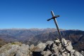

 Difficult
  Easy
Easy