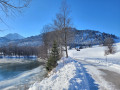
Circular walk from Schattwald via Rehbach and Unterjoch

A varied circular walk starting from Schattwald in the Tannheim Valley. The route takes us along the idyllic River Vils to the reservoir and on to Rehbach. From there, it continues to the Zehrerhöfe and, via a detour to Unterjoch in Germany, back to Schattwald.

Details

n°30944066
Creation:
Last update:
Last review:
  • Walking
    Activity: Walking
  • ↔
    Distance: 8.14 mi
  • ◔
    Average duration: 4h 20 
  • ▲
    Difficulty: Moderate

  • ⚐
    Back to start: Yes
  • ↗
    Ascent: + 650 ft
  • ↘
    Descent: - 659 ft

  • ▲
    Highest point: 3,757 ft
  • ▼
    Lowest point: 3,320 ft

Photos

Description of the walk

(S/E) We start our walk at the Schattwald Dorfplatz bus stop, heading north-east. A bridge takes us over the River Vils uphill to the church.

(1) At the church, we turn left, then take the next left down to the River Vils, then right.

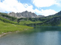
(2) We follow the path along the River Vils all the way to the Vils Reservoir.

(3) At the Vils reservoir, we turn left onto the bridge, then take the second right. We follow the path along the western shore of the lake and take the next left, then right, the second left and right again. We follow the road to the Landhotel Rehbach.

(4) At the main building of the Landhotel Rehbach, we turn left towards Zehrerhöfe. There is a fairly steep climb past a farm. At the edge of the wood, we turn right, then right again at the next junction.

(5) We’ve reached a viewpoint with a lovely panoramic view of the valley. We turn round, turn left, then right. The path takes us downhill across the Rehbach and back uphill on the other side. We turn left at the next opportunity.

(6) We have reached the Zehrerhöfe and are greeted by two alpacas. The Zehrerhöfe are already on the other side of the border in Germany. We turn left and follow the path downhill towards Unterjoch.

(7) We follow the road past the first buildings in Unterjoch towards the centre.

(8) We have reached the centre of Unterjoch with its church. We pass the public toilets and cross the Weißenbach. We turn right into Sorgschrofenstraße. At the Zinkenstube, we turn left, then left again at the next junction, and after this loop through the village we return to the church. We leave Unterjoch via the same route we came along. Once we have left the last houses of Unterjoch (7) behind us, we turn right at the next opportunity, then left.

(9) We cross the border between Germany and Austria. At the end of the path, we turn left.

(10) At the hut, we turn right and follow the road to Steig (11) and on to Schattwald.

(12) We pass the Lutz department store and take the next left. We cross the River Vils (2) and turn right. Then right again at the next junction. The route takes us back to the Schattwald Dorfplatz bus stop (S/E).

Waypoints

  1. S/E : mi 0 - alt. 3,543 ft - Schattwald village square bus stop
  2. 1 : mi 0.27 - alt. 3,520 ft - Church
  3. 2 : mi 0.46 - alt. 3,491 ft - Vils
  4. 3 : mi 1.11 - alt. 3,451 ft - Vils Reservoir
  5. 4 : mi 2.57 - alt. 3,510 ft - Landhotel Rehbach
  6. 5 : mi 3.01 - alt. 3,753 ft - Viewpoint
  7. 6 : mi 3.25 - alt. 3,724 ft - Zehrerhöfe
  8. 7 : mi 3.8 - alt. 3,497 ft - Unterjoch
  9. 8 : mi 4.42 - alt. 3,337 ft - Church
  10. 9 : mi 6.13 - alt. 3,491 ft - Border
  11. 10 : mi 6.62 - alt. 3,484 ft - Mountain hut
  12. 11 : mi 7.25 - alt. 3,497 ft - Stone
  13. 12 : mi 7.57 - alt. 3,481 ft - Lutz Department Store
  14. S/E : mi 8.14 - alt. 3,543 ft - Schattwald village square bus stop

Notes

  • Easy walking routes along roads and groomed winter walking trails. If you wish to shorten the walk, you can skip the detour to Unterjoch or take the bus back to the Tannheim Valley from Unterjoch (at the Zinkenstube, continue straight on to the bus stop).
  • Places to stop for refreshments in Rehbach (4), Unterjoch (8) and Schattwald (S/E).

Reviews and comments

5 / 5
Based on 1 review

Reliability of the description
5 / 5
Ease of following the route
5 / 5
Route interest
5 / 5
Kristin von Travelinspired

We did the walk in winter when there was snow on the ground, so you couldn’t see the ground everywhere. It’s good to know that it’s no problem even with a pushchair and so on – thanks for the info.

Machine-translated

Schneppou67
Schneppou67

Overall rating : 5 / 5

Date of your route : Apr 16, 2026
Reliability of the description : ★★★★★ Very good
Ease of following the route : ★★★★★ Very good
Route interest : ★★★★★ Very good
Very busy route : No

Whilst the scenery is lovely, there’s one very important detail missing: the entire route follows only small tarmac roads. No paths or tracks—neither grassy nor stony—just tarmac. Fine for rollerblading, cycling, pushchairs, etc.

Machine-translated

Other walks in the area

For more walks, use our search engine .

The GPS track and description are the property of this route's author. Please do not copy them without permission.