


 Country:

 City:
City:


The route starts from a car park along the L260 (Ehenbichler Strasse), near a sports ground.
The Schlosskopf circular route from Ehenbichl


A lovely circular route that runs mainly through woodland, which can be a welcome relief in hot weather. The first part of the descent is challenging and can be dangerous in wet weather. On the second part of the descent, from the ruins of Erhenberg, keep well to the left so as not to miss the path.
Details
Creation:
Last update:
Last review:
–
–
-
 Activity: Walking
 -
 Distance: 5.76 mi
 -
 Average duration: 4h 00
 -
 Difficulty: Moderate
 -
-
 Back to start: Yes
 -
 Ascent: + 1,568 ft
 -
 Descent: - 1,572 ft
 -
-
 Highest point: 4,134 ft
 -
 Lowest point: 2,789 ft
Waypoints
- S/E : mi 0 - alt. 2,792 ft - Car park – L260 road
- 1 : mi 1.05 - alt. 2,854 ft - Start of the trail
- 2 : mi 2.95 - alt. 3,980 ft - Hairpin bend
- 3 : mi 3.62 - alt. 4,101 ft - Schlosskopf (1261 m)
- 4 : mi 4.13 - alt. 3,497 ft - Turn left
- S/E : mi 5.76 - alt. 2,792 ft - Car park – L260 road
Notes
Other walks in the area
To Neuschwanstein Castle and Marienbrücke
 Visorando Member2.52 mi
+617 ft
-614 ft
1h 40
Visorando Member2.52 mi
+617 ft
-614 ft
1h 40
 Easy
Easy
 Departure from Schwangau (Swabia)
This circular walk takes us along an easily accessible footpath up to the world-famous Neuschwanstein Castle. Along the way, we have great views of Hohenschwangau Castle opposite. From the Marienbrücke bridge, we can enjoy a breathtaking view of the castle and the surrounding Alps. The return route follows a wide forest path along the summer toboggan run – ideal for nature and culture lovers. This path is also much less frequented than the paved main path.
Vilsalpsee Lake, Bergaicht Wasserfall and Traualpsee
 6.99 mi
+2,228 ft
-2,234 ft
5h 10
Moderate
Departure from Tannheim (Bezirk Reutte)
6.99 mi
+2,228 ft
-2,234 ft
5h 10
Moderate
Departure from Tannheim (Bezirk Reutte)
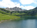
A nice walk around the Vilsalpsee lake to the waterfall and then taking the ascent to the higher lake, Traualpsee, and the refuge.
Shrecksee
9.87 mi
+3,655 ft
-3,652 ft
7h 45
 Difficult
Departure from Bad Hindelang (Swabia)
Difficult
Departure from Bad Hindelang (Swabia)
Hinterstein - Shreksee - Kirchdachsattel - Hinterstein
Route starts from Hinterstein parking. We hiked, but it is possible to take the bus to Kraftwerk Auele, where the trailhead begins. It is a difficult trail with steep inclines with loose rocks and water runoff. It is possible to swim in the lake, and the view from the saddle is really nice.
Tour of Lake Eibsee
4.55 mi
+548 ft
-564 ft
2h 35
Easy
Departure from Grainau (Upper Bavaria)
A very pretty tour of Lake Eibsee in Bavaria. The path runs along the shores from a distance, through a beautiful mossy forest, but it is possible to take secondary paths to reach the many coves and swim in the crystal-clear water.
The Drachensee via the Seebensee
 8.24 mi
+1,798 ft
-1,772 ft
5h 20
Moderate
Departure from Ehrwald (Bezirk Reutte)
8.24 mi
+1,798 ft
-1,772 ft
5h 20
Moderate
Departure from Ehrwald (Bezirk Reutte)
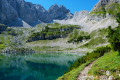
In the heart of the Wetterstein, a mountain range in the northern Eastern Pre-Alps straddling the border between Austria and Germany, this hike will take you past two stunning mountain lakes.
The climb up to the Drachensee is steep, and you can stop off at the Seebensee.
Hinteres Alpjoch circular loop
 2.63 mi
+1,795 ft
-1,818 ft
2h 45
Moderate
Departure from Imst (Bezirk Imst)
2.63 mi
+1,795 ft
-1,818 ft
2h 45
Moderate
Departure from Imst (Bezirk Imst)
A hike that’s a bit challenging in places but offers magnificent views over much of Tyrol. Please note that access to the start is via a cable car for which a fare is charged.
Rosengartenschlucht
 2.97 mi
+981 ft
-971 ft
2h 15
Moderate
Departure from Imst (Bezirk Imst)
2.97 mi
+981 ft
-971 ft
2h 15
Moderate
Departure from Imst (Bezirk Imst)
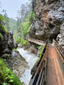
This short walk starting from Imst forms a circular route above the village, climbing towards the Hoch-Imst resort through the Rosengarten Gorge – featuring footbridges overlooking the torrent – before returning via a quieter section through the forest.
For more walks, use our search engine .
The GPS track and description are the property of this route's author. Please do not copy them without permission.

