Country:

 City:
City:


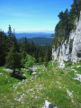
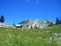
Access is possible from the Corençon Golf Course via theGR® 91 trail: it is quite a long walk and can be monotonous.
The starting point suggested here is the Sarna clearing, which can be reached:
- from Villard-de-Lans, first heading towards Corençon, then taking the road serving the Bois Barbu and Herbouilly Nordic ski areas, which you must pass by: at the start of the descent, take the gravel track on the left to La Sarna.
- from the CD 103 between Saint-Julien-en-Vercors and Saint-Martin-en-Vercors, turn left onto the Herbouilly road and, at the car park, take the gravel track on the right to La Sarna.
(S/E) Head due east along the forest track that passes in front of the Grotte de l’Ours to reach the Col de la Sarna.
(1) Turn right to head back down southwards through the forest, which gradually gives way to open grassland. At a level junction, ignore the 4x4 track heading south to the right and continue straight on towards the south-east along the old charcoal burners’ track, the route of which is clearly visible on the ground.
You’ll reach the Darbounouse plain at a Y-junction.
(2) Turn left to stay on the charcoal burners’ track until you reach the junction with theGR® 91.
(3) Take thisGR® on the left towards the Cabane de Carrette, following a route of ups and downs, until you reach a junction marked by a cairn. There is the option of a 150-metre round trip along theGR® to see a karstic cave.
(4) Leave theGR® and take the path that starts here and climbs through the forest to the Pré du Rey Blanc. The path disappears there, but continue up the meadow, keeping to the left, to pass close to the ruined jasse.
(5) Continue up the Pré until you find a clear path on the left at the top. The terrain becomes more rugged, with sections of woodland and others of sharp limestone pavement: follow the cairns carefully.
On a small ridge, a cairn much larger than the others marks the proximity of the Fontaine Gravianelle, which you reach by descending a path on the right.
(6) Return to the main path and follow it eastwards then south-eastwards until you reach a ledge, beyond which the path descends slightly into a grassier area, the Pot du Rey Blanc.
Cross this area and continue along the bottom of a small valley to the Cirque des Mouflons.
The ascent continues south-eastwards via a sort of passable corridor at the foot of a section of sharp limestone pavement on the left-hand side. Keep to the left-hand side to make use of the grassier slopes and climb up to a rocky passage overlooking a shaded hollow at the bottom of the thalweg.
(7) In this hollow, a spring has been fitted with a small basin by cavers: the Source du Bénitier.
Continue up the thalweg, gradually veering to the right to take the increasingly grassy slopes opposite the imposing sharp limestone pavement.
Via a series of easier, grassy ridges, you reach the ridge line; then, continuing straight up the slope, you reach the summit of the Roches Rousses.
(8) Descend via the grassy slopes, skirting the eastern cliff face; pass directly alongside a first fault, then traverse to the clearly visible Pas Morta.
(9) From the Pas, do not take the paths that continue the traverse along the ridges, nor the ravine opening up at the foot, but head westwards along a barely visible path that leads to a solitary tree, then descends a grassy area to reach a clearly visible cairn marking the start of the more adventurous descent through scree and sharp limestone pavement.
The path is well-marked, even featuring hairpin bends, and leads in stages down to the bottom of the sinkhole where the old Cabane à Jésus once stood.
(10) Stay on the right-hand side of the sinkhole and follow a path heading south. After 250 metres, the path turns right to run alongside a stony valley; at the end of this, before re-entering the forest, climb up a ridge on the left to emerge above the Cabane du Pas Étoupe.
(11) Descend through the vegetation below the hut, then climb up the bottom of a small valley heading south, which will skirt rocky outcrops on the right and emerge at the top of a fault line followed by the drovers' road.
(12) Descend along the bottom of the drovers' road, with a cliff often looming to your right, on a long, straightforward stretch of the route, where the gradient eases as you approach the Darbounouse plain.
(13) On emerging onto the grassy plain, head right to join theGR® 91 and follow it northwards across the plain. Pass directly below the Chalet de Darbounouse until you reach a sign where theGR® turns sharply to the right.
Carry on straight ahead across the plain until you reach the charcoal burners’ track in the Côte area.
(2) Retrace your steps along the route you took on the way there to descend to the Clairière de la Sarna (S/E).

 Visorando Member
 Easy
Easy 
 Very difficult
 Moderate