Country:

 City:
City:


The start is at Place du Tilleul, near the church and the post office. Several small car parks are available at the northern and southern entrances to the village of Saint-Martin-en-Vercors or at Impasse de la Chicoune.
(S/E) From Place du Tilleul, head west along the Chemin des Écoliers. At the end of the tarmac section, continue to the right along the path under the trees.
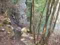
(1) Stay on the path that climbs to the right. Walk through the forest, skirting a clearing, until you reach a small road.
(2) Follow it uphill, turn right at the first junction and then left at the second. Continue along the road to Le Briac.
(3) Leave the road and head right. After 100 metres, carry on straight ahead along the wide path, leaving the path leading to the Château on your right. 100 metres further on, take care not to miss the path that branches off to the left into a line of trees. The climb is gentle, first along a meadow and then through the forest.
(4) Turn right towards the Pas des Voûtes. Then turn left at the next fork when you reach the forest track.
(5) Leave the main track and take a path on the right. There are several vantage points along the way.
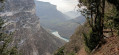
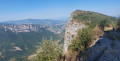
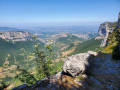
(6) Take a short detour of a few metres to the right to reach the Belvédère du Bienveilleur, offering a sweeping panorama of the Bourne Gorges 800 metres below and, opposite, the access road to the Grotte de Choranche. Then continue to the junction with the forest track.
(7) Follow it to the right, marked with yellow PR® signposts; climb before descending along a stony path towards the Pas des Voûtes. You’ll reach a T-junction at a place called Petite Cournouze. Keep right on the PR® and reach the Pas des Voûtes.
(8) Do not cross it, but continue down the path through the forest in the Massif de la Grande Cournouse, a natural fortress protected almost entirely by its high cliffs. You’ll reach the Grande Cournouse crossroads.
(9) Continue the descent along the path on the right. You’ll reach the junction with the Sentier du Bec de Chatelus.
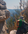
(10) Turn right here and continue through the boxwood trees to the Bec de Chatelus, a viewpoint overlooking the Bourne river above Choranche. Look for the small path on the right which leads, after a few metres, to the carved rock.
(11) Return via the same route to the previous junction. Once you reach point (10), carry on straight ahead until you reach a flat area at the edge of the cliff.
(12) Turn completely left onto a less steep path. Return to the Grande Cournouse crossroads (9) you passed earlier. Turn right and follow the route you took on the way there, but in the opposite direction, to reach the T-junction at a place called Petite Cournouze.
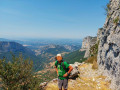
(13) Leave the main path and take a track on the right; it’s a bit steep at first but becomes much easier as you approach the Pas de l’Allier. Make your way towards the viewpoint.
(14) Retrace your steps for a few metres, then take the path on the right. You’ll reach a four-way junction at a place called Les Scialères.
(15) Turn right towards Saint-Martin-en-Vercors, continue through the forest and emerge onto the D612.
(16) Cross the road and continue along the path opposite. After 200 m, at the first fork, take the path on the right towards Les Menuisiers. A very pleasant path through the woodland, leading to another fork.
(17) Make sure to take the first path on the left before a descent; leave the forest and then re-enter it. Keep heading towards Les Menuisiers until you reach this hamlet.
(18) Turn left and continue along the road to return to the village of Saint-Martin-en-Vercors (S/E).
 Visorando Member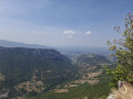
 Moderate
 Easy
Easy