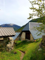
The Sommet des Graus via Roche Cline

This is a variation on a classic route in the area: Roche Cline.
You are in the Mercantour National Park; there are regulations to be observed, and failure to do so may result in a fine of up to €1,500 – see the practical information.

Details

348874
Creation:
Last update:
Last review:
  • Walking
    Activity: Walking
  • ↔
    Distance: 3.74 mi
  • ◔
    Average duration: 3h 40 
  • ▲
    Difficulty: Difficult

  • ⚐
    Back to start: Yes
  • ↗
    Ascent: + 2,221 ft
  • ↘
    Descent: - 2,221 ft

  • ▲
    Highest point: 8,346 ft
  • ▼
    Lowest point: 6,125 ft

Photos

Description of the walk

Access: From Allos, head up towards Lac d’Allos, then turn right just before the Saint-Brigitte farm, onto what looks like a farm track; cross a stream over a concrete slab, then follow the path.
The road from the Sainte-Brigitte farm to the Herbe Blanche barrier is very stony, with clearly marked water crossings; proceed with caution – low-clearance vehicles should avoid this route. Finally, just before the Herbe Blanche barrier, there is one last very deep water crossing; many cars may scrape the bottom!
Park before the Barrière de l’Herbe Blanche, in the fairly large car park there or a few bends further down.

(S/E) Take the path behind the gate until you reach a fork just before the Cabane de l’Herbe Blanche.

(1) Turn right – it’s signposted ‘Roche Cline’. Head straight up through the tall grass; the landscape then becomes rockier until you reach a junction below the summit of Roche Cline.

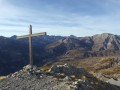
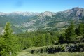
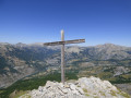
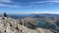
(2) Leave the path, passing the climb to the summit on your right, and continue straight on towards the Sommet des Graus; this isn’t a well-marked path but is signposted by cairns at intervals. There are lovely views in all directions, towards Allos and Valplane.

(3) Return via the same route to the Barrière de l’Herbe Blanche (S/E)

Waypoints

  1. S/E : mi 0 - alt. 6,125 ft - Start at the Herbe Blanche barrier
  2. 1 : mi 0.25 - alt. 6,135 ft - Junction towards Roche Cline
  3. 2 : mi 1.36 - alt. 7,720 ft - Below the summit of Roche Cline
  4. 3 : mi 1.87 - alt. 8,346 ft - Summit of Les Graus
  5. S/E : mi 3.74 - alt. 6,125 ft - Finish at the Herbe Blanche barrier

Notes

Mercantour National Park regulations; full details can be found via this link:
- Between (2) and (3), you are in a wildlife quiet zone. Please respect the regulations.
- Bivouacking and camping: permitted only more than an hour’s walk from road access points and the park boundaries, from 7.00 pm to 9.00 am. It is forbidden to spend the night in your vehicle in a car park or at the side of the road within the heart of the Mercantour National Park.
- Dogs are not permitted, even when kept on a lead
- Fires are prohibited in the heart of the park and also throughout the Alpes-Maritimes department
by prefectural decree.
- Parking may be prohibited at the start of certain walks due to the risk of
torrential mudslides and rockfalls.
No water source. On the final (second) shoulder, just below the summit of Roche Cline, the going is very steep; pace yourself.

Worth a visit

Chamois are often spotted in the valley to the left or just below the summit of Roche Cline. There’s some génépi near the summit of Les Grauss for those who know where to find it… The boundary of the Mercantour National Park is very close by, towards Valplane!

Reviews and comments

4.8 / 5
Based on 2 reviews

Reliability of the description
5 / 5
Ease of following the route
4.5 / 5
Route interest
5 / 5
JPC07
JPC07

Overall rating : 4.7 / 5

Date of your route : Sep 05, 2020
Reliability of the description : ★★★★★ Very good
Ease of following the route : ★★★★☆ Good
Route interest : ★★★★★ Very good
Very busy route : No

We took a different route: setting off from the village of VILLARS BAS on the road to the Col d’ALLOS, we decided not to go all the way to the summit of the GRAUS, as the path seemed very unclear to us. After stopping off at the summit of ROCHECLINE (a magnificent viewpoint), we went for a picnic at the summit of LA JASSINE, a lovely flat area to the south of ROCHECLINE. It’s a relatively challenging climb where you sometimes need to use your hands and mustn’t be afraid of heights, but the effort is rewarded with a marvellous panorama.
A very lovely hike.

Machine-translated

CHAUDANNE
CHAUDANNE

Overall rating : 5 / 5

Date of your route : Jul 06, 2017
Reliability of the description : ★★★★★ Very good
Ease of following the route : ★★★★★ Very good
Route interest : ★★★★★ Very good

A superb walk; the walking times are about right. As for the track by car, it’s fine provided your vehicle isn’t too low to the ground.

We took the short 5-minute detour to climb to the summit of Rochecline, where there’s a breathtaking 360° view of all the peaks and valley floors, as well as the villages of Allos and Colmars-les-Alpes.
I’d recommend this route for hikers who are ‘in good shape’.

Machine-translated

Other walks in the area

For more walks, use our search engine .

The GPS track and description are the property of this route's author. Please do not copy them without permission.