


Refine your search for walks in Rifugio Capnna Mautino
Rifugio Capnna Mautino walks


 Colle Bercia loop, between France and Italy
 Visorando Member
 9.77 mi
 +2,077 ft
 -2,051 ft
 6h 20
6h 20
 Moderate
 Departure from Cervières (Hautes-Alpes)
This route straddles two countries, offering lakes, military heritage, pastoralism and views of the high peaks of Pic de Rochebrune on the French side and Mont Chaberton on the Italian side. It is ideal for walking or running.
Walks near Rifugio Capnna Mautino
The Lakes Circuit starting from Montgenèvre
 8.78 mi
+1,959 ft
-3,120 ft
5h 45
Moderate
Departure from Montgenèvre (Hautes-Alpes)
8.78 mi
+1,959 ft
-3,120 ft
5h 45
Moderate
Departure from Montgenèvre (Hautes-Alpes)
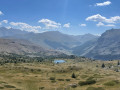
This walk, starting from the Télémix des Chalmettes, will allow you to enjoy several magnificent viewpoints, such as the Grand Charvia or Lake Gignoux, and to discover the eight lakes near the route, all whilst taking in a magnificent view of the Clarée Valley.
The Small Pass via Lac Gignoux
 6.08 mi
+1,014 ft
-1,811 ft
3h 40
Moderate
Departure from Montgenèvre (Hautes-Alpes)
6.08 mi
+1,014 ft
-1,811 ft
3h 40
Moderate
Departure from Montgenèvre (Hautes-Alpes)
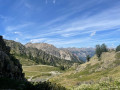
This route, starting from the Sommet des Anges and accessible via the Télémix des Chalmettes followed by the Télésiège des Gondrans, will allow you to discover several magnificent viewpoints as you pass through the Col du Gondran and its small lake, Lac Gignoux, the Col de Gimont and the small pass of Collet Vert.
The Chenaillet Geological Trail via the lakes
 4.33 mi
+1,286 ft
-2,080 ft
3h 05
Moderate
Departure from Montgenèvre (Hautes-Alpes)
4.33 mi
+1,286 ft
-2,080 ft
3h 05
Moderate
Departure from Montgenèvre (Hautes-Alpes)
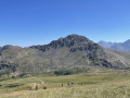
This high-altitude route will allow you to explore the famous Chenaillet Geological Trail, as well as Lac de Chaussé and the source of the Doire. This walk is accessible via the Chalmettes Télémix and the Gondrans chairlift.
Cime Saurel from Montgenèvre
 9.61 mi
+784 ft
-2,766 ft
5h 05
Moderate
Departure from Montgenèvre (Hautes-Alpes)
9.61 mi
+784 ft
-2,766 ft
5h 05
Moderate
Departure from Montgenèvre (Hautes-Alpes)
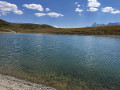
This high-altitude walk, accessible from the Télémix des Chalmettes and the Gondrans chairlift, will allow you to discover several magnificent spots such as Lake Gignoux and the Cime Saurel, all whilst enjoying stunning views of the surrounding peaks.
Refuge des Fonts de Cervières – Andrea Tornior Bivouac
 9.76 mi
+4,888 ft
-3,291 ft
8h 45
9.76 mi
+4,888 ft
-3,291 ft
8h 45
 Difficult
Departure from Cervières (Hautes-Alpes)
Difficult
Departure from Cervières (Hautes-Alpes)
A fairly alpine stage of the Queyras Transfrontière, featuring the ascent of a magnificent 3,000-metre peak: Le Grand Glaiza.
The start of this stage is accessible by car via Cervières on the D902 from Briançon, then the D89T through Cervières.
From Val des Prés to La Chalp
 15.95 mi
+4,905 ft
-3,868 ft
11h 35
Difficult
Departure from Val-des-Prés (Hautes-Alpes)
15.95 mi
+4,905 ft
-3,868 ft
11h 35
Difficult
Departure from Val-des-Prés (Hautes-Alpes)
This thirteenth stage marks the start of the crossing of the Queyras Massif. From La Vachette, the previous day’s trail joins the GR®5. After a flat start, the forest path winds its way along the banks of the Durance as it descends towards the hamlet of L’Envers du Fontenil, before climbing up to a fortification at the foot of the Fort des Trois Têtes and then crossing the remarkable Pont d’Asfeld. The GR®5 climbs to the Cité Vauban in Briançon, one of France’s finest fortified towns, and descends via the Portes d’Embrun to the Parc de la Schappe. It heads south towards Villar-Saint-Pancrace, then veers off towards Les Ayes via the hamlets of La Mourande, Sachas and Soubeyran, from where it climbs to the Chapelle Saint-Laurent, then on to Le Lauzin, before reaching the Chalets des Ayes. It reaches the Col des Ayes, descends the opposite slope, joins a track at L’Eychaillon and turns left onto it, running alongside the Torrent de la Rivière as far as Brunissard and then La Chalp.
 Strada del Valle Argentera
22.07 mi
+2,533 ft
-4,052 ft
3 hrs
Moderate
Departure from Sestriere (Torino)
A wonderful mountain bike ride from Sestrières to the Valle d’Argent. A stunning spot at the bottom of a beautiful, unspoilt valley. Waterfalls, rivers… well worth a visit. The climb back up to Sestrières is a bit technical.
Briançon - La Chalp
14.64 mi
+4,544 ft
-3,389 ft
10h 40
Difficult
Departure from Briançon (Hautes-Alpes)
Étape de la Grande Traversée des Alpes de Briançon à La Chalp par le Col des Ayes.
Refuge de la Chardouse - Pamplinet
10.60 mi
+3,166 ft
-3,681 ft
7h 40
 Very difficult
Departure from Oulx (Torino)
Very difficult
Departure from Oulx (Torino)
This is the first stage of a journey that will take you across France, following the 45th parallel as closely as possible (within 10 km). To truly cross France and avoid going back and forth, the starting point is in Italy. However, it is possible to start from Pamplinet and climb up to the Col de Désertes to start from the French-Italian border.