The Gèle Valley in Béraut

A circular route starting from Béraut, a small village between Valence-sur-Baïse and Condom.

Details

16879525
Creation:
Last update:
Last review:
  • Walking
    Activity: Walking
  • ↔
    Distance: 7.26 mi
  • ◔
    Average duration: 3h 45 
  • ▲
    Difficulty: Moderate

  • ⚐
    Back to start: Yes
  • ↗
    Ascent: + 433 ft
  • ↘
    Descent: - 417 ft

  • ▲
    Highest point: 673 ft
  • ▼
    Lowest point: 285 ft
  • ⚐ Country: France
  • ⚐ City: Béraut (32100)
  • ⚑
    Start/End: N 43.917517° / E 0.406306°
  • ❏
    IGN map(s): Ref. 1742SB, 1841SB, 1842SB
  • Hour-by-hour weather

Photos

Description of the walk

Park in the car park at Béraut Town Hall.

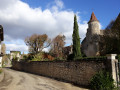
(S/E) Walk down Route de la Gèle, passing the château. Continue along this road until you reach the junction with Impasse de Caubet.

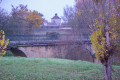
(1) Turn right and, before the bridge over the Ruisseau de la Gèle, turn left onto the footpath. Carry on, going round the sewage treatment works, then follow the Ruisseau de la Gèle. At the fork in the path, stay on the path furthest to the right and continue until you come to a path that heads off to the right into the small wood.

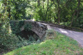
(2) Turn right and cross the Ruisseau de la Gèle via an old stone bridge. As you emerge from the woods, take the path that goes straight up the hill. Continue to the crossroads, just before the steeper climb, and turn left. Carry on to the hamlet of Le Grand Broca; go round it on the left to reach a stone path leading to the hamlet. Turn left and take the Chemin du Grand Broca. Join and cross the D 654 road , taking great care. Continue straight ahead to the next junction at the hamlet of À mon Aise.

(3) Turn right and continue along the Impasse de Saint-Justin. At the end of the tarmac road, carry on straight ahead along the dirt track until you reach a junction with a tarmac road.

(4) Turn right here, stay on Route Bellevue and you’ll arrive opposite the hamlet and Lasserre Castle.

(5) Continue slightly uphill, still on Route Bellevue, to reach the highest point at the hamlet of Bidette.

(6) Turn right onto Route d’Ensoules. After the second bend, turn right onto the path leading to the hamlet known as Le Hour.

(7) Near the houses, a path branches off to your right; take it, skirting a woodland to the north and going round a field until you reach a dirt track at almost a 180° angle. Turn left onto it and rejoin Route d’Ensoules at the junction. Turn right onto it, cross the D 654 road with care and continue straight ahead until you reach the car park at Béraut Town Hall (S/E).

Waypoints

  1. S/E : mi 0 - alt. 384 ft - Béraut town hall car park
  2. 1 : mi 0.39 - alt. 315 ft - Junction with Route de la Gèle
  3. 2 : mi 1.91 - alt. 305 ft - Junction at Pont de la Gèle - Gèle (rivière) - Affluent de la Baïse
  4. 3 : mi 3.29 - alt. 338 ft - Junction with Rue du Grand Broca
  5. 4 : mi 3.7 - alt. 384 ft - Junction with Route de Bellevue
  6. 5 : mi 4.6 - alt. 577 ft - Lasserre
  7. 6 : mi 5.48 - alt. 673 ft - Crossroads at a place called Bidette
  8. 7 : mi 6.21 - alt. 574 ft - Impasse du Hour
  9. S/E : mi 7.26 - alt. 387 ft - Béraut town hall car park

Notes

Avoid this circular loop in hot weather.
Between (4) and (7), there is a 4 km stretch of tarmac road.

Worth a visit

(S/E) Village of Béraut.
Nearby are the villages of Saint-Orens and Roquepine.

Reviews and comments

3.7 / 5
Based on 3 reviews

Reliability of the description
3 / 5
Ease of following the route
4.5 / 5
Route interest
3.7 / 5
User 16549221

Overall rating : 2.5 / 5

Date of your route : Jul 28, 2026
Reliability of the description : ★☆☆☆☆ Very disappointing
Ease of following the route : Not used / Not applicable
Route interest : ★★★★☆ Good
Very busy route : No

Route is impractical and incorrect; confusion with the GRP ‘Cœur de Gascogne’ route.
It’s a shame, as the route recommended on Visiorando is interesting but runs partly along a private road where access is prohibited.
Signposting needs to be re-marked along a significant part of the route.

Machine-translated

TourismeCondom
TourismeCondom

Hello,
Please note that this circular walk route has been altered as a landowner no longer permits access between Herret and Condom! The new route winds through the southern part of the village of Béraut.
The Ténarèze – Condom Tourist Office is happy to provide you with the new route.
Kind regards.

Machine-translated

Laurent Carlier
Laurent Carlier

Overall rating : 4 / 5

Date of your route : Dec 30, 2023
Reliability of the description : ★★★★☆ Good
Ease of following the route : ★★★★☆ Good
Route interest : ★★★★☆ Good
Very busy route : No

The first part of the walk is pleasant as it follows small dirt tracks.
In the second half, there’s a long stretch of road, but fortunately it’s not very busy.
Beautiful scenery with views of the Pyrenees when the weather is clear.

Machine-translated

philippetalenton
philippetalenton

Overall rating : 4 / 5

Date of your route : Sep 25, 2022
Reliability of the description : ★★★★☆ Good
Ease of following the route : ★★★★★ Very good
Route interest : ★★★☆☆ Average
Very busy route : No

A section with too much tarmac

Machine-translated

Other walks in the area

For more walks, use our search engine .

The GPS track and description are the property of this route's author. Please do not copy them without permission.