Country:
 City:
City:


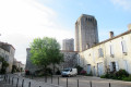
Park along Boulevard Lacave, on the southern side of the village.
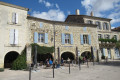
(S/E) From the car park, take the steps to enter the village via the Porte de Rouède, then follow Rue du Puits; there are toilets on the right-hand side of this street. Cross the square, pass under the arcades on the left and turn into Rue de la Fontaine. On leaving the village, continue straight on into Rue Delor for 1.2 km.
(1) Just before the hamlet of Soucaret, before a slight incline, turn left onto the grassy path marked in yellow with the signPR®12.
Follow this path alongside the Petit Auvignon ditch to a small lake; then, in front of the lake, turn left onto the grassy or stony path to the farm in the hamlet of l’Église. Cross the farmyard and continue along the road for about 900 m until you reach the junction with the D166.
(2) At the junction with the D166, at the ‘Give Way’ sign, turn right onto the road and follow it for approximately 650 m until you reach the hamlet known as ‘Le Marquisat’.
(3) At the hamlet, about twenty metres before a three-way junction, turn left onto the stony path running between the houses and continue along the grassy path.
Follow the grassy path towards the wood. About twenty metres before a ruined house, turn left downhill towards the wood. Walk to the ditch, follow it to the left for fifty metres, cross it and continue towards the wood on the left.
(4) At the entrance to the woods, ignore the path leading uphill opposite (marked with a Yellow Cross forthe PR®8) and turn right onto the path running alongside a hedge. Continue following the yellowPR®12signposts. Pass beneath the house in the hamlet of Auriet and carry on along the gravel road until the next junction on the left.
(5) At the junction, take the path leading uphill to the D 267 road, then turn left onto it and follow it for 400 m.
(6) After the hamlet of Le Saraillé, turn left onto the unpaved track towards the hamlet of Le Pouy. Walk past this house and continue along the grassy path, following the yellow/red or yellow mountain bike markings No. 11. Enter the woods and continue along this path. Carry on along the forest track through the Bois de Broustès until you reach the D166 road.
(7) Follow the road to the right for about 400 m, following the yellowPR®12arrow.
(8) Turn left, following the yellow arrow forthe PR®12towards the woods. Before entering the woods, turn right onto the grassy path at the edge of the woods, marked by a yellow arrow forthe PR®12and a karst trail.
(9) After passing the edge of the woodland, enter the woodland and follow the yellowPR®12signposting. On leaving the woodland, continue along the grassy path on the left until you reach the road, where you turn right to return to the village.
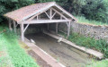
(10) Before entering the village, look down to the right to see the old wash house and the Gothic fountain, then rejoin the (S/E)..


 Visorando Member
 Easy
Easy 
 Difficult