


 Country:
 City:
City:


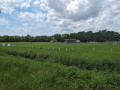

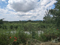
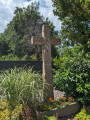
The starting point is situated between the nursery school and the village bell tower. There are parking spaces available there for your vehicle.
(S/E) Facing the bell tower, head left onto the Grand Rue. Ignore the Rue du Centre and continue along the Grand Rue to the right. When you reach the village town hall, cross the road carefully to reach it and go round it on the left. Walk past the war memorial and then go round the church on the left as well. Once on the other side of the building, take the first path on the left and go down a few steps to reach Rue de l’Église. Once there, turn left and then immediately right into Rue de la Digue.
(1) At the next T-junction, turn left into a small cul-de-sac. The tarmac road gives way to a dirt track. Walk past a few benches. Then carefully cross the main road using the pedestrian crossing on your left to continue straight on towards Merxheim, on the D47. Cross the bridge over the River Ill. After the bridge, cross carefully to move to the right-hand side of the road. Ignore Rue Pasteur on your right.
(2) Continue diagonally to the right into Rue de la Gare. A few steps further on, let Rue de la Gare bend to the right and carry straight on into Rue de Gundolsheim. Continue straight on until you leave the village. A few hundred metres further on, at a junction with a pumping station, carry on straight ahead, crossing the bridge over the River Thur. You will then walk alongside a forest on your left for a few hundred metres.
(3) When you reach the edge of the woodland, turn right onto a path that runs between the fields, then turns sharply right and runs alongside a fence. Further on, ignore a path running alongside the fence to the left and carry on straight ahead. Take the next path on the left towards the water tower.
(4) You’ll come out onto the D3bis; follow it to the right. Cross the River Thur again and enter the village of Meyenheim via Rue de la Gare. Continue along this street to the end without turning off. At the end of the street, at the junction where the village town hall is located, turn left into Grand Rue; a few steps further on, cross the road carefully and turn right into Rue de l’Aigle.
(5) At the next junction (with the church and cemetery on your left), carry on straight ahead along Rue du Vignoble, which then bends sharply to the right. At the T-junction, turn left into Rue des Écoles. Ignore Rue de l’Ill on your left and carry on straight ahead along a dirt track.
(6) At the T-junction, with the Ill in front of you, turn right. Walk past a bench. Cross the road carefully, then take the bridge on your left to cross the Ill. From here, follow the Blue Diamond route. After the bridge, leave the main road and turn diagonally right into Rue du Faubourg.
(7) About fifty metres further on, at a pedestrian crossing, turn diagonally right onto a path through the grass, marked by a ‘No Entry’ sign (except for authorised users) and the ‘Blue Diamond’ symbol: you are now on the ‘Sentier de l’Ill’. Continue along this path, which runs between the River Ill on your right and the rear of some houses.
(8) At the Y-junction at the corner of the housing estate, continue diagonally to the right along the Sentier de l’Ill. Pass a bench and continue along the Ill on this narrow path, which widens further on and runs behind the village football ground. Follow the path uphill until you reach the departmental road and turn right. Follow the road along the cycle path to the roundabout.
(9) Cross carefully at the pedestrian crossing and turn left into the Grand Rue. Then turn right into the Rue du Pont. Just as you enter this street, turn left into the S’Haxagassla, a narrow lane which then leads onto the Rue du Sellier. Carry on straight ahead along this street towards the bell tower. At the T-junction, ignore the Blue Diamond signpost which turns right into Rue de l’Église and turn left instead. Then turn right into Grand Rue. Your starting point is just a few steps further on (S/E).

 Visorando Member


 Moderate
 Difficult
