


Refine your search for walks in Refuge Vaccarone (2741m)
Refuge Vaccarone (2741m) walks


 The hidden side of the Maurienne
 Association / Club / Walk leader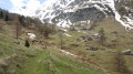
 22.39 mi
 +9,124 ft
 -9,035 ft
 3 days
 Difficult
 Departure from Bramans (Savoie)
The lower part of the Maurienne Valley is better known for its motorway – which people drive along without stopping – than for its wild high-mountain landscapes.
This route, starting from St Pierre d’Extravache and winding through rocky landscapes, deep blue lakes and ever-present glaciers, disproves the reputation that the valley may have been given. You’ll be walking for three days amongst mountain pastures and high peaks, whilst remaining in mid-mountain terrain.
From the Ambin Refuge to Le Planey
 11.65 mi
+3,363 ft
-5,233 ft
8h 15
Difficult
Departure from Bramans (Savoie)
11.65 mi
+3,363 ft
-5,233 ft
8h 15
Difficult
Departure from Bramans (Savoie)
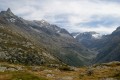
A very beautiful route amongst glaciers and lakes, which crosses the Italian border (beautiful view of the Val di Suza) and returns to France via the Col Clapier, which Hannibal and his elephants probably passed through.
This route follows on from the hike “From the Bramanette Refuge to the Ambin Refuge”, but can easily be done starting from the Ambin Refuge alone.
Walks near Refuge Vaccarone (2741m)
The Refuge de Bramanette
2.24 mi
+1,575 ft
-138 ft
2h 25
 Moderate
Departure from Bramans (Savoie)
Moderate
Departure from Bramans (Savoie)
This short hike is the starting point for a magnificent three-day trek between Haute Maurienne and Val de Suze (Italy), with beautiful lakes and numerous small glaciers.But the setting and the welcome at the Refuge de Bramanette are such that they alone justify spending the night there and descending back down to the valley the next day!
From the Bramanette Refuge to the Ambin Refuge
 8.50 mi
+4,186 ft
-3,665 ft
7h 35
Difficult
Departure from Bramans (Savoie)
8.50 mi
+4,186 ft
-3,665 ft
7h 35
Difficult
Departure from Bramans (Savoie)
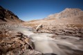
A beautiful route, sometimes off the beaten track or on poorly marked paths. From the top of the passes, you can see both the peaks of the Vanoise (the Dent Parachée) and the Barre des Ecrins.This hike follows on from the "Le refuge de Bramanette" route.
Aussois - Valfréjus
 Visorando Member
 12.42 mi
+3,225 ft
-2,923 ft
8h 30
Difficult
Departure from Aussois (Savoie)
12.42 mi
+3,225 ft
-2,923 ft
8h 30
Difficult
Departure from Aussois (Savoie)
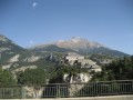
Étape de la Grande Traversée des Alpes d'Aussois (Vanoise) à Valfréjus (Maurienne).
Refuge de la Chardouse - Pamplinet
10.60 mi
+3,166 ft
-3,681 ft
7h 40
 Very difficult
Departure from Oulx (Torino)
Very difficult
Departure from Oulx (Torino)
This is the first stage of a journey that will take you across France, following the 45th parallel as closely as possible (within 10 km). To truly cross France and avoid going back and forth, the starting point is in Italy. However, it is possible to start from Pamplinet and climb up to the Col de Désertes to start from the French-Italian border.
 The Sentier des Sources snowshoe trail from the cable car
1.97 mi
+236 ft
-801 ft
1.5 hrs
 Easy
Departure from Villarodin-Bourget (Savoie)
Easy
Departure from Villarodin-Bourget (Savoie)
A lovely, easy walk in the peaceful forest, starting at the top of the gondola lift and returning by chairlift.
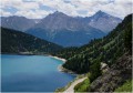
Map of Amont – Roc de la Pêche mountain hut
 9.99 mi
+3,852 ft
-4,390 ft
7h 55
Difficult
Departure from Aussois (Savoie)
9.99 mi
+3,852 ft
-4,390 ft
7h 55
Difficult
Departure from Aussois (Savoie)
The walk begins with a gentle, rural route to the Fond de l’Aussois mountain hut, followed by a steep climb to the Col de l’Aussois.
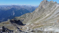
Refuge de la Fournache - Refuge de l'Orgére
 5.91 mi
+2,336 ft
-3,750 ft
4h 45
Difficult
Departure from Aussois (Savoie)
5.91 mi
+2,336 ft
-3,750 ft
4h 45
Difficult
Departure from Aussois (Savoie)
The final stage of this fabulous route from the Refuge de la Fournache to the Refuge de l'Orgére, via the Col de la Masse. The ascent of this pass is difficult due to the steep gradient. The end of the ascent and a good part of the descent are very technical. The view from the pass is absolutely exceptional; you will be able to see the Écrins and the Thabor massif.