


Refine your search for walks in Refuge du Chardonnet
Refuge du Chardonnet walks


 Col du Chardonnet - Lac de la Mine
 Visorando Member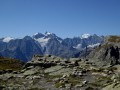
 7.28 mi
 +2,585 ft
 -2,585 ft
 5h 35
5h 35
 Moderate
 Departure from Névache (Hautes-Alpes)
A very pleasant and varied hike in a valley that has remained fairly wild. At the pass, there is a magnificent view of the Écrins Massif, the Cerces and the Grand Galibier Massif.
Fontcouverte Campsite - Lac de la Ponsonnière
 7.08 mi
+3,691 ft
-1,391 ft
6h 30
7.08 mi
+3,691 ft
-1,391 ft
6h 30
 Difficult
Departure from Névache (Hautes-Alpes)
Difficult
Departure from Névache (Hautes-Alpes)
For this first three-day stage, the route offers magnificent views of the Écrins Massif at the Col du Chardonnet and then of the Grand Lac. We have chosen to camp at Lac de la Ponsonnière, but it is entirely possible to camp on the heights of the Grand Lac, near the pastoral house. This allows you to shorten the duration of this first day slightly and, above all, reduce the elevation gain by around 200m.
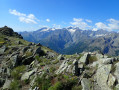
The Chardonnet and Aiguillette passes from Fontcouverte
 9.05 mi
+3,602 ft
-3,586 ft
7h 20
Difficult
Departure from Névache (Hautes-Alpes)
9.05 mi
+3,602 ft
-3,586 ft
7h 20
Difficult
Departure from Névache (Hautes-Alpes)
Starting from the Fontcouverte campsite, climb to the Col du Chardonnet via the Refuge du Chardonnet, then push on (with a bit of off-trail walking) to the Col de l’Aiguillette and the foot of the Peryou. Return via the Col de l’Aiguillette and the Crête du Chardonnet, then descend via the Chalets du Queyrellin.
Refuge du Chardonnet - Arsine
11.94 mi
+2,608 ft
-4,436 ft
7h 45
Difficult
Departure from Névache (Hautes-Alpes)
This third stage of the crossing of France, following the 45th parallel as closely as possible, is long and difficult but absolutely magnificent. You will discover or rediscover the two jewels that are the Écrins and Meije massifs. Most of the route is on the GR® 50 and GR® 57. The paths are well marked and well maintained.
This stage can be divided into four sections: 1) an ascent to the Col du Chardonnet; 2) the descent to Lauzet; 3) the ascent to the Col du Lautaret; 4) the descent to Arsine.
Pamplinet - Refuge du Chardonnet
8.03 mi
+2,546 ft
-135 ft
5h 55
Difficult
Departure from Névache (Hautes-Alpes)
This section corresponds to the second stage of the crossing of France, following the 45th parallel. This stage is magnificent and can be a hike in its own right. You follow the Clarée valley and discover beautiful waterfalls before climbing up to the Refuge du Chardonnet.
Walks near Refuge du Chardonnet
Lac de la Cula via the circular trail
4.95 mi
+2,001 ft
-1,463 ft
4h 00
Moderate
Departure from Névache (Hautes-Alpes)
A beautiful hike with magnificent scenery. The climb to the Ricou refuge is a little steep but not particularly difficult. Once you reach the circular path, the route is very easy, almost flat until you reach the Torrent de la Cula. The view over the entire valley is truly superb. From the lake, the trail descends to Laval.
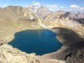
The Clarée lakes route: Laramon, Serpent, Les Gardioles, Blanc
 8.96 mi
+3,579 ft
-4,459 ft
7h 15
Difficult
Departure from Névache (Hautes-Alpes)
8.96 mi
+3,579 ft
-4,459 ft
7h 15
Difficult
Departure from Névache (Hautes-Alpes)
This hike is certainly long, but it will allow you to discover one of the major areas of the wonderful Clarée Valley.
Chalet de Laval - Alpe du Lauzet
8.12 mi
+2,785 ft
-3,793 ft
6h 10
Difficult
Departure from Névache (Hautes-Alpes)
A traverse of the Cerces massif via one of its highest passes (Béraudes) and some very beautiful lakes.And a chance to see much of the previous day’s descent route, as well as the many lakes on the other side.In early summer, the route can be made difficult by the presence of snow in the Lac des Béraudes cirque or a snow cornice on the Col des Béraudes (speaking from experience).
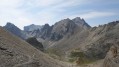
Laval car park - Lac des Cerces
 7.23 mi
+3,537 ft
-2,254 ft
7 hrs
7.23 mi
+3,537 ft
-2,254 ft
7 hrs
 Very difficult
Departure from Névache (Hautes-Alpes)
Very difficult
Departure from Névache (Hautes-Alpes)
First day of a 4-day circular starting from the Laval car park in the Upper Clarée Valley. As with the other parts of this circular, this route is intended for experienced hikers who are accustomed to high mountains.
Laval Refuge – Lac Blanc
 5.65 mi
+3,192 ft
-1,243 ft
5h 25
Difficult
Departure from Névache (Hautes-Alpes)
5.65 mi
+3,192 ft
-1,243 ft
5h 25
Difficult
Departure from Névache (Hautes-Alpes)
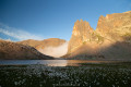
The first day offers the chance to explore the lakes of the Haute Clarée and camp at the foot of the Thabor amidst spectacular scenery.
The Chemin de Ronde between Laval and Biaune
 7.22 mi
+1,680 ft
-2,484 ft
4h 45
Moderate
Departure from Névache (Hautes-Alpes)
7.22 mi
+1,680 ft
-2,484 ft
4h 45
Moderate
Departure from Névache (Hautes-Alpes)
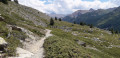
Supported by theGRP® Tour du Mont Thabor, this trail overlooks the upper Clarée Valley and offers magnificent views of this famous valley throughout the route.
From Le Lauzet to the Col du Lautaret
4.19 mi
+1,325 ft
-26 ft
3h 05
Moderate
Departure from Le Monêtier-les-Bains (Hautes-Alpes)
Stage4 of the Tour du Combeynot: from the Guisane Valley to the Col du Lautaret
Névache - Briançon
15.15 mi
+4,222 ft
-5,141 ft
10h 40
Difficult
Departure from Névache (Hautes-Alpes)
Étape de la Grande Traversée des Alpes de Névache dans la vallée de la Clarée à Briançon (plus haute ville de France) par la porte de Cristol.
Lac de la Ponsonnière – Refuge des Drayères
 5.88 mi
+640 ft
-1,909 ft
3h 15
Moderate
Departure from Le Monêtier-les-Bains (Hautes-Alpes)
5.88 mi
+640 ft
-1,909 ft
3h 15
Moderate
Departure from Le Monêtier-les-Bains (Hautes-Alpes)
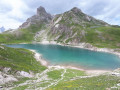
This second, slightly easier stage takes us past four magnificent lakes: Lac des Cerces, Lac du Grand Ban, Lac Rond and Lac de la Clarée
The Crossing from Le Casset to the Col du Lautaret
 11.16 mi
+3,451 ft
-1,693 ft
8h 10
Difficult
Departure from Le Monêtier-les-Bains (Hautes-Alpes)
11.16 mi
+3,451 ft
-1,693 ft
8h 10
Difficult
Departure from Le Monêtier-les-Bains (Hautes-Alpes)
A classic route in the upper Briançon region: reach the Col du Lautaret via Lac d’Arsine and the Crevasses Trail from the hamlet of Le Casset, north of Monetier-les-Bains.