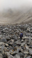
The Chemin de Ronde between Laval and Biaune

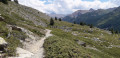
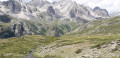
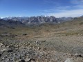
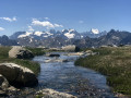
Supported by theGRP® Tour du Mont Thabor, this trail overlooks the upper Clarée Valley and offers magnificent views of this famous valley throughout the route.

Details

84468
Creation:
Last update:
Last review:
  • Walking
    Activity: Walking
  • ↔
    Distance: 7.22 mi
  • ◔
    Average duration: 4h 45 
  • ▲
    Difficulty: Moderate

  • ⚐
    Back to start: No
  • ↗
    Ascent: + 1,680 ft
  • ↘
    Descent: - 2,484 ft

  • ▲
    Highest point: 7,884 ft
  • ▼
    Lowest point: 5,820 ft

Photos

Description of the walk

Park in the car park at Pont du Moutet, the end of the Haute Vallée de la Clarée road. As this walk does not return to the starting point, you will need to park another vehicle in the car park at Chapelle Sainte Elisabeth.

(S/E) Follow the wide track leading to the Refuge des Drayères for about 100 metres.
Join theGRP® Tour du Mont Thabor trail, marked JR (Yellow-Red).

(1) Turn right onto the path which, after a few hairpin bends, leads to the hamlet of Côte du Jas.

(2) Then turn 90° to the right and, following an almost constant contour line, reach the footbridge over the Torrent de Cula.
Continue heading 90° to the right, due south, to reach the hamlet of La Replate, a major crossroads of paths.

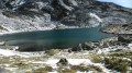
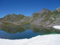
(3). Turn left onto the lovely path leading to Lac Laramon. Return to theGRP® via a cairn-marked path on the right.

(4) Continue along theGRP®, first south-east, then east and finally south, to reach the Chalets de Biaune.

(5) Then head straight south and, after a few hairpin bends, join the road; the Sainte-Elisabeth Chapel is on the left, and the car park (E) is slightly to the right.

Waypoints

  1. S : mi 0 - alt. 6,654 ft - Pont du Moutet car park. Near the - Clarée (rivière)
  2. 1 : mi 0.08 - alt. 6,670 ft - GRP Tour du Mont Thabor
  3. 2 : mi 1.34 - alt. 7,867 ft - Cote du Jas
  4. 3 : mi 3.48 - alt. 7,503 ft - La Replate
  5. 4 : mi 4.06 - alt. 7,556 ft - GRP
  6. 5 : mi 6.5 - alt. 6,736 ft - Biaune chalets
  7. E : mi 7.22 - alt. 5,820 ft - Sainte Elizabeth car park

Notes

There are a few stone shelters along the way.
There is always water here, but it is stream water which should be avoided if there are herds present.

Worth a visit

Névache: a village particularly well known among hiking enthusiasts.
Vallée Étroite: turn right onto the Col de l’Échelle before reaching Névache, a rather unusual valley as it became part of France in 1945 but whose inhabitants (seasonal workers) are almost all Italian.

Reviews and comments

5 / 5
Based on 2 reviews

Reliability of the description
5 / 5
Ease of following the route
5 / 5
Route interest
5 / 5
jl1309m
jl1309m

Overall rating : 5 / 5

Date of your route : Sep 01, 2023
Reliability of the description : ★★★★★ Very good
Ease of following the route : ★★★★★ Very good
Route interest : ★★★★★ Very good
Very busy route : Yes

I decided to do the round trip starting from the Sainte-Barbe Chapel. The path is really easy and pleasant, and the views are extraordinary and different in both directions.
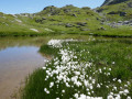
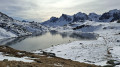
Lakes Serpent and Laramon are stunning and easy to reach;

Machine-translated

Randophil57
Randophil57

Overall rating : 5 / 5

Date of your route : Jul 26, 2019
Reliability of the description : Not used / Not applicable
Ease of following the route : ★★★★★ Very good
Route interest : ★★★★★ Very good

Imagine my surprise to find that I’m the first person to leave a review of this route, even though this walk is incredibly beautiful… and surprisingly easy.
There are constant views of the upper Clarée Valley and the Cerces massif, whilst the balcony path after Lac de la Cula – a short detour well worth taking – is magnificent.
We finished the walk to Névache by taking the road from Lacou.

Machine-translated

Other walks in the area

For more walks, use our search engine .

The GPS track and description are the property of this route's author. Please do not copy them without permission.