Country:

 City:
City:


To reach the site from Perpignan, take the road to Andorra. On leaving Mont-Louis, follow the road to Formiguères (D118). Shortly afterwards, take the road on the left towards the Bouillouses conservation area, at an altitude of 2,010 metres. A shuttle bus runs during the summer months. If you have proof of an overnight stay at the Bouillouses site, you can take the shuttle bus up. Outside the summer season, you must park below the dam.
(S) Cross the Lac des Bouillouses dam. Take the path that runs beneath the hotel. The path leads to Le Carlit. Continue to the Estany del Viver.
(1) Leave the Carlit path and turn right onto the 12 Lakes route. The path winds between the lakes dotted around the foot of the Carlit. Head for the junction of the paths between the Estany del Castellar and the Estany de Trebens.
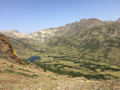
(2) Turn right, off the marked trail. The path is not shown on the IGN map, but it is marked on OpenStreetMap. Continue across grassy terrain, following the blue markings or cairns. Reach a ridge separating the Carlit valley from the Grava (or Têt) valley.
(3) Head down a steep descent towards the Estany del Raco as your landmark. Initially, the descent is over scree. Pass this lake and then join theGR®10.
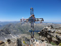
(4) Turn left onto the GR®10 and begin the ascent to the Estanyol (a small pond). Continue up a steeper slope to reach the Portella de la Grava.
(5) Begin the descent, staying on theGR®10and following its red and white markings to reach the Cabane de Rouzet, a junction where several paths meet.
(6) Turn right and, a few metres further on, you’ll reach the junction with theGR®7.
(7) Leave theGR®10here and head due north along theGR®7, which is also marked in red and white. Begin another steep climb towards Portella d’Orlu or Serra Blanca (White Mountain). You will then reach a junction of paths.
(8) Leave theGR®7and continue to the right, passing between the ponds of La Porteilla d’Orlu. You will then rejoin theGR®7; turn right onto it and you will soon reach the junction withthe GR®7andthe GRP® ‘Tour des Pérics et des Montagnes d’Ax’.
(9) Turn right and descend carefully between the rocks. You’ll reach a junction by a pond.
(10) Continue along theGR®7–GRP® routes and, further down, you’ll reach a fork in the path.
(11) Turn right, staying on theGR® -GRP® trails. You will then emerge at the Étangs d’en Beys.
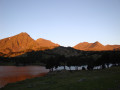
(12) Follow the left bank to reach the Refuge d’en Beys (E), today’s stop.

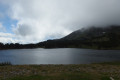
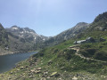
 departure from the Bouillouses refuge, start of a challenging hike after the cabin, but with superb scenery.

 . This route takes you off the beaten track, as we didn’t come across many people. There are sections where the route leaves the main path and runs parallel to it; in these cases, it’s better to follow the main dotted path instead. This is particularly true between points 8 and 9 (where there’s a risk of getting lost) – I’m not sure the detour is worth it – and before the Étang d’en Beys, just before the climb that leads to a landslide area which will force you to turn back.
 Visorando Member
 Moderate