From Les Bouillouses to Le Carlit, then on to the Cabane du Rouzet

Le Carlit is the highest peak in the Pyrénées-Orientales at 2,921 m. It’s a site visited by hundreds of people every summer, but generally most are content to do the Bouillouses–Carlit round trip.

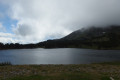
This first stage invites you to include this summit and to finish the stage in the area around the Cabane du Rouzet after walking alongside the large Étang de Lanoux.

Classified as difficult due to the ascent of Puig Carlit and its steep descent on the Étang de Lanoux side.

This walk is part of a multi-day hike: Circuit du Carlit et des Pérics

Details

12062686
Creation:
Last update:
Last review:
  • Walking
    Activity: Walking
  • ↔
    Distance: 8.29 mi
  • ◔
    Average duration: 6h 40 
  • ▲
    Difficulty: Difficult

  • ⚐
    Back to start: No
  • ↗
    Ascent: + 3,248 ft
  • ↘
    Descent: - 2,434 ft

  • ▲
    Highest point: 9,577 ft
  • ▼
    Lowest point: 6,591 ft

Description of the walk

To reach the site from Perpignan, take the road to Andorra. On leaving Mont-Louis, follow the road to Formiguères (D118). Shortly afterwards, take the road on the left towards the Bouillouses nature reserve, at an altitude of 2,000 metres. A shuttle bus runs during the summer months. If you have proof of an overnight stay at the Bouillouses site, you can take the shuttle bus up. Out of season, you must park below the dam.

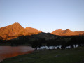
(S) The walk begins by crossing the dam. You’ll be able to see the Grand and Petit Pérics (the destination for thesecond day) at the far end of Lac des Bouillouses, due north.

At the end of the dam, head straight on to the very popular ‘Twelve Lakes’ route, which winds its way around the lower reaches of the Carlit. Pass beneath the Bones Hores hotel.
The path forms part of the HRP*, which crosses the Pyrenees, running parallel to the famousGR®10.
This much-used path is unmissable.
Alternative routes allow you to walk past the lakes, each one as beautiful as the next.
All these paths lead you to the foot of the main ascent, at an altitude of 2,364 metres.

(1) Follow the clearly marked path to the small lake at around 2,690 m (yellow markings). There’s no risk of going astray.

(2) Looking eastwards, the view of the lakes is magnificent. Let’s hope the light is just right with plenty of sunshine.
From this point onwards, things get more challenging. You’ll need to stow away any walking poles, as there are sections requiring climbing. Keep a close eye on and follow the yellow markings. Do not head due west across the slabs.
The path becomes more difficult in the upper part of the chimney, beneath what looks like a pass.

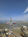
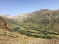
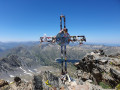
(3) At this pass, turn left and head for Puig Carlit, with its cross. The summit platform can accommodate quite a few people. All the better, as there are some lovely photos to be taken. Looking westwards, down below, the little Estany dels Forats lies at an elevation of 2457. This gives a good idea of the descent that lies ahead.
Retrace your steps to reach the pass-like opening.

(4) Head down to the left along this steep slope. A zigzagging path is visible through the scree. Be careful – the ground is loose underfoot.

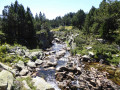
(5) To the right, the Estany dels Forats. To the left, a river where you can top up your water supplies*.
Continue the descent, which becomes gentler, towards the Étang de Lanoux.

(6) Work in progress on the dam means you’ll need to take a diversion from the usual route. Turn right: posts marked with the red and whiteGR®7signposting will guide you to the usual path, which heads north-east up from the Étang de Lanoux. You’ll reach the Cabane Rouzet (E).

Waypoints

  1. S : mi 0 - alt. 6,591 ft - Bouillouses Dam. Accommodation
  2. 1 : mi 3.51 - alt. 7,762 ft - Start of the ascent
  3. 2 : mi 4.13 - alt. 8,514 ft - Small pond
  4. 3 : mi 4.65 - alt. 9,577 ft - Summit - Pic Carlit
  5. 4 : mi 4.7 - alt. 9,537 ft - A sort of pass
  6. 5 : mi 5.37 - alt. 8,084 ft - Stream - Estany dels Forats
  7. 6 : mi 6.26 - alt. 7,497 ft - Detour via the GR7
  8. E : mi 8.29 - alt. 7,408 ft - Rouzet Hut - Lac (ou étang) de Lanoux

Notes

No need to worry about water supplies. The route passes lakes and streams where you can top up your supplies*.

The Cabane Rouzet is basic, with no facilities, but it provides good shelter in bad weather. The site is popular in summer. Bring a tent in case the hut is occupied.

At the start of this journey (S), a hotel and a guesthouse are on hand to welcome you.

 (E). The Rouzet Hut is the end point of this stage. Four walls and a roof – that’s all. Herds of cattle and horses roam the meadows day and night. So be careful where you pitch your tent. There’s no water source: fill up at one of the streams** that feed into the Étang de Lanoux.

  •  The HRP: the Haute Route Pyrénéenne.
  •  The water must be disinfected or filtered.

Worth a visit

Whilst climbing the Carlit, do remember to look back from time to time. The view of the lakes is well worth it.
If you have a map or suitable software, once at the summit you can have fun identifying the many peaks of the Ariège.

Always be cautious and plan ahead when you're outdoors. Visorando and the author of this route cannot be held responsible for any accidents occurring on this route.

The GR® and PR® markings are the intellectual property of the Fédération Française de Randonnée Pédestre.

Reviews and comments

4.6 / 5
Based on 3 reviews

Reliability of the description
4 / 5
Ease of following the route
4.7 / 5
Route interest
5 / 5
richard83
richard83

Overall rating : 4.3 / 5

Date of your route : Sep 19, 2025
Reliability of the description : ★★★★☆ Good
Ease of following the route : ★★★★☆ Good
Route interest : ★★★★★ Very good
Very busy route : No

Hello, everyone.
As experienced hikers who are used to steep climbs (1,000 metres or more), I would like to correct the estimated time mentioned by Randomarc for completing the first two routes of the Perics route.
On the first day, starting from Les Bouillouses and then Carlit to the hut, it took us 8 hours and 15 minutes, including a snack break at the summit of Carlit.
On the second day, we were nowhere near Randomarc's estimated time, which may have been based on the time taken by a trail runner (5 hours and 40 minutes)? That's impossible!!! Including breaks, it took us 9 hours to reach the Camporells refuge, and I can assure you that we didn't take it easy!
I wanted to correct this so that there are no unpleasant surprises for those who embark on this very challenging route with a 10-kilo rucksack on their backs.
Best regards, and see you soon on the fabulous trails of the Pyrenees.
Richard.

Machine-translated

User 27254609

Overall rating : 5 / 5

Date of your route : Sep 18, 2025
Reliability of the description : ★★★★★ Very good
Ease of following the route : ★★★★★ Very good
Route interest : ★★★★★ Very good
Very busy route : No

A very busy route to the summit of Carlit, then much quieter afterwards

Machine-translated

User 26559848

Overall rating : 4.3 / 5

Date of your route : Jul 17, 2025
Reliability of the description : ★★★☆☆ Average
Ease of following the route : ★★★★★ Very good
Route interest : ★★★★★ Very good
Very busy route : No

It would be wise to mention the real difficulty and exposure of the last section up to Carlit, for the safety of everyone, especially hikers who are not familiar with HRP trails and Pyrenean peaks. You mention in one of your replies that families use this trail every year to reach the peak. This is NOT a trail suitable for families and children. The trail requires good physical condition and stamina (high mountain hiking, often at over 2,500 metres). Skill and technical ability are required to complete the final climb to the summit. The last few hundred metres are vertical, with sections of climbing with your back to the void, which requires considerable commitment. Beware of the wind, which can unbalance hikers with a heavy bivouac bag! A strong mind and clear thinking are necessary to climb the chimney.
The duration of the hike mentioned also seems unrealistic to me. For comparison, we were two hikers in good physical condition and used to steep slopes, and it took us 8 hours to pitch our tent near the Estany dels Forats.

Other than the underestimated difficulty, the hike is breathtaking from start to finish, with magnificent views.

Machine-translated

Fred33500
Fred33500

Hello Randomarc, now that we’re back from our trip, I just wanted to tell you that the scenery is extraordinary, and the difficulty of the climb up the Pérics from the Cabane du Rouzet is matched by the beauty of the landscape… You really do need mental strength to make the most of these places!
Thank you for these route descriptions, although our total ascent was considerably greater than yours, particularly on the second day.
Wishing you a lovely summer.
Best regards.
Fred 33500

Machine-translated

Fred33500
Fred33500

Hello, thank you for all this valuable information. We’re now reassured!
We’ll be sure to get back to you. Best regards, Fred

Machine-translated

Randomarc
Randomarc

Hello Fred33500.

First of all, well done for your courage. You’re going to be walking through a magnificent region.

You’ve asked me a question about the tour of the Pérics. I’ve posted a two-day hike on Visorando around the Pérics (without going to the summits). This hike doesn’t go via the Carlit.

However, you’re basing your question on a section of a three-day hike that goes via Le Carlit and the Pérics, which I’ve also posted on Visorando. You’ll need to specify the route you want to take.

I’ll reply based on the three-day Bouillouses–Carlit–Pérics walk.

Your background as a triathlete will be very useful. I’m a runner myself and, despite being in my sixties, it helps me a great deal today.

The hike is classified as difficult because it’s quite long. The climb up to Le Carlit is fairly manageable. Don’t let the 2,921 metres put you off. Lac des Bouillouses is at 2,000 metres, so there’s only a 900-metre climb. The steepest section covers the final few hundred metres of elevation gain. In summer, even families make the climb. You’ll also come across trail runners who run up it. However, make sure you keep your footing on the descent down the western side, as the path is covered in loose scree.

On the second day, don’t use up all your energy on the first section. The climb up Grand Péric is very steep, over fine, loose scree, though fortunately it’s only a 200-metre ascent. Once at the summit, the hardest part is behind you. You reach Petit Péric via a ridge. Then it’s the descent to the Camporells refuge. Bring a tent, as it gets very busy in July.

The third day is a gentle one, almost a stroll. It’ll mainly be a chance to take in the panoramic views of Carlit and the Pérics as you climb Mont Llaret and take in the whole of the Pyrenees range.

Equipment: A tent, of course. Trekking poles and good walking boots too. A water bottle with a filter cartridge means I don’t have to carry lots of heavy bottles of water. There are quite a few places to top up your water supply. A hat and sun cream.
Be careful not to attempt the hike if the Tramontane is forecast. It can blow very strongly and make the route dangerous.

If you have any other questions, please don’t hesitate to ask. Good luck.

Machine-translated

Fred33500
Fred33500

Hello,
We’re new to the site, and my partner and I are planning to do the Tour des Pérics over three days in early July, using your walking guides. We’re regular exercisers and former triathletes, but we have little experience of high-altitude walking. Do you think this trek might be a bit ambitious for us? Does the ‘difficult’ rating mean we’ll need any specific kit? Thank you. Best regards, Fred33500

Machine-translated

Other walks in the area

For more walks, use our search engine .

The GPS track and description are the property of this route's author. Please do not copy them without permission.